Aix-les-Bains elevation
Aix-les-Bains (Auvergne-Rhône-Alpes, Savoie), France elevation is 246 meters and Aix-les-Bains elevation in feet is 807 ft above sea level [src 1]. Aix-les-Bains is a populated place (feature code) with elevation that is 72 meters (236 ft) bigger than average city elevation in France.
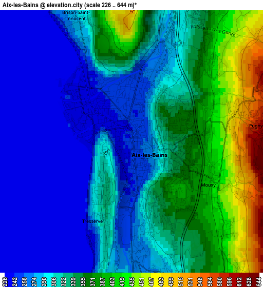
Below is the Elevation map of Aix-les-Bains, which displays elevation range with different colors. Scale of the first map is from 226 to 644 m (741 to 2113 ft) with average elevation of 320.6 meters (=1052 ft) [note 1]
These maps also provides idea of topography and contour of this city, they are displayed at different zoom levels. More info about maps, scale and edge coordinates you can find below images.
| \ | Map #1 | Map #2 | Topo.Map |
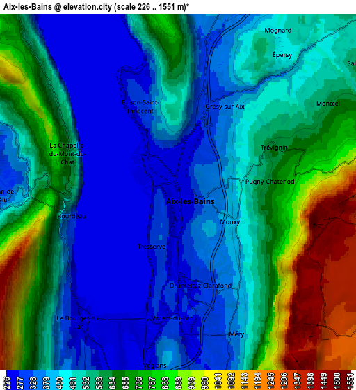
| Scale [m] | 226..644 m | 226..1551 m | × |
| Scale [ft] | 741..2113 ft | 741..5089 ft | × |
| Average | 320.6 m = 1052 ft | 548.1 m = 1798 ft | × |
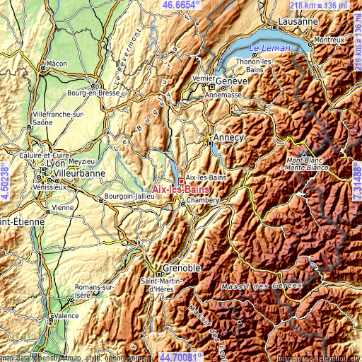
| Width | 6.83 km = 4.2 mi | 13.65 km = 8.5 mi | 218.4 km = 135.7 mi |
| Height | 6.83 km = 4.2 mi | 13.65 km = 8.5 mi | 218.4 km = 135.7 mi |
| ↑Max Latitude | 45.722418° | 45.75309° | 46.6654° |
| Latitude at center | 45.69173° | 45.69173° | 45.69173° |
| ↓Min Latitude | 45.661025° | 45.630303° | 44.70081° |
| ← Min Longitude | 5.864685° | 5.820739° | 4.50238° |
| Longitude center | 5.90863° | 5.90863° | 5.90863° |
| →Max Longitude | 5.952575° | 5.996521° | 7.31488° |
Nearby cities:
Cities around Aix-les-Bains sort by population:
• La Motte-Servolex elevation 263 m
11 km,  196°
196°
• Le Bourget-du-Lac 234 m
5.9 km,  224°
224°
• Grésy-sur-Aix 389 m
3.7 km,  20°
20°
• Tresserve 257 m
1.9 km, 203°
• Drumettaz 340 m
3.5 km,  163°
163°
• Brison-Saint-Innocent 317 m
3.9 km,  337°
337°
• La Biolle 405 m
7.6 km,  11°
11°
• Mouxy 407 m
2.2 km,  112°
112°
• Viviers-du-Lac 242 m
4.7 km,  188°
188°
• Voglans 279 m
8.3 km, 191°
• Sonnaz 281 m
8.3 km,  176°
176°
• Méry 534 m
6 km, 159°
Multilingual:
 En español:
Aix-les-Bains elevación 246 m.
 En France:
Aix-les-Bains élévation 246 m.
 Auf Deutsch:
Aix-les-Bains höhe über dem Meeresspiegel ist 246 m.

Sources and notes:
- [note 1] Map square and city borders are not equal. Map elevation data is calculated only from area inside that square.
- [src 1] Elevation data from geonames database provided with same terms of usage.
- [src 2] The elevation map of Aix-les-Bains is generated using elevation data from NASA's 3 arcsec (90m) resolution SRTM data.
- [src 3] Base (background) map © OpenStreetMap contributors tiles are generated by Geofabrik and OpenTopoMap.
Copyright & License:
This Aix-les-Bains Elevation Map is licensed under CC BY-SA. You may reuse any part from this page, if you give a proper credit by linking to this URL:
 More info on terms of use page.