Amnéville elevation
Amnéville (Grand Est, Moselle), France elevation is 164 meters and Amnéville elevation in feet is 538 ft above sea level [src 1]. Amnéville is a populated place (feature code) with elevation that is 10 meters (33 ft) smaller than average city elevation in France.
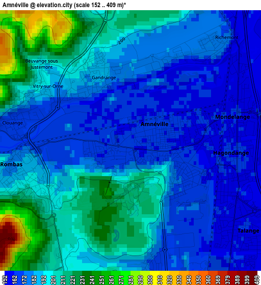
Below is the Elevation map of Amnéville, which displays elevation range with different colors. Scale of the first map is from 152 to 409 m (499 to 1342 ft) with average elevation of 190.1 meters (=624 ft) [note 1]
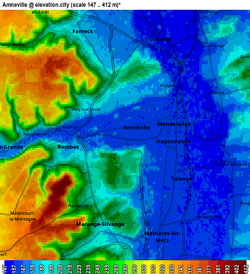
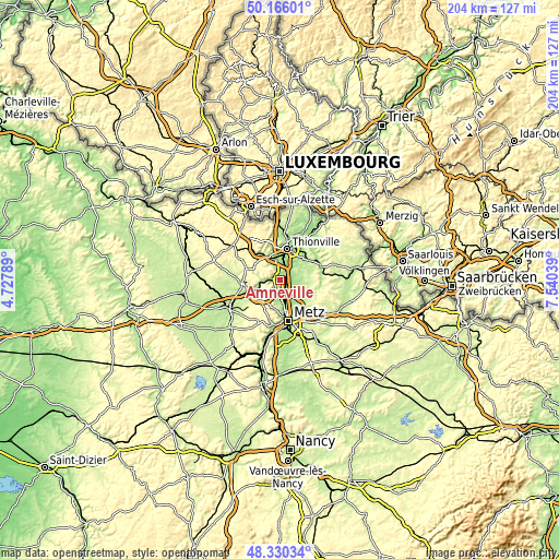
These maps also provides idea of topography and contour of this city, they are displayed at different zoom levels. More info about maps, scale and edge coordinates you can find below images.
| \ | Map #1 | Map #2 | Topo.Map |
| Scale [m] | 152..409 m | 147..412 m | × |
| Scale [ft] | 499..1342 ft | 482..1352 ft | × |
| Average | 190.1 m = 624 ft | 214.9 m = 705 ft | × |
| Width | 6.38 km = 4 mi | 12.76 km = 7.9 mi | 204.1 km = 126.8 mi |
| Height | 6.38 km = 4 mi | 12.76 km = 7.9 mi | 204.1 km = 126.8 mi |
| ↑Max Latitude | 49.285383° | 49.31404° | 50.16601° |
| Latitude at center | 49.25671° | 49.25671° | 49.25671° |
| ↓Min Latitude | 49.22802° | 49.199313° | 48.33034° |
| ← Min Longitude | 6.090195° | 6.046249° | 4.72789° |
| Longitude center | 6.13414° | 6.13414° | 6.13414° |
| →Max Longitude | 6.178085° | 6.222031° | 7.54039° |
Nearby cities:
Cities around Amnéville sort by population:
• Fameck elevation 180 m
5 km,  338°
338°
• Rombas 178 m
3 km,  254°
254°
• Hagondange 160 m
2.3 km,  112°
112°
• Talange 158 m
3.6 km,  130°
130°
• Mondelange 160 m
2.3 km,  76°
76°
• Clouange 169 m
2.8 km,  283°
283°
• Rosselange 185 m
4.7 km,  271°
271°
• Gandrange 176 m
1.7 km, 338°
• Vitry-sur-Orne 176 m
2 km,  301°
301°
• Bousse 176 m
5.1 km,  62°
62°
• Richemont 178 m
3.1 km,  43°
43°
• Pierrevillers 222 m
4.2 km,  212°
212°
Multilingual:
 En español:
Amnéville elevación 164 m.
 En France:
Amnéville élévation 164 m.
 Auf Deutsch:
Amnéville höhe über dem Meeresspiegel ist 164 m.

Sources and notes:
- [note 1] Map square and city borders are not equal. Map elevation data is calculated only from area inside that square.
- [src 1] Elevation data from geonames database provided with same terms of usage.
- [src 2] The elevation map of Amnéville is generated using elevation data from NASA's 3 arcsec (90m) resolution SRTM data.
- [src 3] Base (background) map © OpenStreetMap contributors tiles are generated by Geofabrik and OpenTopoMap.
Copyright & License:
This Amnéville Elevation Map is licensed under CC BY-SA. You may reuse any part from this page, if you give a proper credit by linking to this URL:
 More info on terms of use page.