Ancenis elevation
Ancenis (Pays de la Loire, Loire-Atlantique), France elevation is 7 meters and Ancenis elevation in feet is 23 ft above sea level [src 1]. Ancenis is a seat of a third-order administrative division (feature code) with elevation that is 167 meters (548 ft) smaller than average city elevation in France.
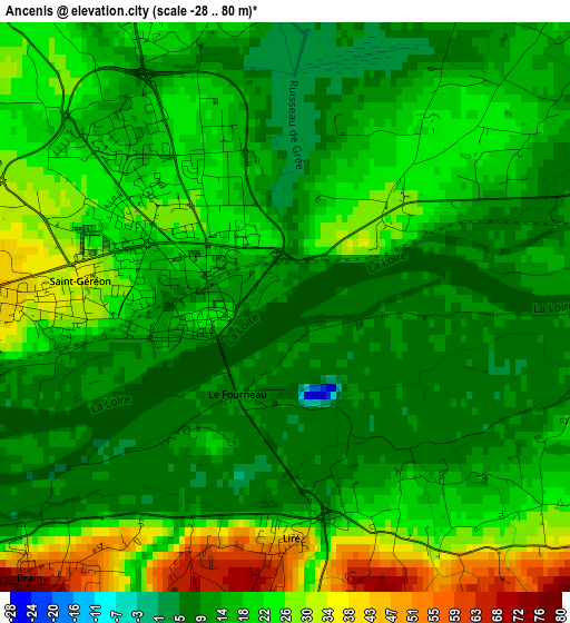
Below is the Elevation map of Ancenis, which displays elevation range with different colors. Scale of the first map is from -28 to 80 m (-92 to 262 ft) with average elevation of 18.2 meters (=60 ft) [note 1]
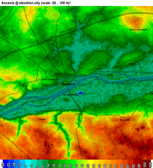
These maps also provides idea of topography and contour of this city, they are displayed at different zoom levels. More info about maps, scale and edge coordinates you can find below images.
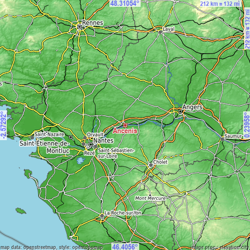
| \ | Map #1 | Map #2 | Topo.Map |
| Scale [m] | -28..80 m | -28..108 m | × |
| Scale [ft] | -92..262 ft | -92..354 ft | × |
| Average | 18.2 m = 60 ft | 38 m = 125 ft | × |
| Width | 6.62 km = 4.1 mi | 13.24 km = 8.2 mi | 211.8 km = 131.6 mi |
| Height | 6.62 km = 4.1 mi | 13.24 km = 8.2 mi | 211.8 km = 131.6 mi |
| ↑Max Latitude | 47.396426° | 47.426165° | 48.31054° |
| Latitude at center | 47.36667° | 47.36667° | 47.36667° |
| ↓Min Latitude | 47.336897° | 47.307108° | 46.4056° |
| ← Min Longitude | -1.210615° | -1.254561° | -2.57292° |
| Longitude center | -1.16667° | -1.16667° | -1.16667° |
| →Max Longitude | -1.122725° | -1.078779° | 0.23958° |
Nearby cities:
Cities around Ancenis sort by population:
• Mésanger elevation 39 m
8.5 km,  327°
327°
• Oudon 24 m
9.2 km,  256°
256°
• Saint-Géréon 36 m
2.7 km,  272°
272°
• Liré 40 m
2.6 km,  177°
177°
• Saint-Herblon 60 m
6.9 km,  48°
48°
• Couffé 27 m
9.9 km,  285°
285°
• Champtoceaux 73 m
8 km,  243°
243°
• Drain 79 m
4.6 km,  222°
222°
• Saint-Laurent-des-Autels 93 m
9.2 km,  190°
190°
• Anetz 22 m
4.8 km,  71°
71°
• Bouzillé 78 m
5.3 km,  127°
127°
• La Chapelle-Saint-Florent 81 m
9.1 km,  113°
113°
Multilingual:
 En español:
Ancenis elevación 7 m.
 En France:
Ancenis élévation 7 m.


Sources and notes:
- [note 1] Map square and city borders are not equal. Map elevation data is calculated only from area inside that square.
- [src 1] Elevation data from geonames database provided with same terms of usage.
- [src 2] The elevation map of Ancenis is generated using elevation data from NASA's 3 arcsec (90m) resolution SRTM data.
- [src 3] Base (background) map © OpenStreetMap contributors tiles are generated by Geofabrik and OpenTopoMap.
Copyright & License:
This Ancenis Elevation Map is licensed under CC BY-SA. You may reuse any part from this page, if you give a proper credit by linking to this URL:
 More info on terms of use page.