Angres elevation
Angres (Hauts-de-France, Pas-de-Calais), France elevation is 62 meters and Angres elevation in feet is 203 ft above sea level [src 1]. Angres is a populated place (feature code) with elevation that is 112 meters (367 ft) smaller than average city elevation in France.
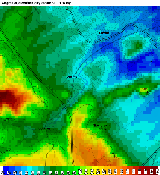
Below is the Elevation map of Angres, which displays elevation range with different colors. Scale of the first map is from 31 to 178 m (102 to 584 ft) with average elevation of 78.7 meters (=258 ft) [note 1]
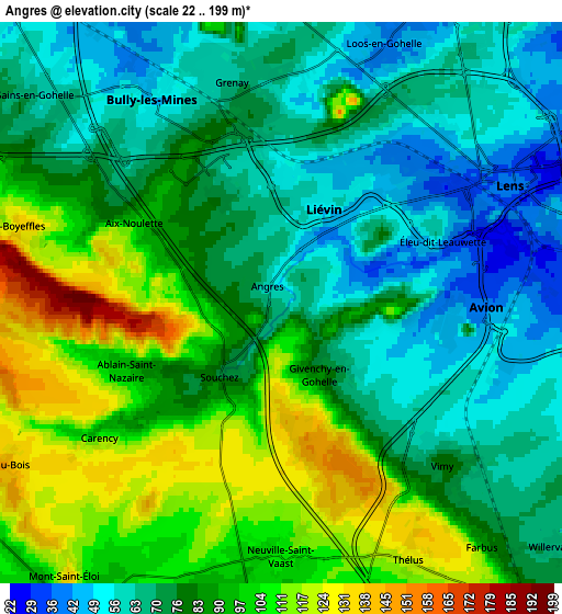
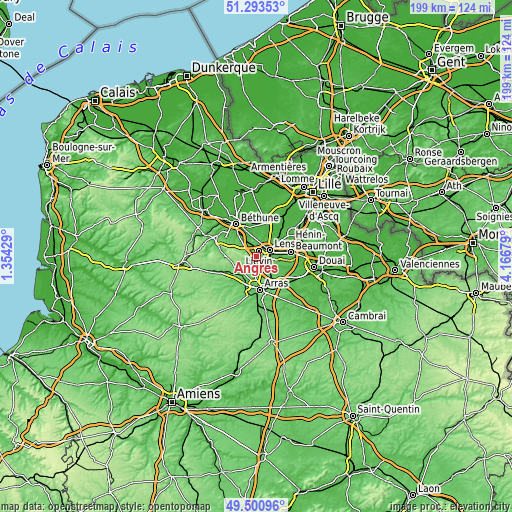
These maps also provides idea of topography and contour of this city, they are displayed at different zoom levels. More info about maps, scale and edge coordinates you can find below images.
| \ | Map #1 | Map #2 | Topo.Map |
| Scale [m] | 31..178 m | 22..199 m | × |
| Scale [ft] | 102..584 ft | 72..653 ft | × |
| Average | 78.7 m = 258 ft | 82.5 m = 271 ft | × |
| Width | 6.23 km = 3.9 mi | 12.46 km = 7.7 mi | 199.3 km = 123.8 mi |
| Height | 6.23 km = 3.9 mi | 12.46 km = 7.7 mi | 199.3 km = 123.8 mi |
| ↑Max Latitude | 50.43372° | 50.461704° | 51.29353° |
| Latitude at center | 50.40572° | 50.40572° | 50.40572° |
| ↓Min Latitude | 50.377703° | 50.34967° | 49.50096° |
| ← Min Longitude | 2.716595° | 2.672649° | 1.35429° |
| Longitude center | 2.76054° | 2.76054° | 2.76054° |
| →Max Longitude | 2.804485° | 2.848431° | 4.16679° |
Nearby cities:
Cities around Angres sort by population:
• Lens elevation 37 m
5.7 km,  57°
57°
• Liévin 46 m
2.1 km,  42°
42°
• Avion 35 m
5 km,  84°
84°
• Bully-les-Mines 54 m
4.9 km,  330°
330°
• Grenay 67 m
4.9 km,  352°
352°
• Vimy 77 m
5.1 km,  136°
136°
• Aix-Noulette 75 m
4.5 km,  299°
299°
• Éleu-dit-Leauwette 35 m
4 km, 63°
• Souchez 80 m
2 km,  225°
225°
• Givenchy-en-Gohelle 85 m
1.9 km,  151°
151°
• Ablain-Saint-Nazaire 94 m
3.9 km,  249°
249°
• Neuville-Saint-Vaast 109 m
5.4 km,  178°
178°
Multilingual:
 En español:
Angres elevación 62 m.
 En France:
Angres élévation 62 m.


Sources and notes:
- [note 1] Map square and city borders are not equal. Map elevation data is calculated only from area inside that square.
- [src 1] Elevation data from geonames database provided with same terms of usage.
- [src 2] The elevation map of Angres is generated using elevation data from NASA's 3 arcsec (90m) resolution SRTM data.
- [src 3] Base (background) map © OpenStreetMap contributors tiles are generated by Geofabrik and OpenTopoMap.
Copyright & License:
This Angres Elevation Map is licensed under CC BY-SA. You may reuse any part from this page, if you give a proper credit by linking to this URL:
 More info on terms of use page.