Aubignan elevation
Aubignan (Provence-Alpes-Côte d'Azur, Département du Vaucluse), France elevation is 71 meters and Aubignan elevation in feet is 233 ft above sea level [src 1]. Aubignan is a populated place (feature code) with elevation that is 103 meters (338 ft) smaller than average city elevation in France.
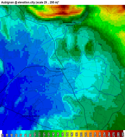
Below is the Elevation map of Aubignan, which displays elevation range with different colors. Scale of the first map is from 29 to 295 m (95 to 968 ft) with average elevation of 86.1 meters (=282 ft) [note 1]
These maps also provides idea of topography and contour of this city, they are displayed at different zoom levels. More info about maps, scale and edge coordinates you can find below images.
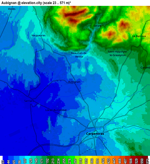
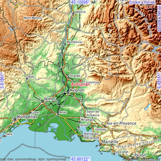
| \ | Map #1 | Map #2 | Topo.Map |
| Scale [m] | 29..295 m | 23..571 m | × |
| Scale [ft] | 95..968 ft | 75..1873 ft | × |
| Average | 86.1 m = 282 ft | 126.4 m = 415 ft | × |
| Width | 7.02 km = 4.4 mi | 14.04 km = 8.7 mi | 224.6 km = 139.6 mi |
| Height | 7.02 km = 4.4 mi | 14.04 km = 8.7 mi | 224.6 km = 139.6 mi |
| ↑Max Latitude | 44.13126° | 44.162793° | 45.10095° |
| Latitude at center | 44.09971° | 44.09971° | 44.09971° |
| ↓Min Latitude | 44.068143° | 44.036559° | 43.08122° |
| ← Min Longitude | 4.981315° | 4.937369° | 3.61901° |
| Longitude center | 5.02526° | 5.02526° | 5.02526° |
| →Max Longitude | 5.069205° | 5.113151° | 6.43151° |
Nearby cities:
Cities around Aubignan sort by population:
• Carpentras elevation 90 m
5.3 km,  159°
159°
• Monteux 49 m
7.4 km,  198°
198°
• Sarrians 40 m
4.7 km,  246°
246°
• Courthézon 51 m
11.4 km,  263°
263°
• Mazan 154 m
9.4 km,  120°
120°
• Jonquières 54 m
10.2 km,  280°
280°
• Caromb 196 m
6.7 km,  79°
79°
• Beaumes-de-Venise 100 m
2.5 km,  9°
9°
• Loriol-du-Comtat 47 m
3.2 km,  217°
217°
• Violès 94 m
8.9 km,  320°
320°
• Sablet 157 m
10.5 km,  351°
351°
• Vacqueyras 115 m
5.4 km, 322°
Multilingual:
 En español:
Aubignan elevación 71 m.
 En France:
Aubignan élévation 71 m.


Sources and notes:
- [note 1] Map square and city borders are not equal. Map elevation data is calculated only from area inside that square.
- [src 1] Elevation data from geonames database provided with same terms of usage.
- [src 2] The elevation map of Aubignan is generated using elevation data from NASA's 3 arcsec (90m) resolution SRTM data.
- [src 3] Base (background) map © OpenStreetMap contributors tiles are generated by Geofabrik and OpenTopoMap.
Copyright & License:
This Aubignan Elevation Map is licensed under CC BY-SA. You may reuse any part from this page, if you give a proper credit by linking to this URL:
 More info on terms of use page.