Auchel elevation
Auchel (Hauts-de-France, Pas-de-Calais), France elevation is 99 meters and Auchel elevation in feet is 325 ft above sea level [src 1]. Auchel is a populated place (feature code) with elevation that is 75 meters (246 ft) smaller than average city elevation in France.
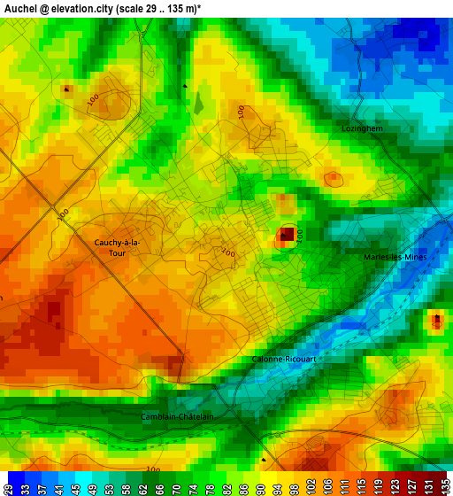
Below is the Elevation map of Auchel, which displays elevation range with different colors. Scale of the first map is from 29 to 135 m (95 to 443 ft) with average elevation of 82.9 meters (=272 ft) [note 1]
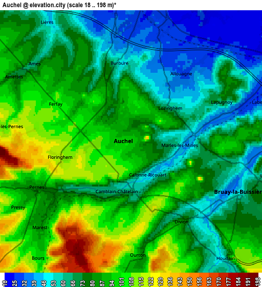
These maps also provides idea of topography and contour of this city, they are displayed at different zoom levels. More info about maps, scale and edge coordinates you can find below images.
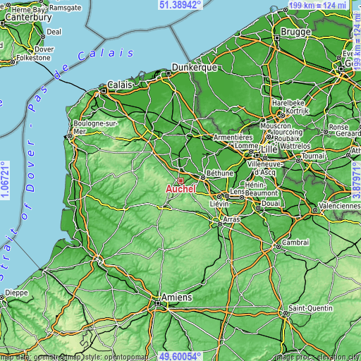
| \ | Map #1 | Map #2 | Topo.Map |
| Scale [m] | 29..135 m | 18..198 m | × |
| Scale [ft] | 95..443 ft | 59..650 ft | × |
| Average | 82.9 m = 272 ft | 80.7 m = 265 ft | × |
| Width | 6.22 km = 3.9 mi | 12.43 km = 7.7 mi | 198.9 km = 123.6 mi |
| Height | 6.22 km = 3.9 mi | 12.43 km = 7.7 mi | 198.9 km = 123.6 mi |
| ↑Max Latitude | 50.531392° | 50.559318° | 51.38942° |
| Latitude at center | 50.50345° | 50.50345° | 50.50345° |
| ↓Min Latitude | 50.475491° | 50.447516° | 49.60054° |
| ← Min Longitude | 2.429515° | 2.385569° | 1.06721° |
| Longitude center | 2.47346° | 2.47346° | 2.47346° |
| →Max Longitude | 2.517405° | 2.561351° | 3.87971° |
Nearby cities:
Cities around Auchel sort by population:
• Bruay-la-Buissière elevation 60 m
5.9 km,  112°
112°
• Divion 61 m
4.2 km,  147°
147°
• Marles-les-Mines 46 m
2.5 km,  86°
86°
• Calonne-Ricouart 53 m
2 km,  180°
180°
• Lapugnoy 41 m
4.6 km,  71°
71°
• Allouagne 29 m
4.2 km,  40°
40°
• Cauchy-à-la-Tour 106 m
1.9 km,  271°
271°
• Burbure 47 m
3.7 km,  355°
355°
• Labeuvrière 35 m
6.5 km, 74°
• Pernes 83 m
4.8 km,  243°
243°
• Camblain-Châtelain 64 m
2.6 km,  210°
210°
• Lozinghem 68 m
2.4 km,  56°
56°
Multilingual:
 En español:
Auchel elevación 99 m.
 En France:
Auchel élévation 99 m.


Sources and notes:
- [note 1] Map square and city borders are not equal. Map elevation data is calculated only from area inside that square.
- [src 1] Elevation data from geonames database provided with same terms of usage.
- [src 2] The elevation map of Auchel is generated using elevation data from NASA's 3 arcsec (90m) resolution SRTM data.
- [src 3] Base (background) map © OpenStreetMap contributors tiles are generated by Geofabrik and OpenTopoMap.
Copyright & License:
This Auchel Elevation Map is licensed under CC BY-SA. You may reuse any part from this page, if you give a proper credit by linking to this URL:
 More info on terms of use page.