Auriol elevation
Auriol (Provence-Alpes-Côte d'Azur, Département des Bouches-du-Rhône), France elevation is 232 meters and Auriol elevation in feet is 761 ft above sea level [src 1]. Auriol is a populated place (feature code) with elevation that is 58 meters (190 ft) bigger than average city elevation in France.
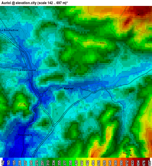
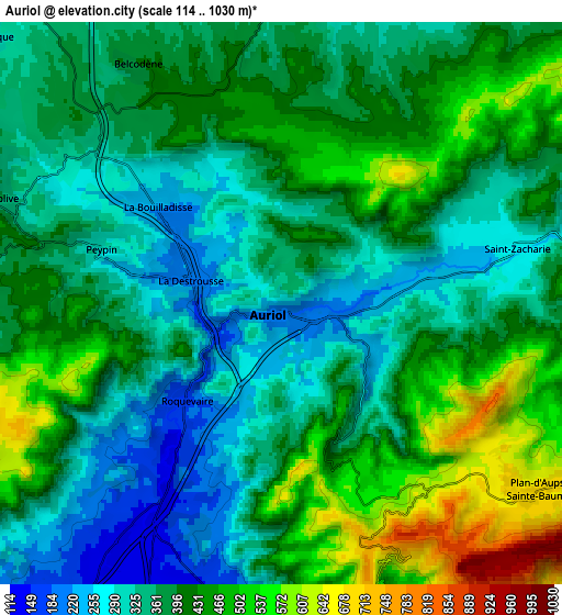
Below is the Elevation map of Auriol, which displays elevation range with different colors. Scale of the first map is from 142 to 697 m (466 to 2287 ft) with average elevation of 302 meters (=991 ft) [note 1]
These maps also provides idea of topography and contour of this city, they are displayed at different zoom levels. More info about maps, scale and edge coordinates you can find below images.
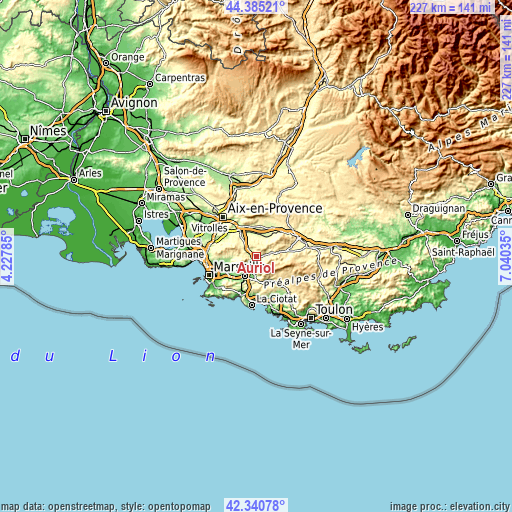
| \ | Map #1 | Map #2 | Topo.Map |
| Scale [m] | 142..697 m | 114..1030 m | × |
| Scale [ft] | 466..2287 ft | 374..3379 ft | × |
| Average | 302 m = 991 ft | 392.9 m = 1289 ft | × |
| Width | 7.1 km = 4.4 mi | 14.21 km = 8.8 mi | 227.3 km = 141.2 mi |
| Height | 7.1 km = 4.4 mi | 14.21 km = 8.8 mi | 227.3 km = 141.2 mi |
| ↑Max Latitude | 43.403546° | 43.435465° | 44.38521° |
| Latitude at center | 43.37161° | 43.37161° | 43.37161° |
| ↓Min Latitude | 43.339657° | 43.307687° | 42.34078° |
| ← Min Longitude | 5.590155° | 5.546209° | 4.22785° |
| Longitude center | 5.6341° | 5.6341° | 5.6341° |
| →Max Longitude | 5.678045° | 5.721991° | 7.04035° |
Nearby cities:
Cities around Auriol sort by population:
• Trets elevation 247 m
9.4 km,  25°
25°
• Roquevaire 160 m
3.4 km,  225°
225°
• Gémenos 152 m
8.3 km,  183°
183°
• Peypin 291 m
4.8 km,  288°
288°
• La Bouilladisse 242 m
4.3 km,  309°
309°
• Saint-Zacharie 278 m
6.2 km,  75°
75°
• Peynier 272 m
8.6 km,  3°
3°
• Saint-Savournin 432 m
9.6 km,  295°
295°
• La Destrousse 208 m
2.3 km,  279°
279°
• Cadolive 367 m
7.7 km, 291°
• Belcodène 396 m
7.1 km,  328°
328°
• Plan-d'Aups-Sainte-Baume 669 m
7.9 km,  122°
122°
Multilingual:
 En español:
Auriol elevación 232 m.
 En France:
Auriol élévation 232 m.


Sources and notes:
- [note 1] Map square and city borders are not equal. Map elevation data is calculated only from area inside that square.
- [src 1] Elevation data from geonames database provided with same terms of usage.
- [src 2] The elevation map of Auriol is generated using elevation data from NASA's 3 arcsec (90m) resolution SRTM data.
- [src 3] Base (background) map © OpenStreetMap contributors tiles are generated by Geofabrik and OpenTopoMap.
Copyright & License:
This Auriol Elevation Map is licensed under CC BY-SA. You may reuse any part from this page, if you give a proper credit by linking to this URL:
 More info on terms of use page.