Autun elevation
Autun (Bourgogne-Franche-Comté, Département de Saône-et-Loire), France elevation is 320 meters and Autun elevation in feet is 1050 ft above sea level [src 1]. Autun is a seat of a third-order administrative division (feature code) with elevation that is 146 meters (479 ft) bigger than average city elevation in France.
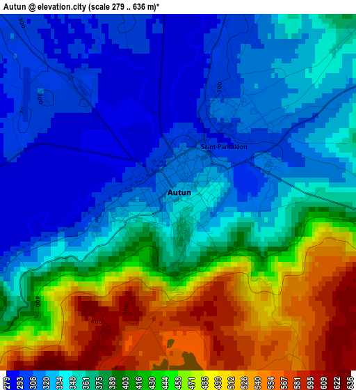
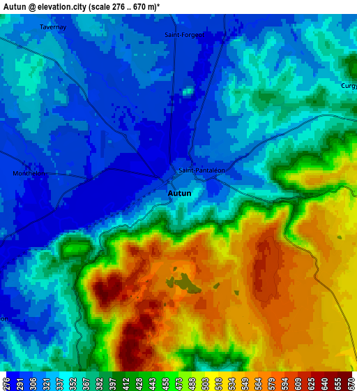
Below is the Elevation map of Autun, which displays elevation range with different colors. Scale of the first map is from 279 to 636 m (915 to 2087 ft) with average elevation of 384.4 meters (=1261 ft) [note 1]
These maps also provides idea of topography and contour of this city, they are displayed at different zoom levels. More info about maps, scale and edge coordinates you can find below images.
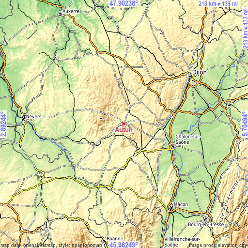
| \ | Map #1 | Map #2 | Topo.Map |
| Scale [m] | 279..636 m | 276..670 m | × |
| Scale [ft] | 915..2087 ft | 906..2198 ft | × |
| Average | 384.4 m = 1261 ft | 398 m = 1306 ft | × |
| Width | 6.67 km = 4.1 mi | 13.34 km = 8.3 mi | 213.5 km = 132.7 mi |
| Height | 6.67 km = 4.1 mi | 13.34 km = 8.3 mi | 213.5 km = 132.7 mi |
| ↑Max Latitude | 46.98103° | 47.011003° | 47.90238° |
| Latitude at center | 46.95104° | 46.95104° | 46.95104° |
| ↓Min Latitude | 46.921034° | 46.89101° | 45.98249° |
| ← Min Longitude | 4.254745° | 4.210799° | 2.89244° |
| Longitude center | 4.29869° | 4.29869° | 4.29869° |
| →Max Longitude | 4.342635° | 4.386581° | 5.70494° |
Nearby cities:
Cities around Autun sort by population:
• Le Creusot elevation 367 m
18.3 km,  150°
150°
• Le Breuil 359 m
20.7 km,  141°
141°
• Torcy 308 m
23.4 km, 149°
• Épinac 330 m
16.9 km,  77°
77°
• Montcenis 407 m
19.4 km,  159°
159°
• Arnay-le-Duc 372 m
24.6 km,  35°
35°
• Étang-sur-Arroux 273 m
12.6 km,  221°
221°
• Saint-Sernin-du-Bois 445 m
15.9 km, 140°
• Couches 384 m
22.4 km,  114°
114°
• Marmagne 317 m
13.5 km, 160°
• Curgy 368 m
7.6 km,  58°
58°
• Auxy 515 m
8 km,  91°
91°
Multilingual:
 En español:
Autun elevación 320 m.
 En France:
Autun élévation 320 m.


Sources and notes:
- [note 1] Map square and city borders are not equal. Map elevation data is calculated only from area inside that square.
- [src 1] Elevation data from geonames database provided with same terms of usage.
- [src 2] The elevation map of Autun is generated using elevation data from NASA's 3 arcsec (90m) resolution SRTM data.
- [src 3] Base (background) map © OpenStreetMap contributors tiles are generated by Geofabrik and OpenTopoMap.
Copyright & License:
This Autun Elevation Map is licensed under CC BY-SA. You may reuse any part from this page, if you give a proper credit by linking to this URL:
 More info on terms of use page.