Auxonne elevation
Auxonne (Bourgogne-Franche-Comté, Département de la Côte-d'Or), France elevation is 189 meters and Auxonne elevation in feet is 620 ft above sea level [src 1]. Auxonne is a populated place (feature code) with elevation that is 15 meters (49 ft) bigger than average city elevation in France.
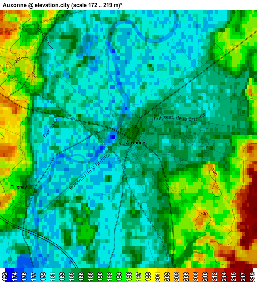
Below is the Elevation map of Auxonne, which displays elevation range with different colors. Scale of the first map is from 172 to 219 m (564 to 719 ft) with average elevation of 187.1 meters (=614 ft) [note 1]
These maps also provides idea of topography and contour of this city, they are displayed at different zoom levels. More info about maps, scale and edge coordinates you can find below images.
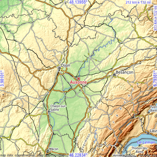
| \ | Map #1 | Map #2 | Topo.Map |
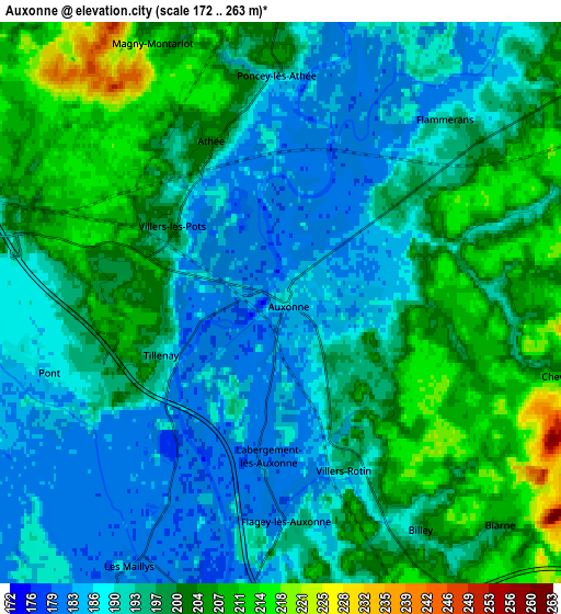
| Scale [m] | 172..219 m | 172..263 m | × |
| Scale [ft] | 564..719 ft | 564..863 ft | × |
| Average | 187.1 m = 614 ft | 195.4 m = 641 ft | × |
| Width | 6.64 km = 4.1 mi | 13.28 km = 8.3 mi | 212.5 km = 132 mi |
| Height | 6.64 km = 4.1 mi | 13.28 km = 8.3 mi | 212.5 km = 132 mi |
| ↑Max Latitude | 47.222404° | 47.252241° | 48.13955° |
| Latitude at center | 47.19255° | 47.19255° | 47.19255° |
| ↓Min Latitude | 47.162679° | 47.132791° | 46.22834° |
| ← Min Longitude | 5.343315° | 5.299369° | 3.98101° |
| Longitude center | 5.38726° | 5.38726° | 5.38726° |
| →Max Longitude | 5.431205° | 5.475151° | 6.79351° |
Nearby cities:
Cities around Auxonne sort by population:
• Dole elevation 222 m
13.6 km,  145°
145°
• Genlis 198 m
13.5 km,  294°
294°
• Damparis 212 m
13.2 km,  171°
171°
• Brazey-en-Plaine 184 m
14.3 km,  244°
244°
• Foucherans 209 m
13.4 km,  157°
157°
• Champvans 221 m
10.5 km, 158°
• Pontailler-sur-Saône 189 m
12.6 km,  9°
9°
• Losne 180 m
14.1 km,  222°
222°
• Saint-Jean-de-Losne 183 m
13.6 km, 222°
• Lamarche-sur-Saône 189 m
8.6 km,  359°
359°
• Longchamp 203 m
10.6 km,  314°
314°
• Saint-Usage 184 m
13.3 km,  226°
226°
Multilingual:
 En español:
Auxonne elevación 189 m.
 En France:
Auxonne élévation 189 m.


Sources and notes:
- [note 1] Map square and city borders are not equal. Map elevation data is calculated only from area inside that square.
- [src 1] Elevation data from geonames database provided with same terms of usage.
- [src 2] The elevation map of Auxonne is generated using elevation data from NASA's 3 arcsec (90m) resolution SRTM data.
- [src 3] Base (background) map © OpenStreetMap contributors tiles are generated by Geofabrik and OpenTopoMap.
Copyright & License:
This Auxonne Elevation Map is licensed under CC BY-SA. You may reuse any part from this page, if you give a proper credit by linking to this URL:
 More info on terms of use page.