Avrillé elevation
Avrillé (Pays de la Loire, Département de Maine-et-Loire), France elevation is 53 meters and Avrillé elevation in feet is 174 ft above sea level [src 1]. Avrillé is a populated place (feature code) with elevation that is 121 meters (397 ft) smaller than average city elevation in France.
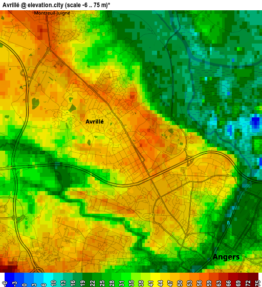
Below is the Elevation map of Avrillé, which displays elevation range with different colors. Scale of the first map is from -6 to 75 m (-20 to 246 ft) with average elevation of 36 meters (=118 ft) [note 1]
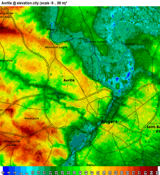
These maps also provides idea of topography and contour of this city, they are displayed at different zoom levels. More info about maps, scale and edge coordinates you can find below images.
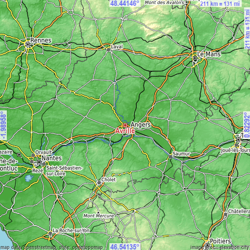
| \ | Map #1 | Map #2 | Topo.Map |
| Scale [m] | -6..75 m | -9..88 m | × |
| Scale [ft] | -20..246 ft | -30..289 ft | × |
| Average | 36 m = 118 ft | 37.3 m = 122 ft | × |
| Width | 6.6 km = 4.1 mi | 13.2 km = 8.2 mi | 211.3 km = 131.3 mi |
| Height | 6.6 km = 4.1 mi | 13.2 km = 8.2 mi | 211.3 km = 131.3 mi |
| ↑Max Latitude | 47.529681° | 47.559344° | 48.44146° |
| Latitude at center | 47.5° | 47.5° | 47.5° |
| ↓Min Latitude | 47.470303° | 47.440588° | 46.54135° |
| ← Min Longitude | -0.627275° | -0.671221° | -1.98958° |
| Longitude center | -0.58333° | -0.58333° | -0.58333° |
| →Max Longitude | -0.539385° | -0.495439° | 0.82292° |
Nearby cities:
Cities around Avrillé sort by population:
• Angers elevation 39 m
4 km,  137°
137°
• Bouchemaine 26 m
8.8 km,  192°
192°
• Beaucouzé 55 m
4.5 km,  231°
231°
• Sainte-Gemmes-sur-Loire 28 m
8.8 km,  166°
166°
• Écouflant 24 m
5.4 km,  50°
50°
• Briollay 19 m
9.2 km,  38°
38°
• Saint-Lambert-la-Potherie 60 m
7.4 km,  255°
255°
• La Meignanne 35 m
6.7 km,  286°
286°
• Cantenay-Épinard 29 m
4 km,  15°
15°
• Feneu 49 m
8.1 km,  354°
354°
• Soulaire-et-Bourg 56 m
9.1 km,  14°
14°
• Le Plessis-Macé 84 m
8.3 km,  304°
304°
Multilingual:
 En español:
Avrillé elevación 53 m.
 En France:
Avrillé élévation 53 m.


Sources and notes:
- [note 1] Map square and city borders are not equal. Map elevation data is calculated only from area inside that square.
- [src 1] Elevation data from geonames database provided with same terms of usage.
- [src 2] The elevation map of Avrillé is generated using elevation data from NASA's 3 arcsec (90m) resolution SRTM data.
- [src 3] Base (background) map © OpenStreetMap contributors tiles are generated by Geofabrik and OpenTopoMap.
Copyright & License:
This Avrillé Elevation Map is licensed under CC BY-SA. You may reuse any part from this page, if you give a proper credit by linking to this URL:
 More info on terms of use page.