Bagneux elevation
Bagneux (Île-de-France, Hauts-de-Seine), France elevation is 111 meters and Bagneux elevation in feet is 364 ft above sea level [src 1]. Bagneux is a populated place (feature code) with elevation that is 63 meters (207 ft) smaller than average city elevation in France.
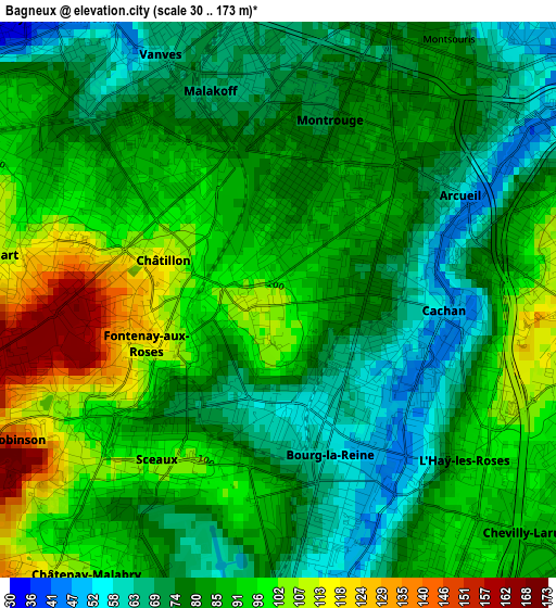
Below is the Elevation map of Bagneux, which displays elevation range with different colors. Scale of the first map is from 30 to 173 m (98 to 568 ft) with average elevation of 84.6 meters (=278 ft) [note 1]
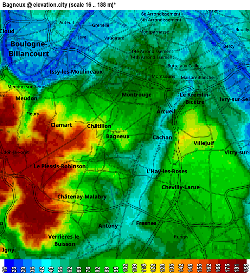
These maps also provides idea of topography and contour of this city, they are displayed at different zoom levels. More info about maps, scale and edge coordinates you can find below images.
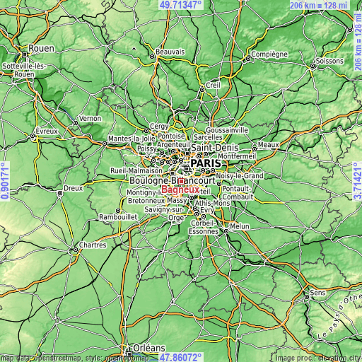
| \ | Map #1 | Map #2 | Topo.Map |
| Scale [m] | 30..173 m | 16..188 m | × |
| Scale [ft] | 98..568 ft | 52..617 ft | × |
| Average | 84.6 m = 278 ft | 82.2 m = 270 ft | × |
| Width | 6.44 km = 4 mi | 12.88 km = 8 mi | 206 km = 128 mi |
| Height | 6.44 km = 4 mi | 12.88 km = 8 mi | 206 km = 128 mi |
| ↑Max Latitude | 48.82459° | 48.853514° | 49.71347° |
| Latitude at center | 48.79565° | 48.79565° | 48.79565° |
| ↓Min Latitude | 48.766693° | 48.737719° | 47.86072° |
| ← Min Longitude | 2.264015° | 2.220069° | 0.90171° |
| Longitude center | 2.30796° | 2.30796° | 2.30796° |
| →Max Longitude | 2.351905° | 2.395851° | 3.71421° |
Nearby cities:
Cities around Bagneux sort by population:
• Clamart elevation 101 m
3.1 km,  285°
285°
• Montrouge 71 m
2.3 km,  10°
10°
• Châtillon 104 m
1.3 km,  305°
305°
• L'Haÿ-les-Roses 62 m
2.3 km,  126°
126°
• Malakoff 69 m
2.8 km,  347°
347°
• Cachan 47 m
2.1 km,  87°
87°
• Fontenay-aux-Roses 100 m
1.1 km,  256°
256°
• Le Plessis-Robinson 159 m
2.8 km,  254°
254°
• Sceaux 93 m
2.5 km,  211°
211°
• Bourg-la-Reine 55 m
2 km,  158°
158°
• Arcueil 45 m
1.9 km,  75°
75°
• Gentilly 66 m
3.1 km,  52°
52°
Multilingual:
 En español:
Bagneux elevación 111 m.
 En France:
Bagneux élévation 111 m.


Sources and notes:
- [note 1] Map square and city borders are not equal. Map elevation data is calculated only from area inside that square.
- [src 1] Elevation data from geonames database provided with same terms of usage.
- [src 2] The elevation map of Bagneux is generated using elevation data from NASA's 3 arcsec (90m) resolution SRTM data.
- [src 3] Base (background) map © OpenStreetMap contributors tiles are generated by Geofabrik and OpenTopoMap.
Copyright & License:
This Bagneux Elevation Map is licensed under CC BY-SA. You may reuse any part from this page, if you give a proper credit by linking to this URL:
 More info on terms of use page.