Bain-de-Bretagne elevation
Bain-de-Bretagne (Brittany, Département d'Ille-et-Vilaine), France elevation is 105 meters and Bain-de-Bretagne elevation in feet is 344 ft above sea level [src 1]. Bain-de-Bretagne is a populated place (feature code) with elevation that is 69 meters (226 ft) smaller than average city elevation in France.
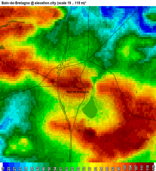
Below is the Elevation map of Bain-de-Bretagne, which displays elevation range with different colors. Scale of the first map is from 19 to 119 m (62 to 390 ft) with average elevation of 72.7 meters (=239 ft) [note 1]
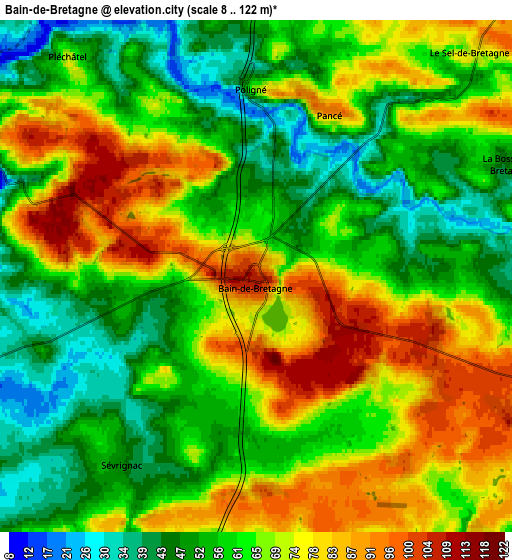
These maps also provides idea of topography and contour of this city, they are displayed at different zoom levels. More info about maps, scale and edge coordinates you can find below images.
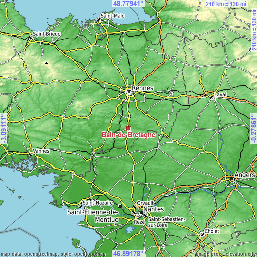
| \ | Map #1 | Map #2 | Topo.Map |
| Scale [m] | 19..119 m | 8..122 m | × |
| Scale [ft] | 62..390 ft | 26..400 ft | × |
| Average | 72.7 m = 239 ft | 64.8 m = 213 ft | × |
| Width | 6.56 km = 4.1 mi | 13.12 km = 8.2 mi | 209.9 km = 130.4 mi |
| Height | 6.56 km = 4.1 mi | 13.12 km = 8.2 mi | 209.9 km = 130.4 mi |
| ↑Max Latitude | 47.873665° | 47.903134° | 48.77941° |
| Latitude at center | 47.84418° | 47.84418° | 47.84418° |
| ↓Min Latitude | 47.814678° | 47.785159° | 46.89178° |
| ← Min Longitude | -1.728805° | -1.772751° | -3.09111° |
| Longitude center | -1.68486° | -1.68486° | -1.68486° |
| →Max Longitude | -1.640915° | -1.596969° | -0.27861° |
Nearby cities:
Cities around Bain-de-Bretagne sort by population:
• Guipry elevation 43 m
11.9 km,  260°
260°
• Messac 12 m
9.7 km, 256°
• Bourg-des-Comptes 36 m
10.5 km,  334°
334°
• Grand-Fougeray 61 m
13.8 km,  194°
194°
• Pléchâtel 72 m
7.4 km,  319°
319°
• Crevin 76 m
10 km,  7°
7°
• Sion-les-Mines 68 m
14 km,  150°
150°
• Ercé-en-Lamée 70 m
9.5 km,  99°
99°
• Saint-Senoux 60 m
10.3 km,  311°
311°
• La Dominelais 57 m
9.1 km,  181°
181°
• Pancé 93 m
4.6 km,  24°
24°
• Tresbœuf 100 m
11 km,  66°
66°
Multilingual:
 En español:
Bain-de-Bretagne elevación 105 m.
 En France:
Bain-de-Bretagne élévation 105 m.
 Auf Deutsch:
Bain-de-Bretagne höhe über dem Meeresspiegel ist 105 m.

Sources and notes:
- [note 1] Map square and city borders are not equal. Map elevation data is calculated only from area inside that square.
- [src 1] Elevation data from geonames database provided with same terms of usage.
- [src 2] The elevation map of Bain-de-Bretagne is generated using elevation data from NASA's 3 arcsec (90m) resolution SRTM data.
- [src 3] Base (background) map © OpenStreetMap contributors tiles are generated by Geofabrik and OpenTopoMap.
Copyright & License:
This Bain-de-Bretagne Elevation Map is licensed under CC BY-SA. You may reuse any part from this page, if you give a proper credit by linking to this URL:
 More info on terms of use page.