Baisieux elevation
Baisieux (Hauts-de-France, Nord), France elevation is 37 meters and Baisieux elevation in feet is 121 ft above sea level [src 1]. Baisieux is a populated place (feature code) with elevation that is 137 meters (449 ft) smaller than average city elevation in France.
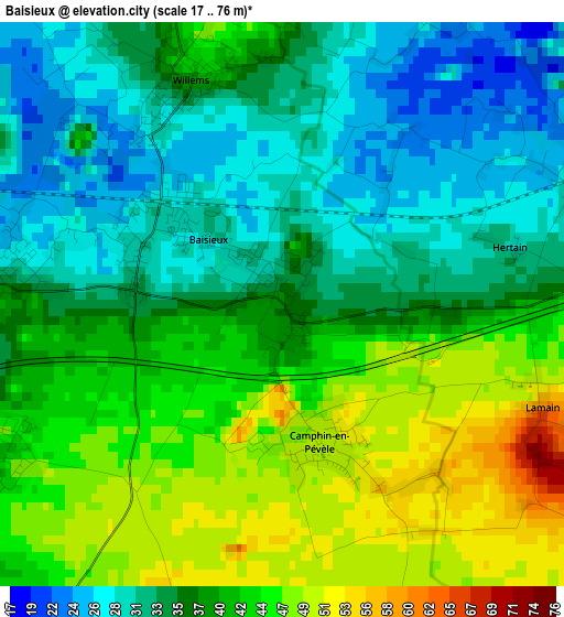
Below is the Elevation map of Baisieux, which displays elevation range with different colors. Scale of the first map is from 17 to 76 m (56 to 249 ft) with average elevation of 38.1 meters (=125 ft) [note 1]
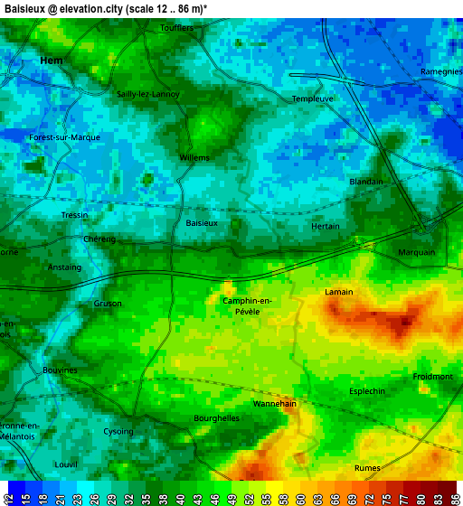
These maps also provides idea of topography and contour of this city, they are displayed at different zoom levels. More info about maps, scale and edge coordinates you can find below images.
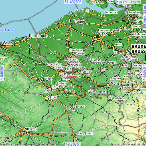
| \ | Map #1 | Map #2 | Topo.Map |
| Scale [m] | 17..76 m | 12..86 m | × |
| Scale [ft] | 56..249 ft | 39..282 ft | × |
| Average | 38.1 m = 125 ft | 36.9 m = 121 ft | × |
| Width | 6.2 km = 3.9 mi | 12.4 km = 7.7 mi | 198.5 km = 123.3 mi |
| Height | 6.2 km = 3.9 mi | 12.4 km = 7.7 mi | 198.4 km = 123.3 mi |
| ↑Max Latitude | 50.63629° | 50.664154° | 51.49239° |
| Latitude at center | 50.60841° | 50.60841° | 50.60841° |
| ↓Min Latitude | 50.580513° | 50.5526° | 49.7075° |
| ← Min Longitude | 3.208565° | 3.164619° | 1.84626° |
| Longitude center | 3.25251° | 3.25251° | 3.25251° |
| →Max Longitude | 3.296455° | 3.340401° | 4.65876° |
Nearby cities:
Cities around Baisieux sort by population:
• Villeneuve-d'Ascq elevation 32 m
6.1 km,  278°
278°
• Cysoing 42 m
5 km,  210°
210°
• Toufflers 38 m
5.9 km,  346°
346°
• Chéreng 35 m
3.2 km,  274°
274°
• Willems 41 m
2.8 km,  339°
339°
• Sailly-lez-Lannoy 43 m
5.3 km,  331°
331°
• Camphin-en-Pévèle 52 m
1.5 km,  157°
157°
• Forest-sur-Marque 26 m
5.2 km,  301°
301°
• Bourghelles 49 m
4.9 km,  186°
186°
• Gruson 44 m
3.5 km,  246°
246°
• Anstaing 32 m
4.4 km,  264°
264°
• Tressin 28 m
4.3 km, 283°
Multilingual:
 En español:
Baisieux elevación 37 m.
 En France:
Baisieux élévation 37 m.


Sources and notes:
- [note 1] Map square and city borders are not equal. Map elevation data is calculated only from area inside that square.
- [src 1] Elevation data from geonames database provided with same terms of usage.
- [src 2] The elevation map of Baisieux is generated using elevation data from NASA's 3 arcsec (90m) resolution SRTM data.
- [src 3] Base (background) map © OpenStreetMap contributors tiles are generated by Geofabrik and OpenTopoMap.
Copyright & License:
This Baisieux Elevation Map is licensed under CC BY-SA. You may reuse any part from this page, if you give a proper credit by linking to this URL:
 More info on terms of use page.