Bannalec elevation
Bannalec (Brittany, Département du Finistère), France elevation is 94 meters and Bannalec elevation in feet is 308 ft above sea level [src 1]. Bannalec is a populated place (feature code) with elevation that is 80 meters (262 ft) smaller than average city elevation in France.
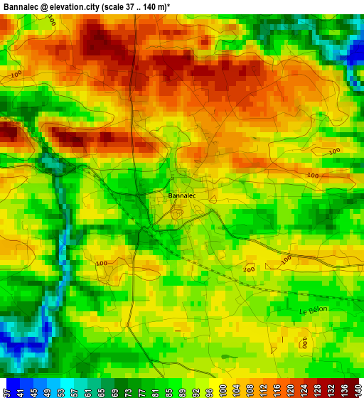
Below is the Elevation map of Bannalec, which displays elevation range with different colors. Scale of the first map is from 37 to 140 m (121 to 459 ft) with average elevation of 95.4 meters (=313 ft) [note 1]
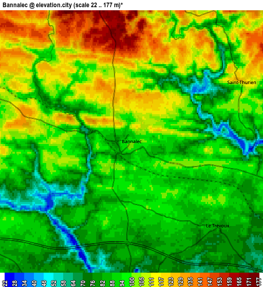
These maps also provides idea of topography and contour of this city, they are displayed at different zoom levels. More info about maps, scale and edge coordinates you can find below images.
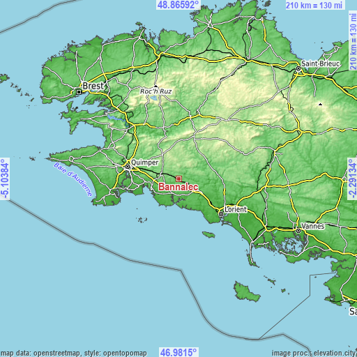
| \ | Map #1 | Map #2 | Topo.Map |
| Scale [m] | 37..140 m | 22..177 m | × |
| Scale [ft] | 121..459 ft | 72..581 ft | × |
| Average | 95.4 m = 313 ft | 96.6 m = 317 ft | × |
| Width | 6.55 km = 4.1 mi | 13.1 km = 8.1 mi | 209.5 km = 130.2 mi |
| Height | 6.55 km = 4.1 mi | 13.1 km = 8.1 mi | 209.5 km = 130.2 mi |
| ↑Max Latitude | 47.961725° | 47.991144° | 48.86592° |
| Latitude at center | 47.93229° | 47.93229° | 47.93229° |
| ↓Min Latitude | 47.902838° | 47.873369° | 46.9815° |
| ← Min Longitude | -3.741535° | -3.785481° | -5.10384° |
| Longitude center | -3.69759° | -3.69759° | -3.69759° |
| →Max Longitude | -3.653645° | -3.609699° | -2.29134° |
Nearby cities:
Cities around Bannalec sort by population:
• Quimperlé elevation 19 m
13.2 km,  123°
123°
• Rosporden 121 m
10.8 km,  290°
290°
• Scaër 157 m
11.2 km,  359°
359°
• Riec-sur-Belon 27 m
11 km,  180°
180°
• Pont-Aven 31 m
9.9 km,  203°
203°
• Melgven 96 m
10.7 km,  254°
254°
• Guiscriff 192 m
13.6 km,  17°
17°
• Mellac 90 m
9.6 km,  109°
109°
• Lanmeur 55 m
11.1 km,  187°
187°
• Tréméven 87 m
12.8 km, 106°
• Querrien 158 m
12.8 km,  72°
72°
• Le Trévoux 85 m
5.9 km,  134°
134°
Multilingual:
 En español:
Bannalec elevación 94 m.
 En France:
Bannalec élévation 94 m.


Sources and notes:
- [note 1] Map square and city borders are not equal. Map elevation data is calculated only from area inside that square.
- [src 1] Elevation data from geonames database provided with same terms of usage.
- [src 2] The elevation map of Bannalec is generated using elevation data from NASA's 3 arcsec (90m) resolution SRTM data.
- [src 3] Base (background) map © OpenStreetMap contributors tiles are generated by Geofabrik and OpenTopoMap.
Copyright & License:
This Bannalec Elevation Map is licensed under CC BY-SA. You may reuse any part from this page, if you give a proper credit by linking to this URL:
 More info on terms of use page.