Beaucourt elevation
Beaucourt (Bourgogne-Franche-Comté, Territoire de Belfort), France elevation is 454 meters and Beaucourt elevation in feet is 1490 ft above sea level [src 1]. Beaucourt is a populated place (feature code) with elevation that is 280 meters (919 ft) bigger than average city elevation in France.
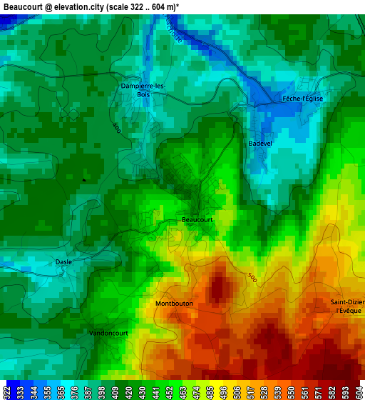
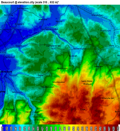
Below is the Elevation map of Beaucourt, which displays elevation range with different colors. Scale of the first map is from 322 to 604 m (1056 to 1982 ft) with average elevation of 435.4 meters (=1428 ft) [note 1]
These maps also provides idea of topography and contour of this city, they are displayed at different zoom levels. More info about maps, scale and edge coordinates you can find below images.
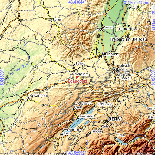
| \ | Map #1 | Map #2 | Topo.Map |
| Scale [m] | 322..604 m | 310..632 m | × |
| Scale [ft] | 1056..1982 ft | 1017..2073 ft | × |
| Average | 435.4 m = 1428 ft | 428.4 m = 1406 ft | × |
| Width | 6.6 km = 4.1 mi | 13.21 km = 8.2 mi | 211.3 km = 131.3 mi |
| Height | 6.6 km = 4.1 mi | 13.21 km = 8.2 mi | 211.3 km = 131.3 mi |
| ↑Max Latitude | 47.518467° | 47.548137° | 48.43044° |
| Latitude at center | 47.48878° | 47.48878° | 47.48878° |
| ↓Min Latitude | 47.459076° | 47.429356° | 46.52992° |
| ← Min Longitude | 6.878195° | 6.834249° | 5.51589° |
| Longitude center | 6.92214° | 6.92214° | 6.92214° |
| →Max Longitude | 6.966085° | 7.010031° | 8.32839° |
Nearby cities:
Cities around Beaucourt sort by population:
• Audincourt elevation 334 m
5.2 km,  263°
263°
• Delle 374 m
6.2 km,  69°
69°
• Seloncourt 361 m
6 km,  237°
237°
• Hérimoncourt 360 m
5.9 km,  210°
210°
• Étupes 371 m
4.3 km,  295°
295°
• Grandvillars 355 m
6.7 km,  33°
33°
• Fesches-le-Châtel 328 m
4.1 km,  342°
342°
• Dampierre-les-Bois 362 m
2.1 km, 340°
• Dasle 385 m
2.2 km, 238°
• Méziré 365 m
5 km,  358°
358°
• Taillecourt 339 m
5.1 km,  277°
277°
• Morvillars 333 m
6.7 km,  7°
7°
Multilingual:
 En español:
Beaucourt elevación 454 m.
 En France:
Beaucourt élévation 454 m.
 Auf Deutsch:
Beaucourt höhe über dem Meeresspiegel ist 454 m.

Sources and notes:
- [note 1] Map square and city borders are not equal. Map elevation data is calculated only from area inside that square.
- [src 1] Elevation data from geonames database provided with same terms of usage.
- [src 2] The elevation map of Beaucourt is generated using elevation data from NASA's 3 arcsec (90m) resolution SRTM data.
- [src 3] Base (background) map © OpenStreetMap contributors tiles are generated by Geofabrik and OpenTopoMap.
Copyright & License:
This Beaucourt Elevation Map is licensed under CC BY-SA. You may reuse any part from this page, if you give a proper credit by linking to this URL:
 More info on terms of use page.