Beauzac elevation
Beauzac (Auvergne-Rhône-Alpes, Haute-Loire), France elevation is 554 meters and Beauzac elevation in feet is 1818 ft above sea level [src 1]. Beauzac is a populated place (feature code) with elevation that is 380 meters (1247 ft) bigger than average city elevation in France.
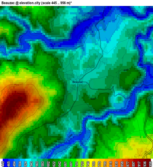
Below is the Elevation map of Beauzac, which displays elevation range with different colors. Scale of the first map is from 445 to 956 m (1460 to 3136 ft) with average elevation of 605 meters (=1985 ft) [note 1]
These maps also provides idea of topography and contour of this city, they are displayed at different zoom levels. More info about maps, scale and edge coordinates you can find below images.
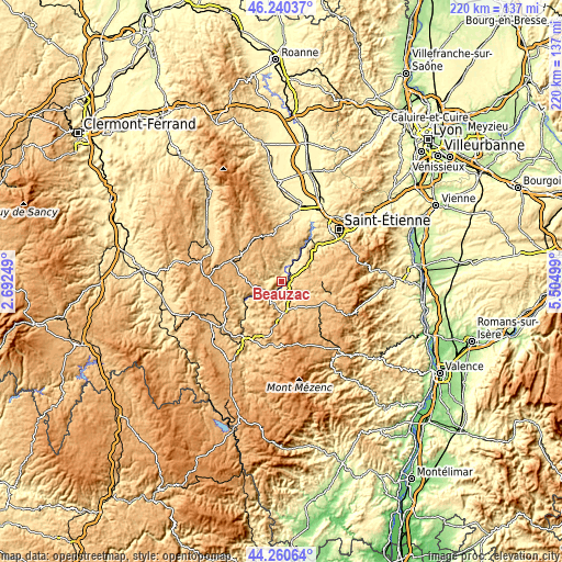
| \ | Map #1 | Topo.Map |
| Scale [m] | 445..956 m | × |
| Scale [ft] | 1460..3136 ft | × |
| Average | 605 m = 1985 ft | × |
| Width | 6.88 km = 4.3 mi | 220.1 km = 136.8 mi |
| Height | 6.88 km = 4.3 mi | 220.1 km = 136.8 mi |
| ↑Max Latitude | 45.290055° | 46.24037° |
| Latitude at center | 45.25913° | 45.25913° |
| ↓Min Latitude | 45.228188° | 44.26064° |
| ← Min Longitude | 4.054795° | 2.69249° |
| Longitude center | 4.09874° | 4.09874° |
| →Max Longitude | 4.142685° | 5.50499° |
Nearby cities:
Cities around Beauzac sort by population:
• Monistrol-sur-Loire elevation 603 m
6.9 km,  57°
57°
• Yssingeaux 866 m
13.1 km,  171°
171°
• Sainte-Sigolène 818 m
10.7 km,  99°
99°
• Aurec-sur-Loire 508 m
14.6 km,  33°
33°
• Bas-en-Basset 465 m
5.3 km,  8°
8°
• Saint-Didier-en-Velay 834 m
14.6 km,  70°
70°
• Retournac 523 m
8 km,  219°
219°
• Saint-Maurice-de-Lignon 762 m
5 km,  140°
140°
• Saint-Pal-de-Mons 826 m
13.8 km, 95°
• Pont-Salomon 743 m
14.6 km,  53°
53°
• Lapte 865 m
12.3 km,  131°
131°
• La Séauve-sur-Semène 748 m
12.5 km, 71°
Multilingual:
 En español:
Beauzac elevación 554 m.
 En France:
Beauzac élévation 554 m.


Sources and notes:
- [note 1] Map square and city borders are not equal. Map elevation data is calculated only from area inside that square.
- [src 1] Elevation data from geonames database provided with same terms of usage.
- [src 2] The elevation map of Beauzac is generated using elevation data from NASA's 3 arcsec (90m) resolution SRTM data.
- [src 3] Base (background) map © OpenStreetMap contributors tiles are generated by Geofabrik and OpenTopoMap.
Copyright & License:
This Beauzac Elevation Map is licensed under CC BY-SA. You may reuse any part from this page, if you give a proper credit by linking to this URL:
 More info on terms of use page.