Belleu elevation
Belleu (Hauts-de-France, Département de l'Aisne), France elevation is 69 meters and Belleu elevation in feet is 226 ft above sea level [src 1]. Belleu is a populated place (feature code) with elevation that is 105 meters (344 ft) smaller than average city elevation in France.
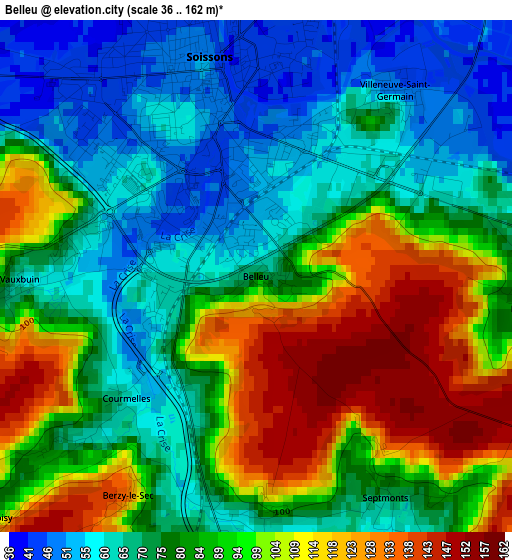
Below is the Elevation map of Belleu, which displays elevation range with different colors. Scale of the first map is from 36 to 162 m (118 to 531 ft) with average elevation of 84.7 meters (=278 ft) [note 1]
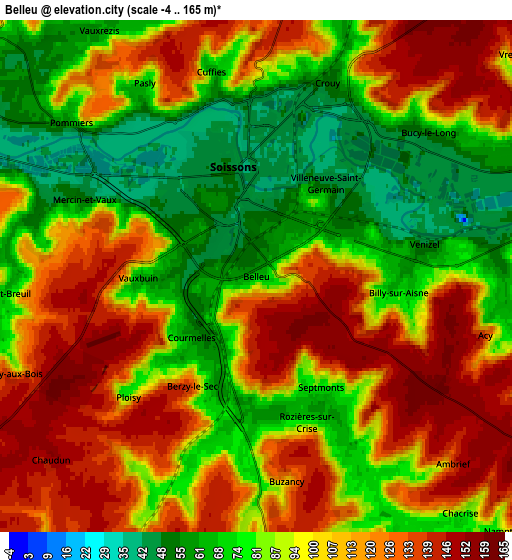
These maps also provides idea of topography and contour of this city, they are displayed at different zoom levels. More info about maps, scale and edge coordinates you can find below images.
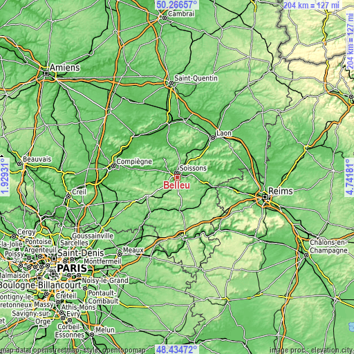
| \ | Map #1 | Map #2 | Topo.Map |
| Scale [m] | 36..162 m | -4..165 m | × |
| Scale [ft] | 118..531 ft | -13..541 ft | × |
| Average | 84.7 m = 278 ft | 98.1 m = 322 ft | × |
| Width | 6.36 km = 4 mi | 12.73 km = 7.9 mi | 203.7 km = 126.6 mi |
| Height | 6.37 km = 4 mi | 12.73 km = 7.9 mi | 203.7 km = 126.6 mi |
| ↑Max Latitude | 49.387784° | 49.416381° | 50.26657° |
| Latitude at center | 49.35917° | 49.35917° | 49.35917° |
| ↓Min Latitude | 49.330539° | 49.301892° | 48.43472° |
| ← Min Longitude | 3.291615° | 3.247669° | 1.92931° |
| Longitude center | 3.33556° | 3.33556° | 3.33556° |
| →Max Longitude | 3.379505° | 3.423451° | 4.74181° |
Nearby cities:
Cities around Belleu sort by population:
• Soissons elevation 50 m
2.6 km,  340°
340°
• Crouy 51 m
5.1 km,  18°
18°
• Villeneuve-Saint-Germain 47 m
2.9 km,  37°
37°
• Vailly-sur-Aisne 50 m
14.2 km,  67°
67°
• Braine 52 m
14.4 km,  97°
97°
• Bucy-le-Long 53 m
5.6 km,  51°
51°
• Courmelles 61 m
2.2 km,  229°
229°
• Cuffies 64 m
5 km,  348°
348°
• Venizel 48 m
4.2 km,  79°
79°
• Ambleny 55 m
11.2 km,  282°
282°
• Billy-sur-Aisne 67 m
3.5 km, 95°
• Pasly 67 m
5.5 km,  328°
328°
Multilingual:
 En español:
Belleu elevación 69 m.
 En France:
Belleu élévation 69 m.


Sources and notes:
- [note 1] Map square and city borders are not equal. Map elevation data is calculated only from area inside that square.
- [src 1] Elevation data from geonames database provided with same terms of usage.
- [src 2] The elevation map of Belleu is generated using elevation data from NASA's 3 arcsec (90m) resolution SRTM data.
- [src 3] Base (background) map © OpenStreetMap contributors tiles are generated by Geofabrik and OpenTopoMap.
Copyright & License:
This Belleu Elevation Map is licensed under CC BY-SA. You may reuse any part from this page, if you give a proper credit by linking to this URL:
 More info on terms of use page.