Bezons elevation
Bezons (Île-de-France, Département du Val-d’Oise), France elevation is 27 meters and Bezons elevation in feet is 89 ft above sea level [src 1]. Bezons is a populated place (feature code) with elevation that is 147 meters (482 ft) smaller than average city elevation in France.
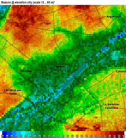
Below is the Elevation map of Bezons, which displays elevation range with different colors. Scale of the first map is from 12 to 65 m (39 to 213 ft) with average elevation of 38.6 meters (=127 ft) [note 1]
These maps also provides idea of topography and contour of this city, they are displayed at different zoom levels. More info about maps, scale and edge coordinates you can find below images.
| \ | Map #1 | Map #2 | Topo.Map |
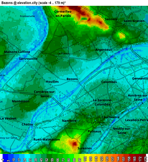
| Scale [m] | 12..65 m | -4..179 m | × |
| Scale [ft] | 39..213 ft | -13..587 ft | × |
| Average | 38.6 m = 127 ft | 45.6 m = 150 ft | × |
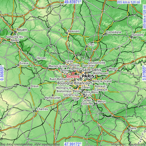
| Width | 6.42 km = 4 mi | 12.84 km = 8 mi | 205.5 km = 127.7 mi |
| Height | 6.42 km = 4 mi | 12.84 km = 8 mi | 205.5 km = 127.7 mi |
| ↑Max Latitude | 48.953126° | 48.981976° | 49.83971° |
| Latitude at center | 48.92426° | 48.92426° | 48.92426° |
| ↓Min Latitude | 48.895377° | 48.866478° | 47.99172° |
| ← Min Longitude | 2.168855° | 2.124909° | 0.80655° |
| Longitude center | 2.2128° | 2.2128° | 2.2128° |
| →Max Longitude | 2.256745° | 2.300691° | 3.61905° |
Nearby cities:
Cities around Bezons sort by population:
• Argenteuil elevation 33 m
3.6 km,  43°
43°
• Asnières-sur-Seine 35 m
5.2 km,  99°
99°
• Nanterre 50 m
3.6 km,  187°
187°
• Courbevoie 49 m
4.4 km,  133°
133°
• Colombes 40 m
3.1 km, 101°
• Sartrouville 58 m
3.1 km,  329°
329°
• Puteaux 33 m
4.9 km,  157°
157°
• Houilles 30 m
1.5 km,  258°
258°
• La Garenne-Colombes 42 m
3.3 km, 131°
• Bois-Colombes 30 m
4.6 km, 96°
• La Defense 53 m
4.1 km,  152°
152°
• Carrières-sur-Seine 41 m
3.1 km,  231°
231°
Multilingual:
 En español:
Bezons elevación 27 m.
 En France:
Bezons élévation 27 m.


Sources and notes:
- [note 1] Map square and city borders are not equal. Map elevation data is calculated only from area inside that square.
- [src 1] Elevation data from geonames database provided with same terms of usage.
- [src 2] The elevation map of Bezons is generated using elevation data from NASA's 3 arcsec (90m) resolution SRTM data.
- [src 3] Base (background) map © OpenStreetMap contributors tiles are generated by Geofabrik and OpenTopoMap.
Copyright & License:
This Bezons Elevation Map is licensed under CC BY-SA. You may reuse any part from this page, if you give a proper credit by linking to this URL:
 More info on terms of use page.