Bompas elevation
Bompas (Occitanie, Département des Pyrénées-Orientales), France elevation is 16 meters and Bompas elevation in feet is 52 ft above sea level [src 1]. Bompas is a populated place (feature code) with elevation that is 158 meters (518 ft) smaller than average city elevation in France.
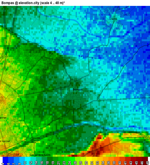
Below is the Elevation map of Bompas, which displays elevation range with different colors. Scale of the first map is from 4 to 48 m (13 to 157 ft) with average elevation of 16.9 meters (=55 ft) [note 1]
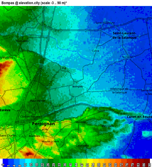
These maps also provides idea of topography and contour of this city, they are displayed at different zoom levels. More info about maps, scale and edge coordinates you can find below images.
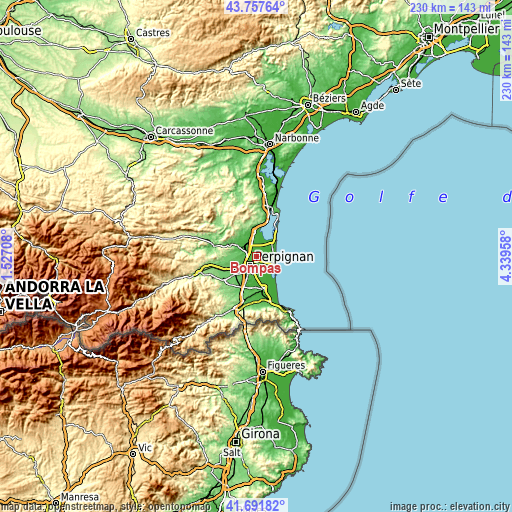
| \ | Map #1 | Map #2 | Topo.Map |
| Scale [m] | 4..48 m | -3..90 m | × |
| Scale [ft] | 13..157 ft | -10..295 ft | × |
| Average | 16.9 m = 55 ft | 20.7 m = 68 ft | × |
| Width | 7.18 km = 4.5 mi | 14.36 km = 8.9 mi | 229.7 km = 142.7 mi |
| Height | 7.18 km = 4.5 mi | 14.36 km = 8.9 mi | 229.7 km = 142.7 mi |
| ↑Max Latitude | 42.7656° | 42.797854° | 43.75764° |
| Latitude at center | 42.73333° | 42.73333° | 42.73333° |
| ↓Min Latitude | 42.701043° | 42.668739° | 41.69182° |
| ← Min Longitude | 2.889385° | 2.845439° | 1.52708° |
| Longitude center | 2.93333° | 2.93333° | 2.93333° |
| →Max Longitude | 2.977275° | 3.021221° | 4.33958° |
Nearby cities:
Cities around Bompas sort by population:
• Perpignan elevation 43 m
5 km,  217°
217°
• Canet-en-Roussillon 2 m
7.8 km,  118°
118°
• Saint-Estève 51 m
7.6 km,  251°
251°
• Cabestany 41 m
5.8 km,  173°
173°
• Rivesaltes 29 m
6.4 km,  308°
308°
• Saint-Laurent-de-la-Salanque 10 m
6.4 km,  46°
46°
• Pia 21 m
1.7 km,  318°
318°
• Claira 15 m
3.5 km,  31°
31°
• Villelongue-de-la-Salanque 11 m
4.1 km,  100°
100°
• Torreilles 9 m
5.4 km,  64°
64°
• Saint-Hippolyte 6 m
6.4 km,  24°
24°
• Peyrestortes 42 m
7 km,  289°
289°
Multilingual:
 En español:
Bompas elevación 16 m.
 En France:
Bompas élévation 16 m.


Sources and notes:
- [note 1] Map square and city borders are not equal. Map elevation data is calculated only from area inside that square.
- [src 1] Elevation data from geonames database provided with same terms of usage.
- [src 2] The elevation map of Bompas is generated using elevation data from NASA's 3 arcsec (90m) resolution SRTM data.
- [src 3] Base (background) map © OpenStreetMap contributors tiles are generated by Geofabrik and OpenTopoMap.
Copyright & License:
This Bompas Elevation Map is licensed under CC BY-SA. You may reuse any part from this page, if you give a proper credit by linking to this URL:
 More info on terms of use page.