La Crèche elevation
La Crèche (Nouvelle-Aquitaine, Département des Deux-Sèvres), France elevation is 43 meters and La Crèche elevation in feet is 141 ft above sea level [src 1]. La Crèche is a populated place (feature code) with elevation that is 131 meters (430 ft) smaller than average city elevation in France.
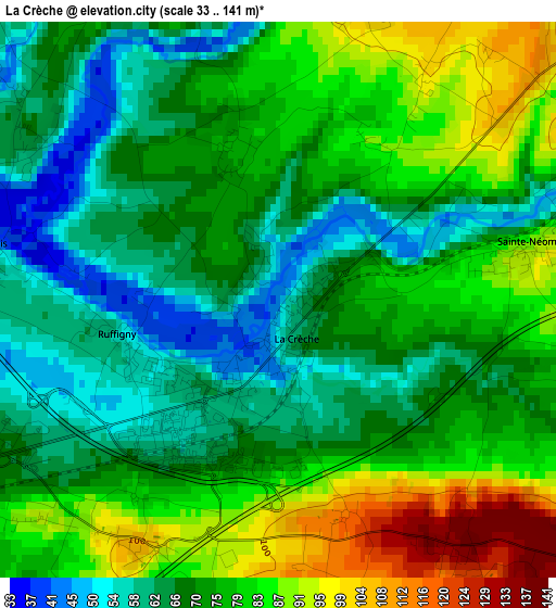
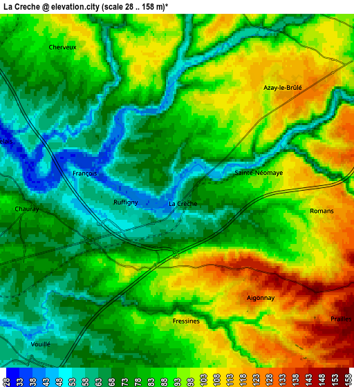
Below is the Elevation map of La Crèche, which displays elevation range with different colors. Scale of the first map is from 33 to 141 m (108 to 463 ft) with average elevation of 73.9 meters (=242 ft) [note 1]
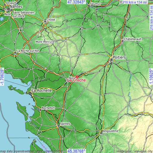
These maps also provides idea of topography and contour of this city, they are displayed at different zoom levels. More info about maps, scale and edge coordinates you can find below images.
| \ | Map #1 | Map #2 | Topo.Map |
| Scale [m] | 33..141 m | 28..158 m | × |
| Scale [ft] | 108..463 ft | 92..518 ft | × |
| Average | 73.9 m = 242 ft | 84.7 m = 278 ft | × |
| Width | 6.74 km = 4.2 mi | 13.49 km = 8.4 mi | 215.8 km = 134.1 mi |
| Height | 6.74 km = 4.2 mi | 13.49 km = 8.4 mi | 215.8 km = 134.1 mi |
| ↑Max Latitude | 46.396986° | 46.427284° | 47.32843° |
| Latitude at center | 46.36667° | 46.36667° | 46.36667° |
| ↓Min Latitude | 46.336338° | 46.305988° | 45.38768° |
| ← Min Longitude | -0.343945° | -0.387891° | -1.70625° |
| Longitude center | -0.3° | -0.3° | -0.3° |
| →Max Longitude | -0.256055° | -0.212109° | 1.10625° |
Nearby cities:
Cities around La Crèche sort by population:
• Chauray elevation 66 m
6 km,  263°
263°
• Aiffres 31 m
12.4 km,  225°
225°
• Échiré 50 m
9.2 km,  286°
286°
• Vouillé 53 m
7.8 km,  222°
222°
• Mougon 86 m
8 km,  172°
172°
• Nanteuil 77 m
10.9 km,  62°
62°
• Azay-le-Brûlé 120 m
5.6 km,  46°
46°
• Saint-Gelais 58 m
7.1 km,  284°
284°
• Cherveux 92 m
7 km,  321°
321°
• Exireuil 149 m
11.1 km, 48°
• Saivres 114 m
8.8 km,  33°
33°
• Thorigné 109 m
9.2 km,  155°
155°
Multilingual:
 En español:
La Crèche elevación 43 m.
 En France:
La Crèche élévation 43 m.
 Auf Deutsch:
La Crèche höhe über dem Meeresspiegel ist 43 m.

Sources and notes:
- [note 1] Map square and city borders are not equal. Map elevation data is calculated only from area inside that square.
- [src 1] Elevation data from geonames database provided with same terms of usage.
- [src 2] The elevation map of La Crèche is generated using elevation data from NASA's 3 arcsec (90m) resolution SRTM data.
- [src 3] Base (background) map © OpenStreetMap contributors tiles are generated by Geofabrik and OpenTopoMap.
Copyright & License:
This La Crèche Elevation Map is licensed under CC BY-SA. You may reuse any part from this page, if you give a proper credit by linking to this URL:
 More info on terms of use page.