Bressuire elevation
Bressuire (Nouvelle-Aquitaine, Département des Deux-Sèvres), France elevation is 200 meters and Bressuire elevation in feet is 656 ft above sea level [src 1]. Bressuire is a seat of a third-order administrative division (feature code) with elevation that is 26 meters (85 ft) bigger than average city elevation in France.
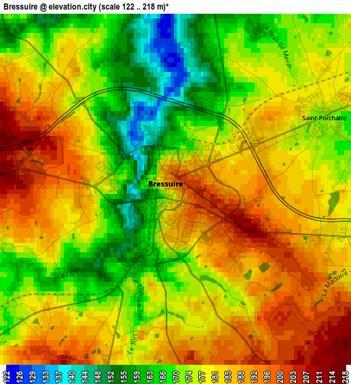
Below is the Elevation map of Bressuire, which displays elevation range with different colors. Scale of the first map is from 122 to 218 m (400 to 715 ft) with average elevation of 178.3 meters (=585 ft) [note 1]
These maps also provides idea of topography and contour of this city, they are displayed at different zoom levels. More info about maps, scale and edge coordinates you can find below images.
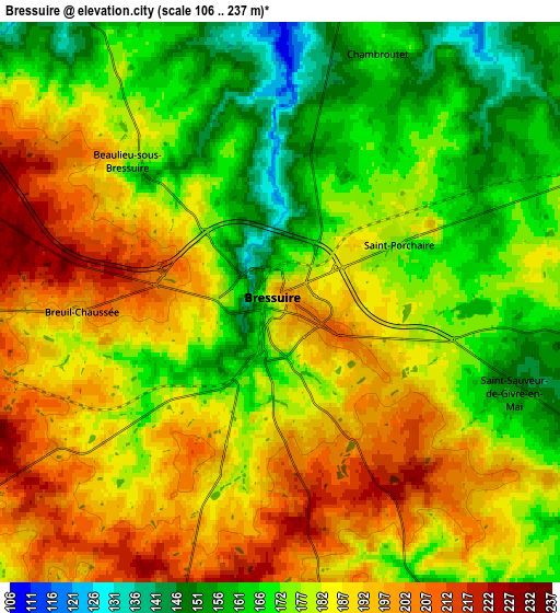
| \ | Map #1 | Map #2 | Topo.Map |
| Scale [m] | 122..218 m | 106..237 m | × |
| Scale [ft] | 400..715 ft | 348..778 ft | × |
| Average | 178.3 m = 585 ft | 180.5 m = 592 ft | × |
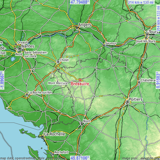
| Width | 6.68 km = 4.2 mi | 13.37 km = 8.3 mi | 213.9 km = 132.9 mi |
| Height | 6.68 km = 4.2 mi | 13.37 km = 8.3 mi | 213.9 km = 132.9 mi |
| ↑Max Latitude | 46.871631° | 46.901665° | 47.79488° |
| Latitude at center | 46.84158° | 46.84158° | 46.84158° |
| ↓Min Latitude | 46.811512° | 46.781428° | 45.87106° |
| ← Min Longitude | -0.534365° | -0.578311° | -1.89667° |
| Longitude center | -0.49042° | -0.49042° | -0.49042° |
| →Max Longitude | -0.446475° | -0.402529° | 0.91583° |
Nearby cities:
Cities around Bressuire sort by population:
• Nueil-les-Aubiers elevation 108 m
12.4 km,  325°
325°
• Cerizay 189 m
13.5 km,  260°
260°
• Moncoutant 197 m
15.1 km,  209°
209°
• La Forêt-sur-Sèvre 160 m
14.5 km,  236°
236°
• Courlay 197 m
9.1 km,  220°
220°
• Saint-Mesmin 167 m
19.2 km,  253°
253°
• La Chapelle-Saint-Laurent 183 m
10.7 km,  174°
174°
• Chiché 153 m
11.1 km,  116°
116°
• Combrand 197 m
15.3 km,  279°
279°
• Boismé 151 m
8.5 km,  150°
150°
• Argenton-les-Vallées 106 m
16.3 km,  10°
10°
• Le Pin 195 m
12.7 km, 280°
Multilingual:
 En español:
Bressuire elevación 200 m.
 En France:
Bressuire élévation 200 m.
 Auf Deutsch:
Bressuire höhe über dem Meeresspiegel ist 200 m.

Sources and notes:
- [note 1] Map square and city borders are not equal. Map elevation data is calculated only from area inside that square.
- [src 1] Elevation data from geonames database provided with same terms of usage.
- [src 2] The elevation map of Bressuire is generated using elevation data from NASA's 3 arcsec (90m) resolution SRTM data.
- [src 3] Base (background) map © OpenStreetMap contributors tiles are generated by Geofabrik and OpenTopoMap.
Copyright & License:
This Bressuire Elevation Map is licensed under CC BY-SA. You may reuse any part from this page, if you give a proper credit by linking to this URL:
 More info on terms of use page.