Brou-sur-Chantereine elevation
Brou-sur-Chantereine (Île-de-France, Seine-et-Marne), France elevation is 51 meters and Brou-sur-Chantereine elevation in feet is 167 ft above sea level [src 1]. Brou-sur-Chantereine is a populated place (feature code) with elevation that is 123 meters (404 ft) smaller than average city elevation in France.
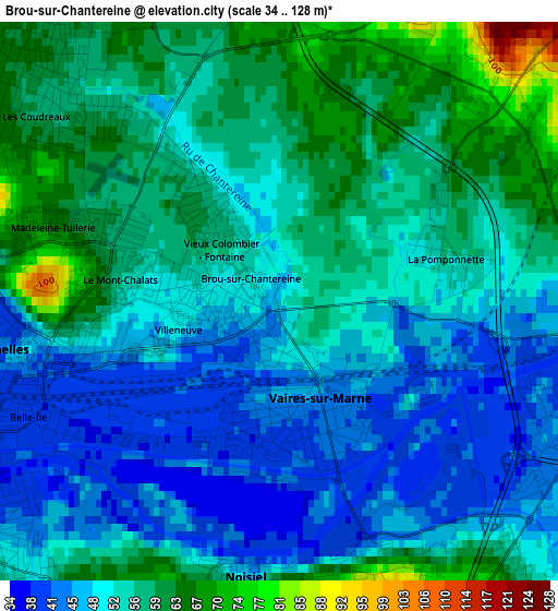
Below is the Elevation map of Brou-sur-Chantereine, which displays elevation range with different colors. Scale of the first map is from 34 to 128 m (112 to 420 ft) with average elevation of 53.4 meters (=175 ft) [note 1]
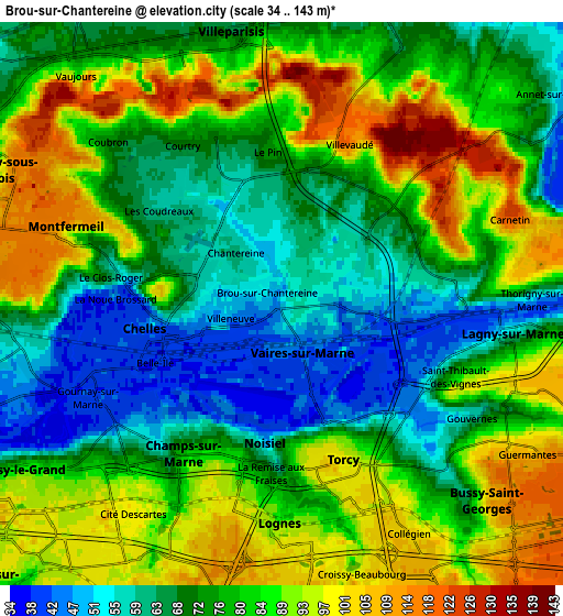
These maps also provides idea of topography and contour of this city, they are displayed at different zoom levels. More info about maps, scale and edge coordinates you can find below images.
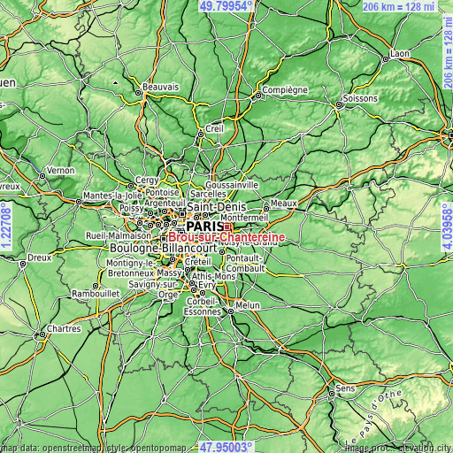
| \ | Map #1 | Map #2 | Topo.Map |
| Scale [m] | 34..128 m | 34..143 m | × |
| Scale [ft] | 112..420 ft | 112..469 ft | × |
| Average | 53.4 m = 175 ft | 78.4 m = 257 ft | × |
| Width | 6.43 km = 4 mi | 12.85 km = 8 mi | 205.6 km = 127.8 mi |
| Height | 6.43 km = 4 mi | 12.85 km = 8 mi | 205.6 km = 127.8 mi |
| ↑Max Latitude | 48.91222° | 48.941093° | 49.79954° |
| Latitude at center | 48.88333° | 48.88333° | 48.88333° |
| ↓Min Latitude | 48.854423° | 48.8255° | 47.95003° |
| ← Min Longitude | 2.589385° | 2.545439° | 1.22708° |
| Longitude center | 2.63333° | 2.63333° | 2.63333° |
| →Max Longitude | 2.677275° | 2.721221° | 4.03958° |
Nearby cities:
Cities around Brou-sur-Chantereine sort by population:
• Chelles elevation 44 m
3 km,  265°
265°
• Champs-sur-Marne 74 m
4.4 km,  213°
213°
• Torcy 101 m
3.9 km,  160°
160°
• Montfermeil 105 m
4.3 km,  292°
292°
• Noisiel 77 m
3.9 km,  189°
189°
• Vaires-sur-Marne 48 m
0.9 km,  148°
148°
• Courtry 80 m
4.5 km,  331°
331°
• Saint-Thibault-des-Vignes 42 m
3.7 km,  111°
111°
• Gournay-sur-Marne 40 m
4.3 km,  236°
236°
• Pomponne 50 m
3.6 km,  93°
93°
• Villevaudé 118 m
4 km,  20°
20°
• Le Pin 72 m
3.6 km,  354°
354°
Multilingual:
 En español:
Brou-sur-Chantereine elevación 51 m.
 En France:
Brou-sur-Chantereine élévation 51 m.
 Auf Deutsch:
Brou-sur-Chantereine höhe über dem Meeresspiegel ist 51 m.
 На русском:
Brou-sur-Chantereine высота над уровнем моря 51 м
Sources and notes:
- [note 1] Map square and city borders are not equal. Map elevation data is calculated only from area inside that square.
- [src 1] Elevation data from geonames database provided with same terms of usage.
- [src 2] The elevation map of Brou-sur-Chantereine is generated using elevation data from NASA's 3 arcsec (90m) resolution SRTM data.
- [src 3] Base (background) map © OpenStreetMap contributors tiles are generated by Geofabrik and OpenTopoMap.
Copyright & License:
This Brou-sur-Chantereine Elevation Map is licensed under CC BY-SA. You may reuse any part from this page, if you give a proper credit by linking to this URL:
 More info on terms of use page.