Camon elevation
Camon (Hauts-de-France, Somme), France elevation is 30 meters and Camon elevation in feet is 98 ft above sea level [src 1]. Camon is a populated place (feature code) with elevation that is 144 meters (472 ft) smaller than average city elevation in France.
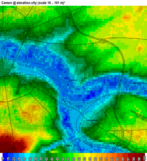
Below is the Elevation map of Camon, which displays elevation range with different colors. Scale of the first map is from 16 to 101 m (52 to 331 ft) with average elevation of 47.6 meters (=156 ft) [note 1]
These maps also provides idea of topography and contour of this city, they are displayed at different zoom levels. More info about maps, scale and edge coordinates you can find below images.
| \ | Map #1 | Map #2 | Topo.Map |
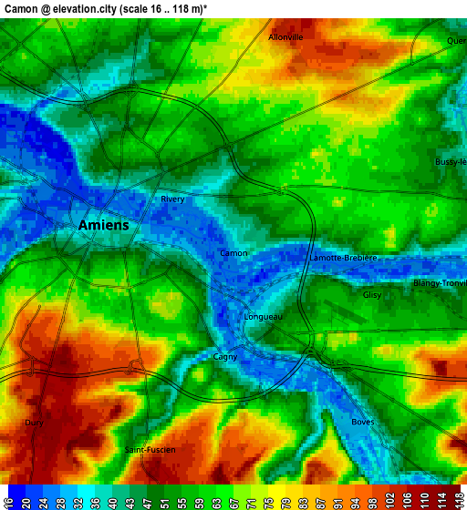
| Scale [m] | 16..101 m | 16..118 m | × |
| Scale [ft] | 52..331 ft | 52..387 ft | × |
| Average | 47.6 m = 156 ft | 59.8 m = 196 ft | × |
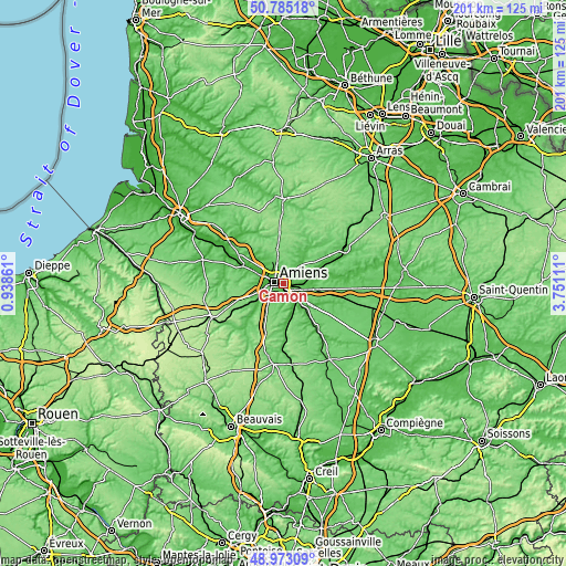
| Width | 6.3 km = 3.9 mi | 12.59 km = 7.8 mi | 201.5 km = 125.2 mi |
| Height | 6.3 km = 3.9 mi | 12.59 km = 7.8 mi | 201.5 km = 125.2 mi |
| ↑Max Latitude | 49.915945° | 49.944234° | 50.78518° |
| Latitude at center | 49.88764° | 49.88764° | 49.88764° |
| ↓Min Latitude | 49.859318° | 49.83098° | 48.97309° |
| ← Min Longitude | 2.300915° | 2.256969° | 0.93861° |
| Longitude center | 2.34486° | 2.34486° | 2.34486° |
| →Max Longitude | 2.388805° | 2.432751° | 3.75111° |
Nearby cities:
Cities around Camon sort by population:
• Amiens elevation 28 m
3.5 km,  293°
293°
• Longueau 39 m
2 km,  149°
149°
• Salouël 30 m
7.5 km,  254°
254°
• Rivery 44 m
2.4 km,  317°
317°
• Boves 35 m
5.9 km,  141°
141°
• Saleux 33 m
8.5 km, 245°
• Pont-de-Metz 29 m
7.4 km,  261°
261°
• Dreuil-lès-Amiens 32 m
8.8 km, 290°
• Cagny 31 m
2.8 km,  183°
183°
• Poulainville 68 m
7 km,  341°
341°
• Dury 113 m
7 km,  229°
229°
• Sains-en-Amiénois 111 m
8.1 km,  193°
193°
Multilingual:
 En español:
Camon elevación 30 m.
 En France:
Camon élévation 30 m.


Sources and notes:
- [note 1] Map square and city borders are not equal. Map elevation data is calculated only from area inside that square.
- [src 1] Elevation data from geonames database provided with same terms of usage.
- [src 2] The elevation map of Camon is generated using elevation data from NASA's 3 arcsec (90m) resolution SRTM data.
- [src 3] Base (background) map © OpenStreetMap contributors tiles are generated by Geofabrik and OpenTopoMap.
Copyright & License:
This Camon Elevation Map is licensed under CC BY-SA. You may reuse any part from this page, if you give a proper credit by linking to this URL:
 More info on terms of use page.