Canohès elevation
Canohès (Occitanie, Département des Pyrénées-Orientales), France elevation is 65 meters and Canohès elevation in feet is 213 ft above sea level [src 1]. Canohès is a populated place (feature code) with elevation that is 109 meters (358 ft) smaller than average city elevation in France.
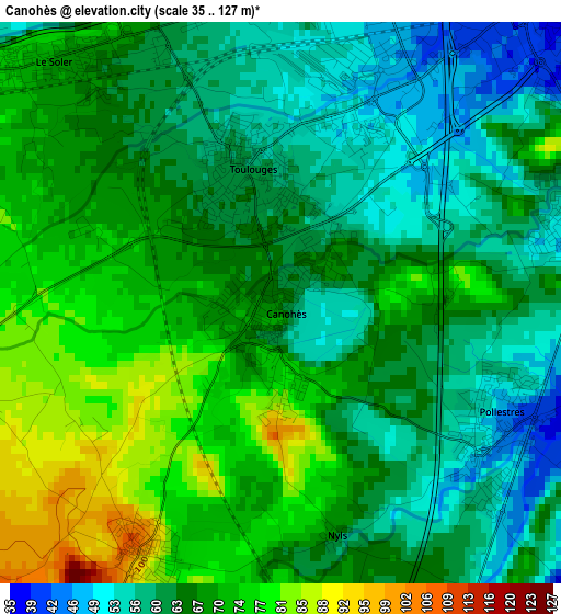
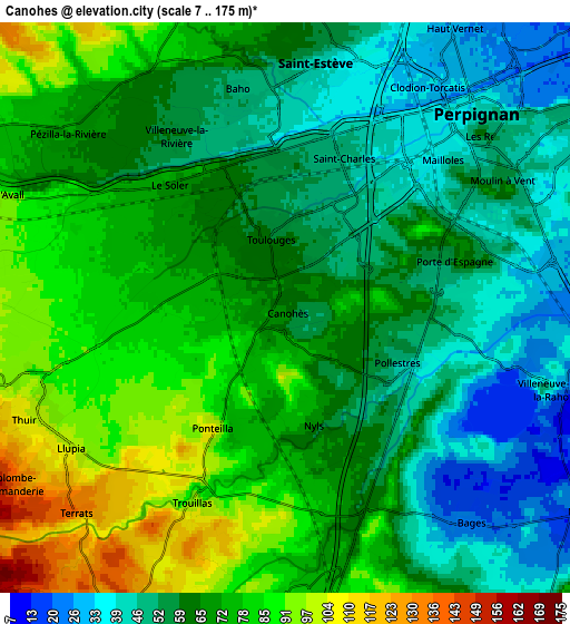
Below is the Elevation map of Canohès, which displays elevation range with different colors. Scale of the first map is from 35 to 127 m (115 to 417 ft) with average elevation of 66.2 meters (=217 ft) [note 1]
These maps also provides idea of topography and contour of this city, they are displayed at different zoom levels. More info about maps, scale and edge coordinates you can find below images.
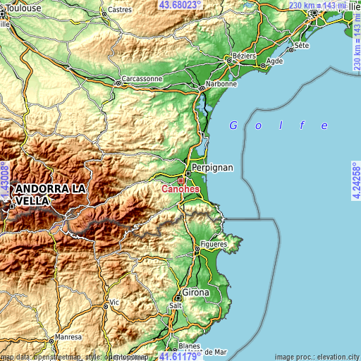
| \ | Map #1 | Map #2 | Topo.Map |
| Scale [m] | 35..127 m | 7..175 m | × |
| Scale [ft] | 115..417 ft | 23..574 ft | × |
| Average | 66.2 m = 217 ft | 65.8 m = 216 ft | × |
| Width | 7.19 km = 4.5 mi | 14.37 km = 8.9 mi | 230 km = 142.9 mi |
| Height | 7.19 km = 4.5 mi | 14.37 km = 8.9 mi | 230 km = 142.9 mi |
| ↑Max Latitude | 42.686921° | 42.719216° | 43.68023° |
| Latitude at center | 42.65461° | 42.65461° | 42.65461° |
| ↓Min Latitude | 42.622282° | 42.589937° | 41.61179° |
| ← Min Longitude | 2.792385° | 2.748439° | 1.43008° |
| Longitude center | 2.83633° | 2.83633° | 2.83633° |
| →Max Longitude | 2.880275° | 2.924221° | 4.24258° |
Nearby cities:
Cities around Canohès sort by population:
• Perpignan elevation 43 m
6.8 km,  45°
45°
• Saint-Estève 51 m
6.4 km,  6°
6°
• Le Soler 72 m
4.6 km,  309°
309°
• Toulouges 60 m
1.7 km,  342°
342°
• Villeneuve-de-la-Raho 47 m
6.9 km,  107°
107°
• Pollestres 46 m
3.2 km,  116°
116°
• Pézilla-la-Rivière 72 m
7 km, 310°
• Baho 53 m
5.2 km,  346°
346°
• Ponteilla 107 m
3.7 km,  210°
210°
• Llupia 108 m
6.7 km,  235°
235°
• Trouillas 99 m
5.4 km, 205°
• Villeneuve-la-Rivière 60 m
5.1 km,  327°
327°
Multilingual:
 En español:
Canohès elevación 65 m.
 En France:
Canohès élévation 65 m.


Sources and notes:
- [note 1] Map square and city borders are not equal. Map elevation data is calculated only from area inside that square.
- [src 1] Elevation data from geonames database provided with same terms of usage.
- [src 2] The elevation map of Canohès is generated using elevation data from NASA's 3 arcsec (90m) resolution SRTM data.
- [src 3] Base (background) map © OpenStreetMap contributors tiles are generated by Geofabrik and OpenTopoMap.
Copyright & License:
This Canohès Elevation Map is licensed under CC BY-SA. You may reuse any part from this page, if you give a proper credit by linking to this URL:
 More info on terms of use page.