Carros elevation
Carros (Provence-Alpes-Côte d'Azur, Alpes-Maritimes), France elevation is 136 meters and Carros elevation in feet is 446 ft above sea level [src 1]. Carros is a populated place (feature code) with elevation that is 38 meters (125 ft) smaller than average city elevation in France.
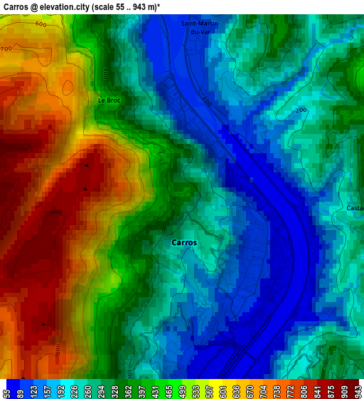
Below is the Elevation map of Carros, which displays elevation range with different colors. Scale of the first map is from 55 to 943 m (180 to 3094 ft) with average elevation of 369.5 meters (=1212 ft) [note 1]
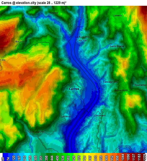
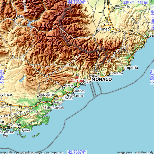
These maps also provides idea of topography and contour of this city, they are displayed at different zoom levels. More info about maps, scale and edge coordinates you can find below images.
| \ | Map #1 | Map #2 | Topo.Map |
| Scale [m] | 55..943 m | 28..1229 m | × |
| Scale [ft] | 180..3094 ft | 92..4032 ft | × |
| Average | 369.5 m = 1212 ft | 453.9 m = 1489 ft | × |
| Width | 7.05 km = 4.4 mi | 14.11 km = 8.8 mi | 225.7 km = 140.2 mi |
| Height | 7.05 km = 4.4 mi | 14.11 km = 8.8 mi | 225.7 km = 140.2 mi |
| ↑Max Latitude | 43.824174° | 43.85587° | 44.79894° |
| Latitude at center | 43.79246° | 43.79246° | 43.79246° |
| ↓Min Latitude | 43.76073° | 43.728982° | 42.76874° |
| ← Min Longitude | 7.143505° | 7.099559° | 5.7812° |
| Longitude center | 7.18745° | 7.18745° | 7.18745° |
| →Max Longitude | 7.231395° | 7.275341° | 8.5937° |
Nearby cities:
Cities around Carros sort by population:
• La Gaude elevation 232 m
8.3 km,  199°
199°
• Tourrette-Levens 450 m
7.1 km,  95°
95°
• Levens 677 m
8.1 km,  22°
22°
• Saint-Jeannet 443 m
6.2 km,  215°
215°
• Gattières 97 m
3.8 km,  194°
194°
• Colomars 293 m
4.3 km,  139°
139°
• Saint-Martin-du-Var 105 m
2.9 km,  5°
5°
• Aspremont 472 m
4.7 km, 102°
• Falicon 100 m
8.8 km,  123°
123°
• Castagniers 364 m
3.5 km,  92°
92°
• Gilette 417 m
6.7 km,  343°
343°
• Le Broc 449 m
2.4 km,  320°
320°
Multilingual:
 En español:
Carros elevación 136 m.
 En France:
Carros élévation 136 m.


Sources and notes:
- [note 1] Map square and city borders are not equal. Map elevation data is calculated only from area inside that square.
- [src 1] Elevation data from geonames database provided with same terms of usage.
- [src 2] The elevation map of Carros is generated using elevation data from NASA's 3 arcsec (90m) resolution SRTM data.
- [src 3] Base (background) map © OpenStreetMap contributors tiles are generated by Geofabrik and OpenTopoMap.
Copyright & License:
This Carros Elevation Map is licensed under CC BY-SA. You may reuse any part from this page, if you give a proper credit by linking to this URL:
 More info on terms of use page.