Castres elevation
Castres (Occitanie, Tarn), France elevation is 178 meters and Castres elevation in feet is 584 ft above sea level [src 1]. Castres is a seat of a third-order administrative division (feature code) with elevation that is 4 meters (13 ft) bigger than average city elevation in France.
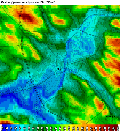
Below is the Elevation map of Castres, which displays elevation range with different colors. Scale of the first map is from 158 to 279 m (518 to 915 ft) with average elevation of 199.5 meters (=655 ft) [note 1]
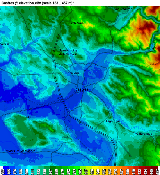
These maps also provides idea of topography and contour of this city, they are displayed at different zoom levels. More info about maps, scale and edge coordinates you can find below images.
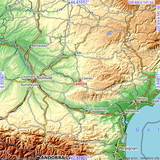
| \ | Map #1 | Map #2 | Topo.Map |
| Scale [m] | 158..279 m | 153..457 m | × |
| Scale [ft] | 518..915 ft | 502..1499 ft | × |
| Average | 199.5 m = 655 ft | 224.1 m = 735 ft | × |
| Width | 7.08 km = 4.4 mi | 14.15 km = 8.8 mi | 226.4 km = 140.7 mi |
| Height | 7.08 km = 4.4 mi | 14.15 km = 8.8 mi | 226.4 km = 140.7 mi |
| ↑Max Latitude | 43.637702° | 43.669498° | 44.61553° |
| Latitude at center | 43.60589° | 43.60589° | 43.60589° |
| ↓Min Latitude | 43.574061° | 43.542215° | 42.57901° |
| ← Min Longitude | 2.195975° | 2.152029° | 0.83367° |
| Longitude center | 2.23992° | 2.23992° | 2.23992° |
| →Max Longitude | 2.283865° | 2.327811° | 3.64617° |
Nearby cities:
Cities around Castres sort by population:
• Labruguière elevation 191 m
7.7 km,  165°
165°
• Saïx 158 m
5.2 km,  241°
241°
• Roquecourbe 220 m
7.8 km,  33°
33°
• Payrin-Augmontel 340 m
11.5 km,  126°
126°
• Soual 171 m
11.4 km, 240°
• Sémalens 157 m
10.4 km,  261°
261°
• Burlats 198 m
7.2 km,  61°
61°
• Lacrouzette 518 m
10.6 km, 55°
• Lagarrigue 208 m
4.4 km,  135°
135°
• Viviers-lès-Montagnes 195 m
7.6 km,  221°
221°
• Lautrec 296 m
13.8 km,  323°
323°
• Vielmur-sur-Agout 149 m
11.3 km,  276°
276°
Multilingual:
 En español:
Castres elevación 178 m.
 En France:
Castres-sur-l’Agout, Castres élévation 178 m.


Sources and notes:
- [note 1] Map square and city borders are not equal. Map elevation data is calculated only from area inside that square.
- [src 1] Elevation data from geonames database provided with same terms of usage.
- [src 2] The elevation map of Castres is generated using elevation data from NASA's 3 arcsec (90m) resolution SRTM data.
- [src 3] Base (background) map © OpenStreetMap contributors tiles are generated by Geofabrik and OpenTopoMap.
Copyright & License:
This Castres Elevation Map is licensed under CC BY-SA. You may reuse any part from this page, if you give a proper credit by linking to this URL:
 More info on terms of use page.