Chabeuil elevation
Chabeuil (Auvergne-Rhône-Alpes, Département de la Drôme), France elevation is 214 meters and Chabeuil elevation in feet is 702 ft above sea level [src 1]. Chabeuil is a populated place (feature code) with elevation that is 40 meters (131 ft) bigger than average city elevation in France.
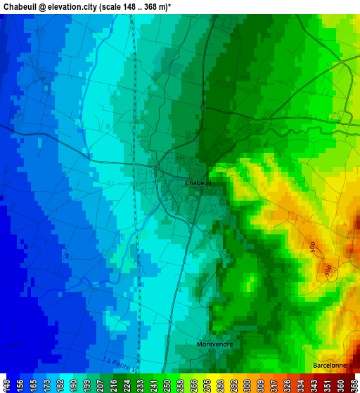
Below is the Elevation map of Chabeuil, which displays elevation range with different colors. Scale of the first map is from 148 to 368 m (486 to 1207 ft) with average elevation of 209.1 meters (=686 ft) [note 1]
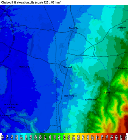
These maps also provides idea of topography and contour of this city, they are displayed at different zoom levels. More info about maps, scale and edge coordinates you can find below images.
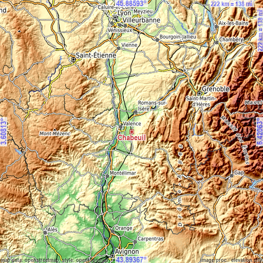
| \ | Map #1 | Map #2 | Topo.Map |
| Scale [m] | 148..368 m | 125..881 m | × |
| Scale [ft] | 486..1207 ft | 410..2890 ft | × |
| Average | 209.1 m = 686 ft | 242.3 m = 795 ft | × |
| Width | 6.92 km = 4.3 mi | 13.84 km = 8.6 mi | 221.5 km = 137.6 mi |
| Height | 6.92 km = 4.3 mi | 13.84 km = 8.6 mi | 221.5 km = 137.6 mi |
| ↑Max Latitude | 44.929551° | 44.960654° | 45.88593° |
| Latitude at center | 44.89843° | 44.89843° | 44.89843° |
| ↓Min Latitude | 44.867293° | 44.836138° | 43.89367° |
| ← Min Longitude | 4.970435° | 4.926489° | 3.60813° |
| Longitude center | 5.01438° | 5.01438° | 5.01438° |
| →Max Longitude | 5.058325° | 5.102271° | 6.42063° |
Nearby cities:
Cities around Chabeuil sort by population:
• Valence elevation 154 m
8.8 km,  290°
290°
• Bourg-lès-Valence 147 m
10.9 km,  299°
299°
• Portes-lès-Valence 120 m
11.3 km,  257°
257°
• Saint-Marcel-lès-Valence 163 m
9.4 km,  329°
329°
• Beaumont-lès-Valence 149 m
6.9 km,  234°
234°
• Montélier 222 m
4.2 km,  18°
18°
• Malissard 155 m
4.8 km,  271°
271°
• Montmeyran 199 m
7.9 km,  205°
205°
• Alixan 196 m
8.5 km,  7°
7°
• Beauvallon 141 m
9.7 km,  240°
240°
• Montéléger 167 m
8 km, 230°
• Upie 223 m
11.1 km,  195°
195°
Multilingual:
 En español:
Chabeuil elevación 214 m.
 En France:
Chabeuil élévation 214 m.
 Auf Deutsch:
Chabeuil höhe über dem Meeresspiegel ist 214 m.

Sources and notes:
- [note 1] Map square and city borders are not equal. Map elevation data is calculated only from area inside that square.
- [src 1] Elevation data from geonames database provided with same terms of usage.
- [src 2] The elevation map of Chabeuil is generated using elevation data from NASA's 3 arcsec (90m) resolution SRTM data.
- [src 3] Base (background) map © OpenStreetMap contributors tiles are generated by Geofabrik and OpenTopoMap.
Copyright & License:
This Chabeuil Elevation Map is licensed under CC BY-SA. You may reuse any part from this page, if you give a proper credit by linking to this URL:
 More info on terms of use page.