Châlette-sur-Loing elevation
Châlette-sur-Loing (Centre, Loiret), France elevation is 85 meters and Châlette-sur-Loing elevation in feet is 279 ft above sea level [src 1]. Châlette-sur-Loing is a populated place (feature code) with elevation that is 89 meters (292 ft) smaller than average city elevation in France.
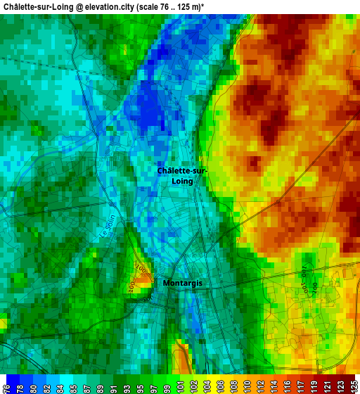
Below is the Elevation map of Châlette-sur-Loing, which displays elevation range with different colors. Scale of the first map is from 76 to 125 m (249 to 410 ft) with average elevation of 96.1 meters (=315 ft) [note 1]
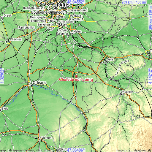
These maps also provides idea of topography and contour of this city, they are displayed at different zoom levels. More info about maps, scale and edge coordinates you can find below images.
| \ | Map #1 | Map #2 | Topo.Map |
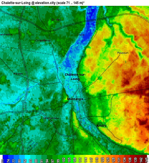
| Scale [m] | 76..125 m | 71..145 m | × |
| Scale [ft] | 249..410 ft | 233..476 ft | × |
| Average | 96.1 m = 315 ft | 100.4 m = 329 ft | × |
| Width | 6.54 km = 4.1 mi | 13.07 km = 8.1 mi | 209.2 km = 130 mi |
| Height | 6.54 km = 4.1 mi | 13.07 km = 8.1 mi | 209.2 km = 130 mi |
| ↑Max Latitude | 48.042759° | 48.072132° | 48.94552° |
| Latitude at center | 48.01337° | 48.01337° | 48.01337° |
| ↓Min Latitude | 47.983964° | 47.954541° | 47.06406° |
| ← Min Longitude | 2.691925° | 2.647979° | 1.32962° |
| Longitude center | 2.73587° | 2.73587° | 2.73587° |
| →Max Longitude | 2.779815° | 2.823761° | 4.14212° |
Nearby cities:
Cities around Châlette-sur-Loing sort by population:
• Montargis elevation 86 m
1.8 km,  187°
187°
• Amilly 115 m
5.2 km,  149°
149°
• Villemandeur 93 m
3.2 km,  204°
204°
• Pannes 91 m
5.1 km,  277°
277°
• Corquilleroy 89 m
4 km,  323°
323°
• Cepoy 94 m
3.8 km,  2°
2°
• Saint-Germain-des-Prés 116 m
10.7 km,  128°
128°
• Fontenay-sur-Loing 89 m
10.5 km,  16°
16°
• Chevillon-sur-Huillard 99 m
10 km,  235°
235°
• Nargis 84 m
11 km,  7°
7°
• Saint-Maurice-sur-Fessard 89 m
8.8 km,  254°
254°
• Vimory 95 m
8.1 km,  206°
206°
Multilingual:
 En español:
Châlette-sur-Loing elevación 85 m.
 En France:
Châlette-sur-Loing élévation 85 m.
 Auf Deutsch:
Châlette-sur-Loing höhe über dem Meeresspiegel ist 85 m.

Sources and notes:
- [note 1] Map square and city borders are not equal. Map elevation data is calculated only from area inside that square.
- [src 1] Elevation data from geonames database provided with same terms of usage.
- [src 2] The elevation map of Châlette-sur-Loing is generated using elevation data from NASA's 3 arcsec (90m) resolution SRTM data.
- [src 3] Base (background) map © OpenStreetMap contributors tiles are generated by Geofabrik and OpenTopoMap.
Copyright & License:
This Châlette-sur-Loing Elevation Map is licensed under CC BY-SA. You may reuse any part from this page, if you give a proper credit by linking to this URL:
 More info on terms of use page.