Changé elevation
Changé (Pays de la Loire, Mayenne), France elevation is 59 meters and Changé elevation in feet is 194 ft above sea level [src 1]. Changé is a populated place (feature code) with elevation that is 115 meters (377 ft) smaller than average city elevation in France.
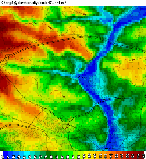
Below is the Elevation map of Changé, which displays elevation range with different colors. Scale of the first map is from 47 to 141 m (154 to 463 ft) with average elevation of 91.6 meters (=301 ft) [note 1]
These maps also provides idea of topography and contour of this city, they are displayed at different zoom levels. More info about maps, scale and edge coordinates you can find below images.
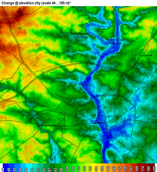
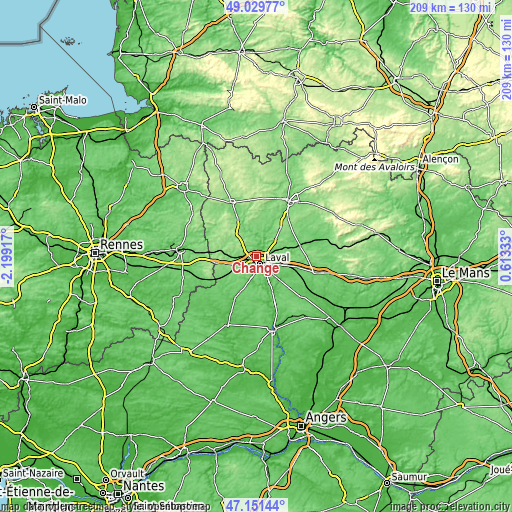
| \ | Map #1 | Map #2 | Topo.Map |
| Scale [m] | 47..141 m | 44..185 m | × |
| Scale [ft] | 154..463 ft | 144..607 ft | × |
| Average | 91.6 m = 301 ft | 100.8 m = 331 ft | × |
| Width | 6.53 km = 4.1 mi | 13.05 km = 8.1 mi | 208.9 km = 129.8 mi |
| Height | 6.53 km = 4.1 mi | 13.05 km = 8.1 mi | 208.8 km = 129.7 mi |
| ↑Max Latitude | 48.12852° | 48.157844° | 49.02977° |
| Latitude at center | 48.09918° | 48.09918° | 48.09918° |
| ↓Min Latitude | 48.069823° | 48.040449° | 47.15144° |
| ← Min Longitude | -0.836865° | -0.880811° | -2.19917° |
| Longitude center | -0.79292° | -0.79292° | -0.79292° |
| →Max Longitude | -0.748975° | -0.705029° | 0.61333° |
Nearby cities:
Cities around Changé sort by population:
• Laval elevation 71 m
3.6 km,  142°
142°
• Saint-Berthevin 105 m
4.7 km,  219°
219°
• Bonchamp-lès-Laval 86 m
7.5 km,  112°
112°
• Louverné 112 m
6.2 km,  65°
65°
• Argentré 103 m
11.4 km,  98°
98°
• Andouillé 85 m
8.7 km,  4°
4°
• Saint-Ouën-des-Toits 164 m
8.8 km,  295°
295°
• Ahuillé 103 m
10.4 km,  213°
213°
• La Baconnière 181 m
11.6 km,  320°
320°
• Loiron 145 m
11 km,  250°
250°
• Montigné-le-Brillant 79 m
10.2 km,  189°
189°
• Saint-Jean-sur-Mayenne 95 m
4.8 km,  34°
34°
Multilingual:
 En español:
Changé elevación 59 m.
 En France:
Changé élévation 59 m.


Sources and notes:
- [note 1] Map square and city borders are not equal. Map elevation data is calculated only from area inside that square.
- [src 1] Elevation data from geonames database provided with same terms of usage.
- [src 2] The elevation map of Changé is generated using elevation data from NASA's 3 arcsec (90m) resolution SRTM data.
- [src 3] Base (background) map © OpenStreetMap contributors tiles are generated by Geofabrik and OpenTopoMap.
Copyright & License:
This Changé Elevation Map is licensed under CC BY-SA. You may reuse any part from this page, if you give a proper credit by linking to this URL:
 More info on terms of use page.