Chassieu elevation
Chassieu (Auvergne-Rhône-Alpes, Département du Rhône), France elevation is 236 meters and Chassieu elevation in feet is 774 ft above sea level [src 1]. Chassieu is a populated place (feature code) with elevation that is 62 meters (203 ft) bigger than average city elevation in France.
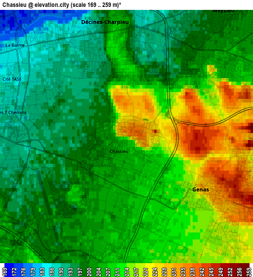
Below is the Elevation map of Chassieu, which displays elevation range with different colors. Scale of the first map is from 169 to 259 m (554 to 850 ft) with average elevation of 206.1 meters (=676 ft) [note 1]
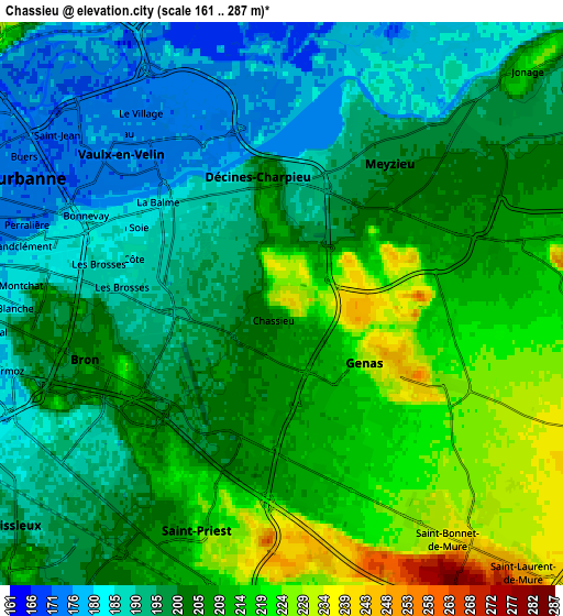
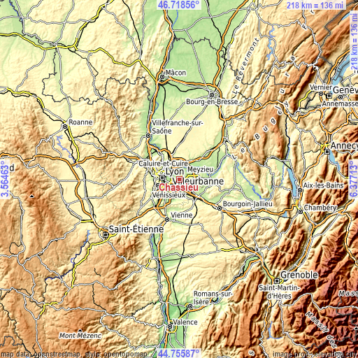
These maps also provides idea of topography and contour of this city, they are displayed at different zoom levels. More info about maps, scale and edge coordinates you can find below images.
| \ | Map #1 | Map #2 | Topo.Map |
| Scale [m] | 169..259 m | 161..287 m | × |
| Scale [ft] | 554..850 ft | 528..942 ft | × |
| Average | 206.1 m = 676 ft | 202.4 m = 664 ft | × |
| Width | 6.82 km = 4.2 mi | 13.64 km = 8.5 mi | 218.2 km = 135.6 mi |
| Height | 6.82 km = 4.2 mi | 13.64 km = 8.5 mi | 218.2 km = 135.6 mi |
| ↑Max Latitude | 45.776498° | 45.80714° | 46.71856° |
| Latitude at center | 45.74584° | 45.74584° | 45.74584° |
| ↓Min Latitude | 45.715165° | 45.684472° | 44.75587° |
| ← Min Longitude | 4.926935° | 4.882989° | 3.56463° |
| Longitude center | 4.97088° | 4.97088° | 4.97088° |
| →Max Longitude | 5.014825° | 5.058771° | 6.37713° |
Nearby cities:
Cities around Chassieu sort by population:
• Villeurbanne elevation 178 m
7.4 km,  287°
287°
• Vénissieux 198 m
8.5 km,  230°
230°
• Saint-Priest 228 m
5.9 km,  200°
200°
• Bron 200 m
4.6 km,  259°
259°
• Vaulx-en-Velin 173 m
5.8 km,  322°
322°
• Meyzieu 210 m
3.4 km,  47°
47°
• Décines-Charpieu 201 m
2.7 km,  339°
339°
• Genas 237 m
2.9 km,  123°
123°
• Saint-Bonnet-de-Mure 268 m
7.6 km,  143°
143°
• Jonage 195 m
8.1 km, 46°
• Pusignan 215 m
7.6 km,  81°
81°
• Thil 180 m
8.6 km,  28°
28°
Multilingual:
 En español:
Chassieu elevación 236 m.
 En France:
Chassieu élévation 236 m.
 Auf Deutsch:
Chassieu höhe über dem Meeresspiegel ist 236 m.

Sources and notes:
- [note 1] Map square and city borders are not equal. Map elevation data is calculated only from area inside that square.
- [src 1] Elevation data from geonames database provided with same terms of usage.
- [src 2] The elevation map of Chassieu is generated using elevation data from NASA's 3 arcsec (90m) resolution SRTM data.
- [src 3] Base (background) map © OpenStreetMap contributors tiles are generated by Geofabrik and OpenTopoMap.
Copyright & License:
This Chassieu Elevation Map is licensed under CC BY-SA. You may reuse any part from this page, if you give a proper credit by linking to this URL:
 More info on terms of use page.