Châteauneuf-sur-Isère elevation
Châteauneuf-sur-Isère (Auvergne-Rhône-Alpes, Département de la Drôme), France elevation is 128 meters and Châteauneuf-sur-Isère elevation in feet is 420 ft above sea level [src 1]. Châteauneuf-sur-Isère is a populated place (feature code) with elevation that is 46 meters (151 ft) smaller than average city elevation in France.
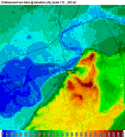
Below is the Elevation map of Châteauneuf-sur-Isère, which displays elevation range with different colors. Scale of the first map is from 112 to 243 m (367 to 797 ft) with average elevation of 153.3 meters (=503 ft) [note 1]
These maps also provides idea of topography and contour of this city, they are displayed at different zoom levels. More info about maps, scale and edge coordinates you can find below images.
| \ | Map #1 | Map #2 | Topo.Map |
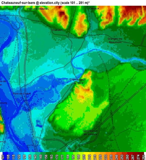
| Scale [m] | 112..243 m | 101..281 m | × |
| Scale [ft] | 367..797 ft | 331..922 ft | × |
| Average | 153.3 m = 503 ft | 156.3 m = 513 ft | × |
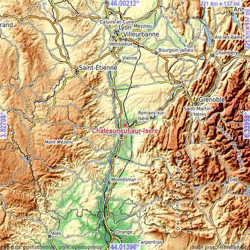
| Width | 6.91 km = 4.3 mi | 13.82 km = 8.6 mi | 221.1 km = 137.4 mi |
| Height | 6.91 km = 4.3 mi | 13.82 km = 8.6 mi | 221.1 km = 137.4 mi |
| ↑Max Latitude | 45.047727° | 45.078766° | 46.00212° |
| Latitude at center | 45.01667° | 45.01667° | 45.01667° |
| ↓Min Latitude | 44.985597° | 44.954506° | 44.01396° |
| ← Min Longitude | 4.889385° | 4.845439° | 3.52708° |
| Longitude center | 4.93333° | 4.93333° | 4.93333° |
| →Max Longitude | 4.977275° | 5.021221° | 6.33958° |
Nearby cities:
Cities around Châteauneuf-sur-Isère sort by population:
• Bourg-lès-Valence elevation 147 m
8.3 km,  201°
201°
• Bourg-de-Péage 162 m
9.3 km,  79°
79°
• Tain-l’Hermitage 132 m
8.2 km,  312°
312°
• Saint-Marcel-lès-Valence 163 m
5.3 km,  162°
162°
• La Roche-de-Glun 120 m
7 km,  266°
266°
• Alixan 196 m
8.8 km,  122°
122°
• Cornas 126 m
8.9 km,  228°
228°
• Clérieux 226 m
6.9 km,  17°
17°
• Mercurol-Veaunes 192 m
7.2 km,  333°
333°
• Mauves 116 m
8.5 km,  286°
286°
• Chanos-Curson 222 m
4.9 km,  351°
351°
• Beaumont-Monteux 135 m
1.2 km, 286°
Multilingual:
 En español:
Châteauneuf-sur-Isère elevación 128 m.
 En France:
Châteauneuf-sur-Isère élévation 128 m.
 Auf Deutsch:
Châteauneuf-sur-Isère höhe über dem Meeresspiegel ist 128 m.
 На русском:
Châteauneuf-sur-Isère высота над уровнем моря 128 м
Sources and notes:
- [note 1] Map square and city borders are not equal. Map elevation data is calculated only from area inside that square.
- [src 1] Elevation data from geonames database provided with same terms of usage.
- [src 2] The elevation map of Châteauneuf-sur-Isère is generated using elevation data from NASA's 3 arcsec (90m) resolution SRTM data.
- [src 3] Base (background) map © OpenStreetMap contributors tiles are generated by Geofabrik and OpenTopoMap.
Copyright & License:
This Châteauneuf-sur-Isère Elevation Map is licensed under CC BY-SA. You may reuse any part from this page, if you give a proper credit by linking to this URL:
 More info on terms of use page.