Cheverny elevation
Cheverny (Centre, Département du Loir-et-Cher), France elevation is 95 meters and Cheverny elevation in feet is 312 ft above sea level [src 1]. Cheverny is a populated place (feature code) with elevation that is 79 meters (259 ft) smaller than average city elevation in France.
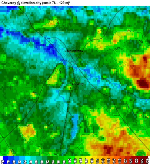
Below is the Elevation map of Cheverny, which displays elevation range with different colors. Scale of the first map is from 76 to 129 m (249 to 423 ft) with average elevation of 95.6 meters (=314 ft) [note 1]
These maps also provides idea of topography and contour of this city, they are displayed at different zoom levels. More info about maps, scale and edge coordinates you can find below images.
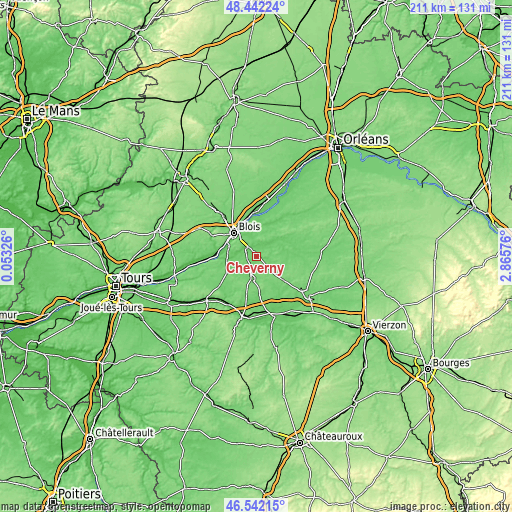
| \ | Map #1 | Topo.Map |
| Scale [m] | 76..129 m | × |
| Scale [ft] | 249..423 ft | × |
| Average | 95.6 m = 314 ft | × |
| Width | 6.6 km = 4.1 mi | 211.3 km = 131.3 mi |
| Height | 6.6 km = 4.1 mi | 211.3 km = 131.3 mi |
| ↑Max Latitude | 47.53047° | 48.44224° |
| Latitude at center | 47.50079° | 47.50079° |
| ↓Min Latitude | 47.471093° | 46.54215° |
| ← Min Longitude | 1.415565° | 0.05326° |
| Longitude center | 1.45951° | 1.45951° |
| →Max Longitude | 1.503455° | 2.86576° |
Nearby cities:
Cities around Cheverny sort by population:
• Vineuil elevation 84 m
11.2 km,  325°
325°
• Saint-Gervais-la-Forêt 98 m
10.8 km,  313°
313°
• Contres 99 m
9.5 km,  194°
194°
• Mont-près-Chambord 105 m
6.8 km,  358°
358°
• Cour-Cheverny 87 m
1.1 km,  345°
345°
• Cellettes 77 m
6.6 km,  296°
296°
• Chailles 81 m
12 km,  292°
292°
• Huisseau-sur-Cosson 78 m
10.3 km, 357°
• Soings-en-Sologne 111 m
10.9 km,  153°
153°
• Cormeray 101 m
4.1 km,  256°
256°
• Bracieux 80 m
8.1 km,  48°
48°
• Chitenay 88 m
6.6 km,  266°
266°
Multilingual:
 En español:
Cheverny elevación 95 m.
 En France:
Cheverny élévation 95 m.


Sources and notes:
- [note 1] Map square and city borders are not equal. Map elevation data is calculated only from area inside that square.
- [src 1] Elevation data from geonames database provided with same terms of usage.
- [src 2] The elevation map of Cheverny is generated using elevation data from NASA's 3 arcsec (90m) resolution SRTM data.
- [src 3] Base (background) map © OpenStreetMap contributors tiles are generated by Geofabrik and OpenTopoMap.
Copyright & License:
This Cheverny Elevation Map is licensed under CC BY-SA. You may reuse any part from this page, if you give a proper credit by linking to this URL:
 More info on terms of use page.