Cognin elevation
Cognin (Auvergne-Rhône-Alpes, Savoie), France elevation is 292 meters and Cognin elevation in feet is 958 ft above sea level [src 1]. Cognin is a populated place (feature code) with elevation that is 118 meters (387 ft) bigger than average city elevation in France.
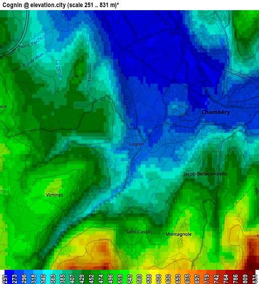
Below is the Elevation map of Cognin, which displays elevation range with different colors. Scale of the first map is from 251 to 831 m (823 to 2726 ft) with average elevation of 411.9 meters (=1351 ft) [note 1]
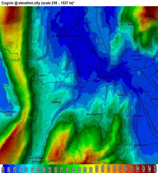
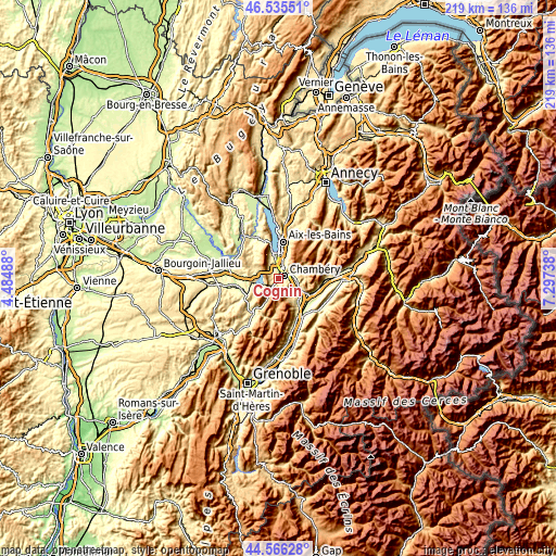
These maps also provides idea of topography and contour of this city, they are displayed at different zoom levels. More info about maps, scale and edge coordinates you can find below images.
| \ | Map #1 | Map #2 | Topo.Map |
| Scale [m] | 251..831 m | 239..1537 m | × |
| Scale [ft] | 823..2726 ft | 784..5043 ft | × |
| Average | 411.9 m = 1351 ft | 567.1 m = 1861 ft | × |
| Width | 6.84 km = 4.3 mi | 13.68 km = 8.5 mi | 219 km = 136.1 mi |
| Height | 6.84 km = 4.3 mi | 13.68 km = 8.5 mi | 218.9 km = 136 mi |
| ↑Max Latitude | 45.590281° | 45.621024° | 46.53551° |
| Latitude at center | 45.55952° | 45.55952° | 45.55952° |
| ↓Min Latitude | 45.528742° | 45.497948° | 44.56628° |
| ← Min Longitude | 5.847185° | 5.803239° | 4.48488° |
| Longitude center | 5.89113° | 5.89113° | 5.89113° |
| →Max Longitude | 5.935075° | 5.979021° | 7.29738° |
Nearby cities:
Cities around Cognin sort by population:
• Chambéry elevation 289 m
2.4 km,  71°
71°
• La Motte-Servolex 263 m
4.6 km,  335°
335°
• La Ravoire 299 m
5.2 km,  86°
86°
• Saint-Alban-Leysse 305 m
5.3 km,  59°
59°
• Barberaz 313 m
4.1 km, 86°
• Bassens 294 m
4.1 km, 64°
• Jacob-Bellecombette 420 m
1.9 km,  96°
96°
• Barby 438 m
7 km,  82°
82°
• Saint-Baldoph 314 m
5.7 km,  123°
123°
• Vimines 493 m
2.5 km,  234°
234°
• Voglans 279 m
6.6 km,  357°
357°
• Sonnaz 281 m
6.7 km,  16°
16°
Multilingual:
 En español:
Cognin elevación 292 m.
 En France:
Cognin élévation 292 m.


Sources and notes:
- [note 1] Map square and city borders are not equal. Map elevation data is calculated only from area inside that square.
- [src 1] Elevation data from geonames database provided with same terms of usage.
- [src 2] The elevation map of Cognin is generated using elevation data from NASA's 3 arcsec (90m) resolution SRTM data.
- [src 3] Base (background) map © OpenStreetMap contributors tiles are generated by Geofabrik and OpenTopoMap.
Copyright & License:
This Cognin Elevation Map is licensed under CC BY-SA. You may reuse any part from this page, if you give a proper credit by linking to this URL:
 More info on terms of use page.