Coise elevation
Coise (Auvergne-Rhône-Alpes, Savoie), France elevation is 340 meters and Coise elevation in feet is 1115 ft above sea level [src 1]. Coise is a populated place (feature code) with elevation that is 166 meters (545 ft) bigger than average city elevation in France.
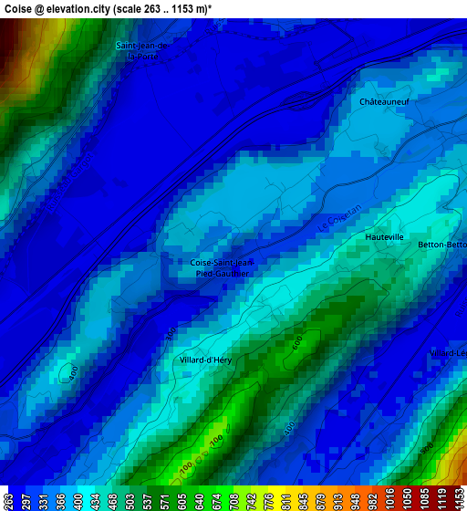
Below is the Elevation map of Coise, which displays elevation range with different colors. Scale of the first map is from 263 to 1153 m (863 to 3783 ft) with average elevation of 379.1 meters (=1244 ft) [note 1]
These maps also provides idea of topography and contour of this city, they are displayed at different zoom levels. More info about maps, scale and edge coordinates you can find below images.
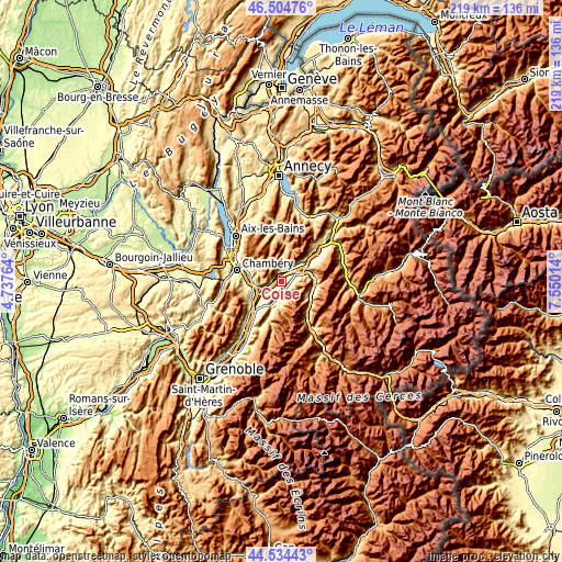
| \ | Map #1 | Topo.Map |
| Scale [m] | 263..1153 m | × |
| Scale [ft] | 863..3783 ft | × |
| Average | 379.1 m = 1244 ft | × |
| Width | 6.85 km = 4.3 mi | 219.1 km = 136.1 mi |
| Height | 6.85 km = 4.3 mi | 219.1 km = 136.1 mi |
| ↑Max Latitude | 45.558998° | 46.50476° |
| Latitude at center | 45.52822° | 45.52822° |
| ↓Min Latitude | 45.497425° | 44.53443° |
| ← Min Longitude | 6.099945° | 4.73764° |
| Longitude center | 6.14389° | 6.14389° |
| →Max Longitude | 6.187835° | 7.55014° |
Nearby cities:
Cities around Coise sort by population:
• Pontcharra elevation 261 m
14.2 km,  223°
223°
• La Ravoire 299 m
15 km,  284°
284°
• Challes-les-Eaux 310 m
12.9 km, 279°
• Montmélian 277 m
7.3 km,  249°
249°
• La Rochette 381 m
8.2 km,  196°
196°
• Barby 438 m
13.5 km,  289°
289°
• Saint-Baldoph 314 m
14.9 km,  271°
271°
• Chapareillan 284 m
13.8 km,  239°
239°
• Les Marches 300 m
11.3 km, 254°
• Aiton 393 m
9.7 km,  67°
67°
• Grésy-sur-Isère 316 m
11.6 km,  47°
47°
• Cruet 358 m
4 km, 271°
Multilingual:
 En español:
Coise elevación 340 m.
 En France:
Coise élévation 340 m.


Sources and notes:
- [note 1] Map square and city borders are not equal. Map elevation data is calculated only from area inside that square.
- [src 1] Elevation data from geonames database provided with same terms of usage.
- [src 2] The elevation map of Coise is generated using elevation data from NASA's 3 arcsec (90m) resolution SRTM data.
- [src 3] Base (background) map © OpenStreetMap contributors tiles are generated by Geofabrik and OpenTopoMap.
Copyright & License:
This Coise Elevation Map is licensed under CC BY-SA. You may reuse any part from this page, if you give a proper credit by linking to this URL:
 More info on terms of use page.