Coublevie elevation
Coublevie (Auvergne-Rhône-Alpes, Département de l'Isère), France elevation is 370 meters and Coublevie elevation in feet is 1214 ft above sea level [src 1]. Coublevie is a populated place (feature code) with elevation that is 196 meters (643 ft) bigger than average city elevation in France.
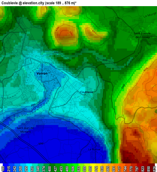
Below is the Elevation map of Coublevie, which displays elevation range with different colors. Scale of the first map is from 189 to 876 m (620 to 2874 ft) with average elevation of 411.1 meters (=1349 ft) [note 1]
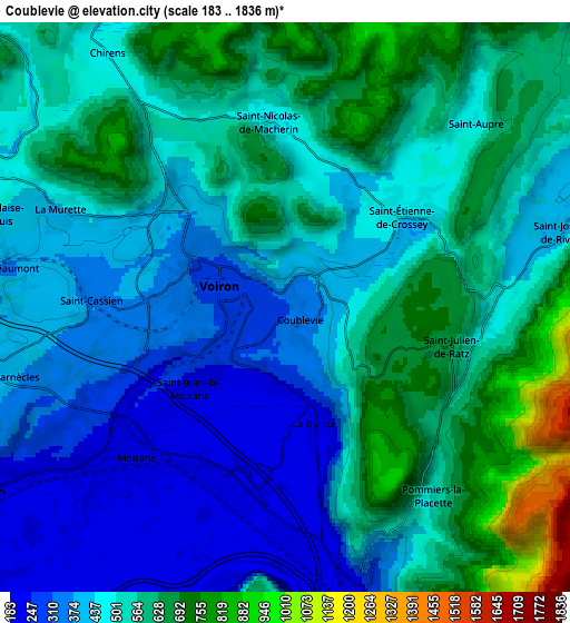
These maps also provides idea of topography and contour of this city, they are displayed at different zoom levels. More info about maps, scale and edge coordinates you can find below images.
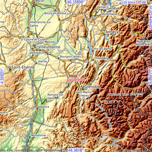
| \ | Map #1 | Map #2 | Topo.Map |
| Scale [m] | 189..876 m | 183..1836 m | × |
| Scale [ft] | 620..2874 ft | 600..6024 ft | × |
| Average | 411.1 m = 1349 ft | 501.7 m = 1646 ft | × |
| Width | 6.87 km = 4.3 mi | 13.73 km = 8.5 mi | 219.7 km = 136.5 mi |
| Height | 6.87 km = 4.3 mi | 13.73 km = 8.5 mi | 219.7 km = 136.5 mi |
| ↑Max Latitude | 45.389431° | 45.420284° | 46.33806° |
| Latitude at center | 45.35856° | 45.35856° | 45.35856° |
| ↓Min Latitude | 45.327673° | 45.296768° | 44.3618° |
| ← Min Longitude | 5.567515° | 5.523569° | 4.20521° |
| Longitude center | 5.61146° | 5.61146° | 5.61146° |
| →Max Longitude | 5.655405° | 5.699351° | 7.01771° |
Nearby cities:
Cities around Coublevie sort by population:
• Voiron elevation 279 m
2.1 km,  288°
288°
• Voreppe 235 m
7.3 km,  167°
167°
• Moirans 200 m
5.4 km,  235°
235°
• Saint-Jean-de-Moirans 256 m
2.5 km,  233°
233°
• Saint-Étienne-de-Crossey 450 m
3.5 km,  46°
46°
• La Buisse 324 m
1.4 km, 170°
• Chirens 489 m
7.2 km,  323°
323°
• La Murette 438 m
5.9 km, 292°
• Charnècles 360 m
6.7 km,  256°
256°
• Saint-Joseph-de-Rivière 419 m
6.9 km,  73°
73°
• Saint-Aupre 614 m
6.6 km,  41°
41°
• Saint-Cassien 345 m
5 km,  268°
268°
Multilingual:
 En español:
Coublevie elevación 370 m.
 En France:
Coublevie élévation 370 m.
 Auf Deutsch:
Coublevie höhe über dem Meeresspiegel ist 370 m.

Sources and notes:
- [note 1] Map square and city borders are not equal. Map elevation data is calculated only from area inside that square.
- [src 1] Elevation data from geonames database provided with same terms of usage.
- [src 2] The elevation map of Coublevie is generated using elevation data from NASA's 3 arcsec (90m) resolution SRTM data.
- [src 3] Base (background) map © OpenStreetMap contributors tiles are generated by Geofabrik and OpenTopoMap.
Copyright & License:
This Coublevie Elevation Map is licensed under CC BY-SA. You may reuse any part from this page, if you give a proper credit by linking to this URL:
 More info on terms of use page.