Dagneux elevation
Dagneux (Auvergne-Rhône-Alpes, Département de l'Ain), France elevation is 203 meters and Dagneux elevation in feet is 666 ft above sea level [src 1]. Dagneux is a populated place (feature code) with elevation that is 29 meters (95 ft) bigger than average city elevation in France.
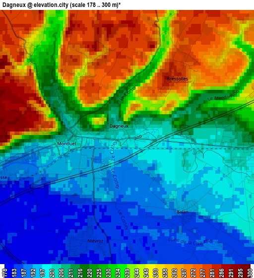
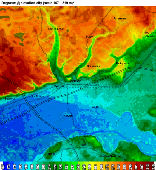
Below is the Elevation map of Dagneux, which displays elevation range with different colors. Scale of the first map is from 178 to 300 m (584 to 984 ft) with average elevation of 222.9 meters (=731 ft) [note 1]
These maps also provides idea of topography and contour of this city, they are displayed at different zoom levels. More info about maps, scale and edge coordinates you can find below images.
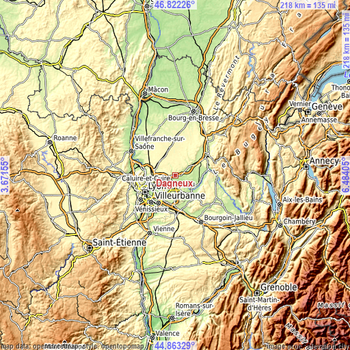
| \ | Map #1 | Map #2 | Topo.Map |
| Scale [m] | 178..300 m | 167..319 m | × |
| Scale [ft] | 584..984 ft | 548..1047 ft | × |
| Average | 222.9 m = 731 ft | 232 m = 761 ft | × |
| Width | 6.81 km = 4.2 mi | 13.61 km = 8.5 mi | 217.8 km = 135.3 mi |
| Height | 6.81 km = 4.2 mi | 13.61 km = 8.5 mi | 217.8 km = 135.3 mi |
| ↑Max Latitude | 45.882° | 45.912584° | 46.82226° |
| Latitude at center | 45.8514° | 45.8514° | 45.8514° |
| ↓Min Latitude | 45.820783° | 45.790149° | 44.86329° |
| ← Min Longitude | 5.033855° | 4.989909° | 3.67155° |
| Longitude center | 5.0778° | 5.0778° | 5.0778° |
| →Max Longitude | 5.121745° | 5.165691° | 6.48405° |
Nearby cities:
Cities around Dagneux sort by population:
• Montluel elevation 205 m
1.5 km,  272°
272°
• Jonage 195 m
6.6 km,  201°
201°
• Saint-Maurice-de-Beynost 199 m
8 km,  256°
256°
• Beynost 185 m
6.3 km,  254°
254°
• La Boisse 189 m
3.3 km, 253°
• Béligneux 256 m
4.3 km,  64°
64°
• Balan 195 m
2.5 km,  139°
139°
• Saint-Maurice-de-Gourdans 205 m
9.6 km,  109°
109°
• Tramoyes 300 m
9.2 km,  287°
287°
• Niévroz 185 m
3.1 km, 204°
• Jons 222 m
4.8 km,  177°
177°
• Thil 180 m
6 km,  225°
225°
Multilingual:
 En español:
Dagneux elevación 203 m.
 En France:
Dagneux élévation 203 m.


Sources and notes:
- [note 1] Map square and city borders are not equal. Map elevation data is calculated only from area inside that square.
- [src 1] Elevation data from geonames database provided with same terms of usage.
- [src 2] The elevation map of Dagneux is generated using elevation data from NASA's 3 arcsec (90m) resolution SRTM data.
- [src 3] Base (background) map © OpenStreetMap contributors tiles are generated by Geofabrik and OpenTopoMap.
Copyright & License:
This Dagneux Elevation Map is licensed under CC BY-SA. You may reuse any part from this page, if you give a proper credit by linking to this URL:
 More info on terms of use page.