Denain elevation
Denain (Hauts-de-France, Nord), France elevation is 36 meters and Denain elevation in feet is 118 ft above sea level [src 1]. Denain is a populated place (feature code) with elevation that is 138 meters (453 ft) smaller than average city elevation in France.
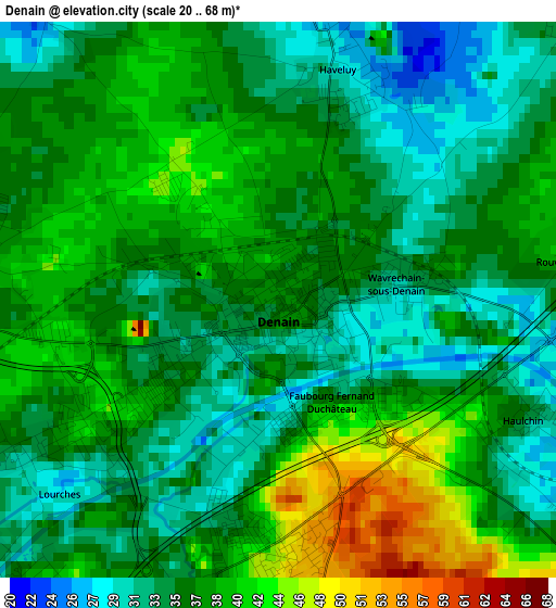
Below is the Elevation map of Denain, which displays elevation range with different colors. Scale of the first map is from 20 to 68 m (66 to 223 ft) with average elevation of 36.4 meters (=119 ft) [note 1]
These maps also provides idea of topography and contour of this city, they are displayed at different zoom levels. More info about maps, scale and edge coordinates you can find below images.
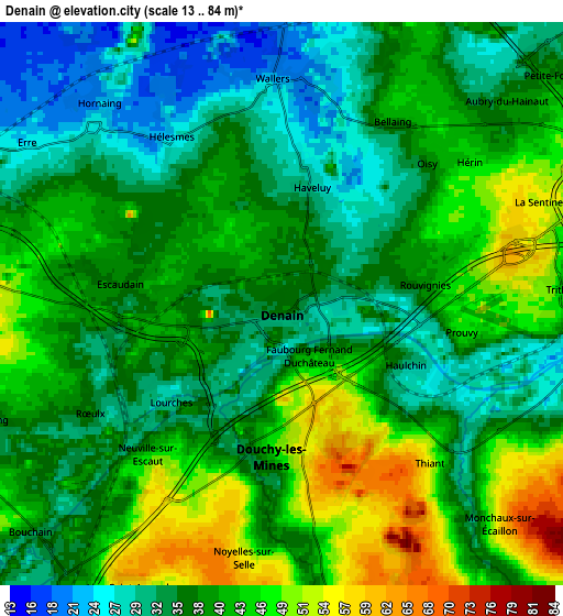
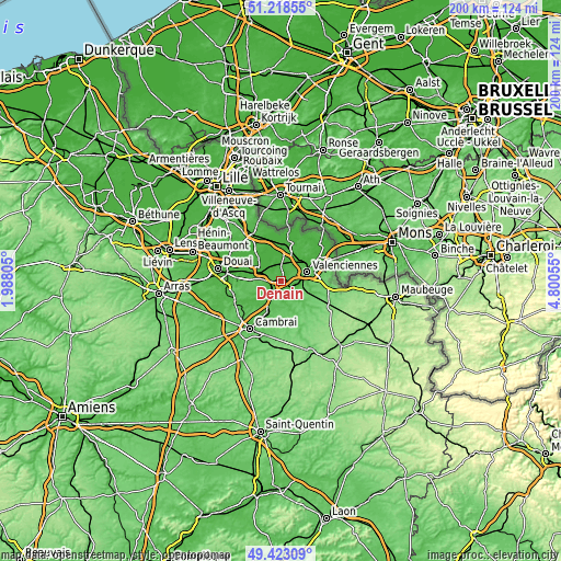
| \ | Map #1 | Map #2 | Topo.Map |
| Scale [m] | 20..68 m | 13..84 m | × |
| Scale [ft] | 66..223 ft | 43..276 ft | × |
| Average | 36.4 m = 119 ft | 38.9 m = 128 ft | × |
| Width | 6.24 km = 3.9 mi | 12.48 km = 7.8 mi | 199.6 km = 124 mi |
| Height | 6.24 km = 3.9 mi | 12.48 km = 7.8 mi | 199.6 km = 124 mi |
| ↑Max Latitude | 50.357345° | 50.385374° | 51.21855° |
| Latitude at center | 50.3293° | 50.3293° | 50.3293° |
| ↓Min Latitude | 50.301238° | 50.27316° | 49.42309° |
| ← Min Longitude | 3.350355° | 3.306409° | 1.98805° |
| Longitude center | 3.3943° | 3.3943° | 3.3943° |
| →Max Longitude | 3.438245° | 3.482191° | 4.80055° |
Nearby cities:
Cities around Denain sort by population:
• Douchy-les-Mines elevation 48 m
3.2 km,  182°
182°
• Escaudain 39 m
3.6 km,  276°
276°
• Wallers 22 m
5 km,  358°
358°
• Hérin 45 m
5.1 km,  55°
55°
• Lourches 30 m
3.4 km,  239°
239°
• Haveluy 29 m
2.7 km,  14°
14°
• Neuville-sur-Escaut 36 m
4.5 km,  223°
223°
• Thiant 39 m
4.7 km,  125°
125°
• Prouvy 37 m
4.2 km,  107°
107°
• Haulchin 32 m
3.3 km, 114°
• Wavrechain-sous-Denain 33 m
1.3 km,  75°
75°
• Bellaing 41 m
4.8 km,  26°
26°
Multilingual:
 En español:
Denain elevación 36 m.
 En France:
Denain élévation 36 m.


Sources and notes:
- [note 1] Map square and city borders are not equal. Map elevation data is calculated only from area inside that square.
- [src 1] Elevation data from geonames database provided with same terms of usage.
- [src 2] The elevation map of Denain is generated using elevation data from NASA's 3 arcsec (90m) resolution SRTM data.
- [src 3] Base (background) map © OpenStreetMap contributors tiles are generated by Geofabrik and OpenTopoMap.
Copyright & License:
This Denain Elevation Map is licensed under CC BY-SA. You may reuse any part from this page, if you give a proper credit by linking to this URL:
 More info on terms of use page.