Égly elevation
Égly (Île-de-France, Département de l'Essonne), France elevation is 85 meters and Égly elevation in feet is 279 ft above sea level [src 1]. Égly is a populated place (feature code) with elevation that is 89 meters (292 ft) smaller than average city elevation in France.
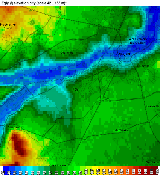
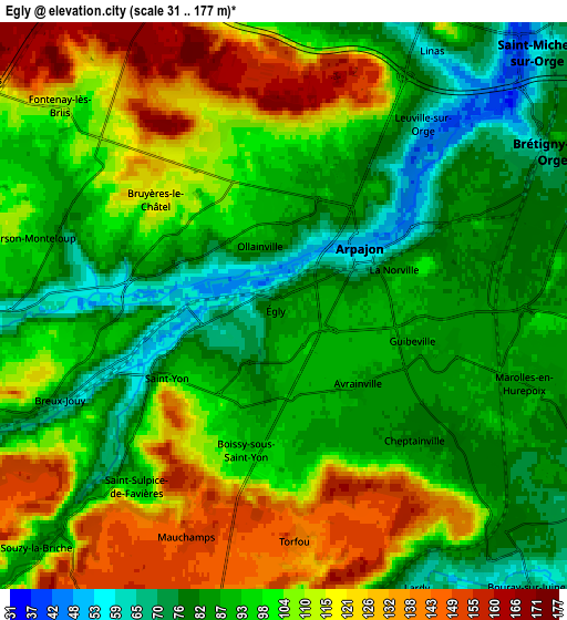
Below is the Elevation map of Égly, which displays elevation range with different colors. Scale of the first map is from 42 to 155 m (138 to 509 ft) with average elevation of 83.4 meters (=274 ft) [note 1]
These maps also provides idea of topography and contour of this city, they are displayed at different zoom levels. More info about maps, scale and edge coordinates you can find below images.
| \ | Map #1 | Map #2 | Topo.Map |
| Scale [m] | 42..155 m | 31..177 m | × |
| Scale [ft] | 138..509 ft | 102..581 ft | × |
| Average | 83.4 m = 274 ft | 98.9 m = 324 ft | × |
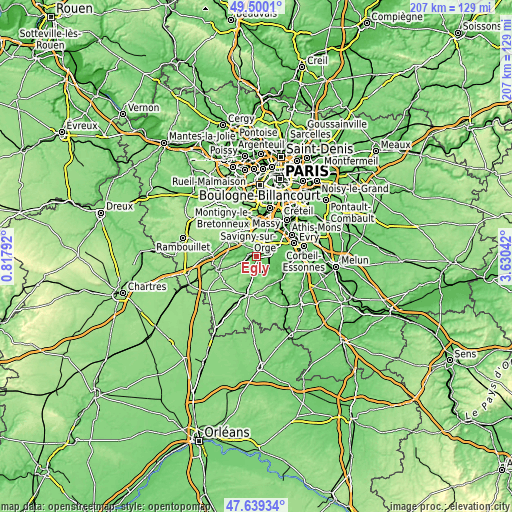
| Width | 6.47 km = 4 mi | 12.93 km = 8 mi | 206.9 km = 128.6 mi |
| Height | 6.47 km = 4 mi | 12.93 km = 8 mi | 206.9 km = 128.6 mi |
| ↑Max Latitude | 48.607346° | 48.636395° | 49.5001° |
| Latitude at center | 48.57828° | 48.57828° | 48.57828° |
| ↓Min Latitude | 48.549198° | 48.520098° | 47.63934° |
| ← Min Longitude | 2.180225° | 2.136279° | 0.81792° |
| Longitude center | 2.22417° | 2.22417° | 2.22417° |
| →Max Longitude | 2.268115° | 2.312061° | 3.63042° |
Nearby cities:
Cities around Égly sort by population:
• Arpajon elevation 50 m
2 km,  54°
54°
• Saint-Germain-lès-Arpajon 48 m
3.7 km, 54°
• Breuillet 92 m
3.8 km,  256°
256°
• Linas 74 m
6.5 km,  26°
26°
• Marolles-en-Hurepoix 85 m
5.8 km,  107°
107°
• Ollainville 86 m
1.4 km,  345°
345°
• La Norville 89 m
2.8 km,  80°
80°
• Leuville-sur-Orge 67 m
5.4 km,  35°
35°
• Boissy-sous-Saint-Yon 91 m
2.9 km,  198°
198°
• Bruyères-le-Châtel 82 m
2.8 km,  294°
294°
• Cheptainville 79 m
4.9 km,  128°
128°
• Chamarande 98 m
6.8 km,  184°
184°
Multilingual:
 En español:
Égly elevación 85 m.
 En France:
Égly élévation 85 m.


Sources and notes:
- [note 1] Map square and city borders are not equal. Map elevation data is calculated only from area inside that square.
- [src 1] Elevation data from geonames database provided with same terms of usage.
- [src 2] The elevation map of Égly is generated using elevation data from NASA's 3 arcsec (90m) resolution SRTM data.
- [src 3] Base (background) map © OpenStreetMap contributors tiles are generated by Geofabrik and OpenTopoMap.
Copyright & License:
This Égly Elevation Map is licensed under CC BY-SA. You may reuse any part from this page, if you give a proper credit by linking to this URL:
 More info on terms of use page.