Eschau elevation
Eschau (Grand Est, Bas-Rhin), France elevation is 144 meters and Eschau elevation in feet is 472 ft above sea level [src 1]. Eschau is a populated place (feature code) with elevation that is 30 meters (98 ft) smaller than average city elevation in France.
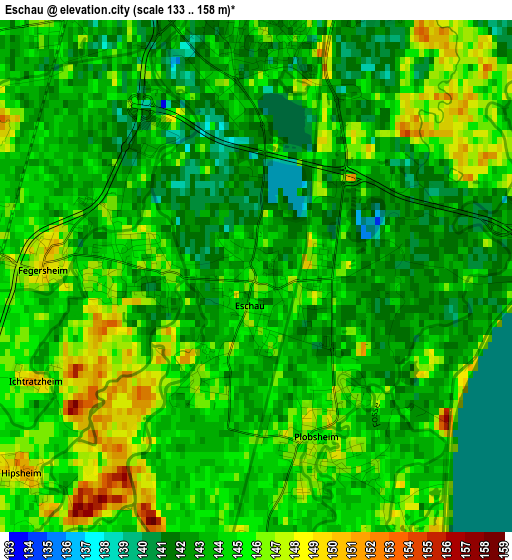
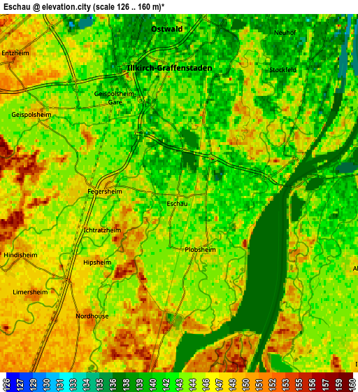
Below is the Elevation map of Eschau, which displays elevation range with different colors. Scale of the first map is from 133 to 158 m (436 to 518 ft) with average elevation of 143.8 meters (=472 ft) [note 1]
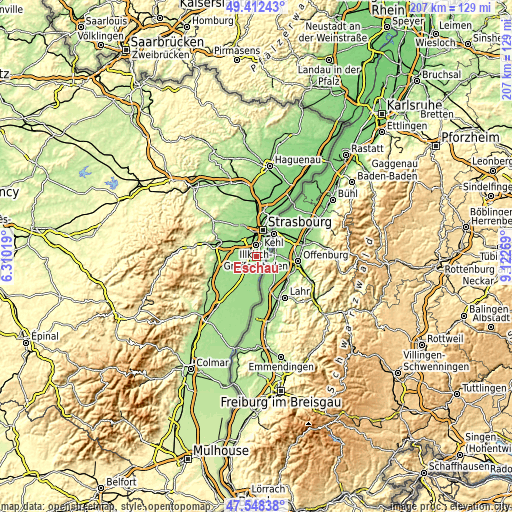
These maps also provides idea of topography and contour of this city, they are displayed at different zoom levels. More info about maps, scale and edge coordinates you can find below images.
| \ | Map #1 | Map #2 | Topo.Map |
| Scale [m] | 133..158 m | 126..160 m | × |
| Scale [ft] | 436..518 ft | 413..525 ft | × |
| Average | 143.8 m = 472 ft | 144.4 m = 474 ft | × |
| Width | 6.48 km = 4 mi | 12.95 km = 8 mi | 207.3 km = 128.8 mi |
| Height | 6.48 km = 4 mi | 12.95 km = 8 mi | 207.2 km = 128.7 mi |
| ↑Max Latitude | 48.518087° | 48.547187° | 49.41243° |
| Latitude at center | 48.48897° | 48.48897° | 48.48897° |
| ↓Min Latitude | 48.459836° | 48.430686° | 47.54838° |
| ← Min Longitude | 7.672495° | 7.628549° | 6.31019° |
| Longitude center | 7.71644° | 7.71644° | 7.71644° |
| →Max Longitude | 7.760385° | 7.804331° | 9.12269° |
Nearby cities:
Cities around Eschau sort by population:
• Illkirch-Graffenstaden elevation 143 m
4.4 km,  358°
358°
• Lingolsheim 148 m
8 km,  341°
341°
• Ostwald 142 m
6.1 km, 356°
• Erstein 156 m
8.3 km,  208°
208°
• Geispolsheim 146 m
5.9 km,  300°
300°
• Fegersheim 148 m
2.6 km,  272°
272°
• Plobsheim 146 m
2.2 km,  164°
164°
• Lipsheim 146 m
3.6 km, 274°
• Entzheim 148 m
7.7 km,  310°
310°
• Nordhouse 153 m
5.5 km,  215°
215°
• Blaesheim 153 m
8.1 km,  283°
283°
• Hindisheim 150 m
6.2 km,  248°
248°
Multilingual:
 En español:
Eschau elevación 144 m.
 En France:
Eschau élévation 144 m.


Sources and notes:
- [note 1] Map square and city borders are not equal. Map elevation data is calculated only from area inside that square.
- [src 1] Elevation data from geonames database provided with same terms of usage.
- [src 2] The elevation map of Eschau is generated using elevation data from NASA's 3 arcsec (90m) resolution SRTM data.
- [src 3] Base (background) map © OpenStreetMap contributors tiles are generated by Geofabrik and OpenTopoMap.
Copyright & License:
This Eschau Elevation Map is licensed under CC BY-SA. You may reuse any part from this page, if you give a proper credit by linking to this URL:
 More info on terms of use page.