Fleurey-sur-Ouche elevation
Fleurey-sur-Ouche (Bourgogne-Franche-Comté, Département de la Côte-d'Or), France elevation is 287 meters and Fleurey-sur-Ouche elevation in feet is 942 ft above sea level [src 1]. Fleurey-sur-Ouche is a populated place (feature code) with elevation that is 113 meters (371 ft) bigger than average city elevation in France.
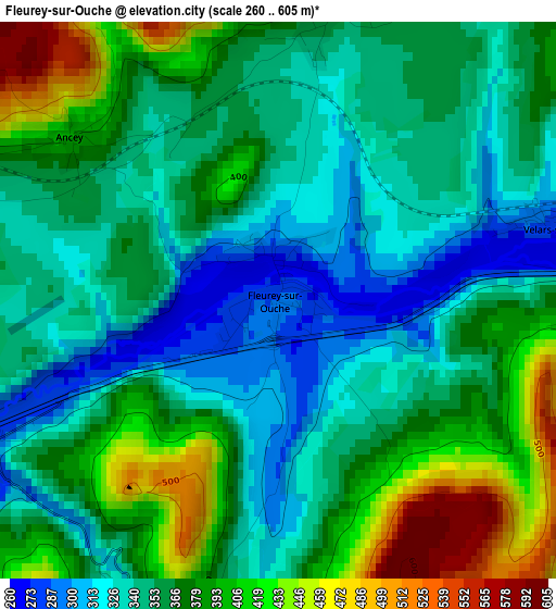
Below is the Elevation map of Fleurey-sur-Ouche, which displays elevation range with different colors. Scale of the first map is from 260 to 605 m (853 to 1985 ft) with average elevation of 364.7 meters (=1197 ft) [note 1]
These maps also provides idea of topography and contour of this city, they are displayed at different zoom levels. More info about maps, scale and edge coordinates you can find below images.
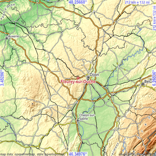
| \ | Map #1 | Topo.Map |
| Scale [m] | 260..605 m | × |
| Scale [ft] | 853..1985 ft | × |
| Average | 364.7 m = 1197 ft | × |
| Width | 6.63 km = 4.1 mi | 212 km = 131.7 mi |
| Height | 6.63 km = 4.1 mi | 212 km = 131.7 mi |
| ↑Max Latitude | 47.341607° | 48.25668° |
| Latitude at center | 47.31182° | 47.31182° |
| ↓Min Latitude | 47.282016° | 46.34976° |
| ← Min Longitude | 4.815165° | 3.45286° |
| Longitude center | 4.85911° | 4.85911° |
| →Max Longitude | 4.903055° | 6.26536° |
Nearby cities:
Cities around Fleurey-sur-Ouche sort by population:
• Dijon elevation 242 m
11.9 km,  87°
87°
• Chenôve 266 m
11.2 km,  100°
100°
• Talant 311 m
11.6 km,  76°
76°
• Fontaine-lès-Dijon 293 m
12.6 km,  74°
74°
• Marsannay-la-Côte 276 m
10.8 km,  114°
114°
• Gevrey-Chambertin 281 m
12.6 km,  139°
139°
• Plombières-lès-Dijon 372 m
8.5 km, 73°
• Perrigny-lès-Dijon 254 m
12.2 km, 114°
• Velars-sur-Ouche 273 m
3.6 km, 76°
• Daix 329 m
11.5 km, 67°
• Couchey 278 m
11 km,  121°
121°
• Hauteville-lès-Dijon 386 m
11.8 km,  59°
59°
Multilingual:
 En español:
Fleurey-sur-Ouche elevación 287 m.
 En France:
Fleurey-sur-Ouche élévation 287 m.
 Auf Deutsch:
Fleurey-sur-Ouche höhe über dem Meeresspiegel ist 287 m.

Sources and notes:
- [note 1] Map square and city borders are not equal. Map elevation data is calculated only from area inside that square.
- [src 1] Elevation data from geonames database provided with same terms of usage.
- [src 2] The elevation map of Fleurey-sur-Ouche is generated using elevation data from NASA's 3 arcsec (90m) resolution SRTM data.
- [src 3] Base (background) map © OpenStreetMap contributors tiles are generated by Geofabrik and OpenTopoMap.
Copyright & License:
This Fleurey-sur-Ouche Elevation Map is licensed under CC BY-SA. You may reuse any part from this page, if you give a proper credit by linking to this URL:
 More info on terms of use page.