Flize elevation
Flize (Grand Est, Ardennes), France elevation is 160 meters and Flize elevation in feet is 525 ft above sea level [src 1]. Flize is a populated place (feature code) with elevation that is 14 meters (46 ft) smaller than average city elevation in France.
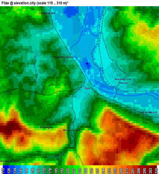
Below is the Elevation map of Flize, which displays elevation range with different colors. Scale of the first map is from 119 to 310 m (390 to 1017 ft) with average elevation of 193.4 meters (=635 ft) [note 1]
These maps also provides idea of topography and contour of this city, they are displayed at different zoom levels. More info about maps, scale and edge coordinates you can find below images.
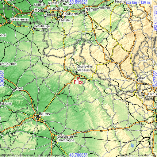
| \ | Map #1 | Topo.Map |
| Scale [m] | 119..310 m | × |
| Scale [ft] | 390..1017 ft | × |
| Average | 193.4 m = 635 ft | × |
| Width | 6.32 km = 3.9 mi | 202.3 km = 125.7 mi |
| Height | 6.32 km = 3.9 mi | 202.3 km = 125.7 mi |
| ↑Max Latitude | 49.727166° | 50.59982° |
| Latitude at center | 49.69875° | 49.69875° |
| ↓Min Latitude | 49.670318° | 48.78065° |
| ← Min Longitude | 4.727765° | 3.36546° |
| Longitude center | 4.77171° | 4.77171° |
| →Max Longitude | 4.815655° | 6.17796° |
Nearby cities:
Cities around Flize sort by population:
• Charleville-Mézières elevation 150 m
8.5 km,  336°
336°
• Vrigne-aux-Bois 162 m
7.4 km,  54°
54°
• Villers-Semeuse 167 m
5.1 km, 339°
• Vivier-au-Court 169 m
5.6 km, 47°
• Donchery 151 m
7.4 km,  92°
92°
• Nouvion-sur-Meuse 154 m
1.7 km, 87°
• La Francheville 161 m
5.4 km,  308°
308°
• Montcy-Notre-Dame 165 m
8.7 km,  346°
346°
• Prix-lès-Mézières 144 m
8.6 km,  317°
317°
• Lumes 158 m
4.1 km,  14°
14°
• Saint-Laurent 252 m
7.3 km,  0°
0°
• Dom-le-Mesnil 162 m
2.5 km,  112°
112°
Multilingual:
 En español:
Flize elevación 160 m.
 En France:
Flize élévation 160 m.


Sources and notes:
- [note 1] Map square and city borders are not equal. Map elevation data is calculated only from area inside that square.
- [src 1] Elevation data from geonames database provided with same terms of usage.
- [src 2] The elevation map of Flize is generated using elevation data from NASA's 3 arcsec (90m) resolution SRTM data.
- [src 3] Base (background) map © OpenStreetMap contributors tiles are generated by Geofabrik and OpenTopoMap.
Copyright & License:
This Flize Elevation Map is licensed under CC BY-SA. You may reuse any part from this page, if you give a proper credit by linking to this URL:
 More info on terms of use page.