Fosses elevation
Fosses (Île-de-France, Département du Val-d’Oise), France elevation is 117 meters and Fosses elevation in feet is 384 ft above sea level [src 1]. Fosses is a populated place (feature code) with elevation that is 57 meters (187 ft) smaller than average city elevation in France.
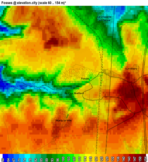
Below is the Elevation map of Fosses, which displays elevation range with different colors. Scale of the first map is from 60 to 154 m (197 to 505 ft) with average elevation of 118.5 meters (=389 ft) [note 1]
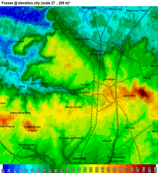
These maps also provides idea of topography and contour of this city, they are displayed at different zoom levels. More info about maps, scale and edge coordinates you can find below images.
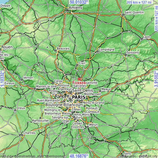
| \ | Map #1 | Map #2 | Topo.Map |
| Scale [m] | 60..154 m | 27..208 m | × |
| Scale [ft] | 197..505 ft | 89..682 ft | × |
| Average | 118.5 m = 389 ft | 101.7 m = 334 ft | × |
| Width | 6.4 km = 4 mi | 12.8 km = 8 mi | 204.8 km = 127.3 mi |
| Height | 6.4 km = 4 mi | 12.8 km = 8 mi | 204.7 km = 127.2 mi |
| ↑Max Latitude | 49.126846° | 49.155594° | 50.01032° |
| Latitude at center | 49.09808° | 49.09808° | 49.09808° |
| ↓Min Latitude | 49.069298° | 49.040499° | 48.16876° |
| ← Min Longitude | 2.465625° | 2.421679° | 1.10332° |
| Longitude center | 2.50957° | 2.50957° | 2.50957° |
| →Max Longitude | 2.553515° | 2.597461° | 3.91582° |
Nearby cities:
Cities around Fosses sort by population:
• Louvres elevation 108 m
6 km,  183°
183°
• Marly-la-Ville 133 m
1.8 km,  193°
193°
• Coye-la-Forêt 44 m
5.7 km,  329°
329°
• Survilliers 142 m
2.5 km,  92°
92°
• Orry-la-Ville 75 m
3.9 km,  1°
1°
• Chaumontel 51 m
6.4 km,  297°
297°
• Puiseux-en-France 113 m
4.8 km, 188°
• La Chapelle-en-Serval 68 m
3.8 km,  27°
27°
• Saint-Witz 162 m
4.6 km,  99°
99°
• Vémars 111 m
5.2 km,  127°
127°
• Fontenay-en-Parisis 102 m
6.5 km,  220°
220°
• Plailly 106 m
5.6 km,  84°
84°
Multilingual:
 En español:
Fosses elevación 117 m.
 En France:
Fosses élévation 117 m.


Sources and notes:
- [note 1] Map square and city borders are not equal. Map elevation data is calculated only from area inside that square.
- [src 1] Elevation data from geonames database provided with same terms of usage.
- [src 2] The elevation map of Fosses is generated using elevation data from NASA's 3 arcsec (90m) resolution SRTM data.
- [src 3] Base (background) map © OpenStreetMap contributors tiles are generated by Geofabrik and OpenTopoMap.
Copyright & License:
This Fosses Elevation Map is licensed under CC BY-SA. You may reuse any part from this page, if you give a proper credit by linking to this URL:
 More info on terms of use page.