Fougères elevation
Fougères (Brittany, Département d'Ille-et-Vilaine), France elevation is 99 meters and Fougères elevation in feet is 325 ft above sea level [src 1]. Fougères is a seat of a third-order administrative division (feature code) with elevation that is 75 meters (246 ft) smaller than average city elevation in France.
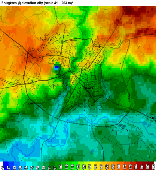
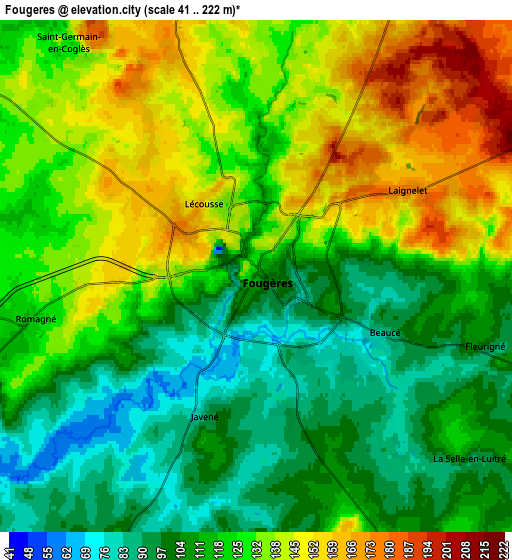
Below is the Elevation map of Fougères, which displays elevation range with different colors. Scale of the first map is from 41 to 203 m (135 to 666 ft) with average elevation of 115.1 meters (=378 ft) [note 1]
These maps also provides idea of topography and contour of this city, they are displayed at different zoom levels. More info about maps, scale and edge coordinates you can find below images.
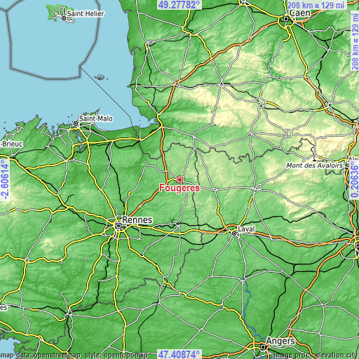
| \ | Map #1 | Map #2 | Topo.Map |
| Scale [m] | 41..203 m | 41..222 m | × |
| Scale [ft] | 135..666 ft | 135..728 ft | × |
| Average | 115.1 m = 378 ft | 122.5 m = 402 ft | × |
| Width | 6.49 km = 4 mi | 12.99 km = 8.1 mi | 207.8 km = 129.1 mi |
| Height | 6.49 km = 4 mi | 12.99 km = 8.1 mi | 207.8 km = 129.1 mi |
| ↑Max Latitude | 48.381046° | 48.410225° | 49.27782° |
| Latitude at center | 48.35185° | 48.35185° | 48.35185° |
| ↓Min Latitude | 48.322638° | 48.293408° | 47.40874° |
| ← Min Longitude | -1.243835° | -1.287781° | -2.60614° |
| Longitude center | -1.19989° | -1.19989° | -1.19989° |
| →Max Longitude | -1.155945° | -1.111999° | 0.20636° |
Nearby cities:
Cities around Fougères sort by population:
• Lécousse elevation 142 m
1.7 km,  325°
325°
• Saint-Germain-en-Coglès 126 m
7.6 km,  321°
321°
• Romagné 118 m
5.9 km,  257°
257°
• Javené 91 m
3.8 km,  198°
198°
• Saint-Étienne-en-Coglès 110 m
11 km,  300°
300°
• Landéan 145 m
7.6 km,  27°
27°
• Luitré 146 m
9.8 km,  142°
142°
• La Chapelle-Janson 122 m
7.2 km,  93°
93°
• Saint-Sauveur-des-Landes 119 m
8.4 km, 263°
• Parigné 159 m
8.4 km,  3°
3°
• Beaucé 83 m
3.4 km,  114°
114°
• Saint-Jean-sur-Couesnon 62 m
14.2 km,  241°
241°
Multilingual:
 En español:
Fougères elevación 99 m.
 En France:
Fougères élévation 99 m.


Sources and notes:
- [note 1] Map square and city borders are not equal. Map elevation data is calculated only from area inside that square.
- [src 1] Elevation data from geonames database provided with same terms of usage.
- [src 2] The elevation map of Fougères is generated using elevation data from NASA's 3 arcsec (90m) resolution SRTM data.
- [src 3] Base (background) map © OpenStreetMap contributors tiles are generated by Geofabrik and OpenTopoMap.
Copyright & License:
This Fougères Elevation Map is licensed under CC BY-SA. You may reuse any part from this page, if you give a proper credit by linking to this URL:
 More info on terms of use page.