Fumel elevation
Fumel (Nouvelle-Aquitaine, Département du Lot-et-Garonne), France elevation is 123 meters and Fumel elevation in feet is 404 ft above sea level [src 1]. Fumel is a populated place (feature code) with elevation that is 51 meters (167 ft) smaller than average city elevation in France.
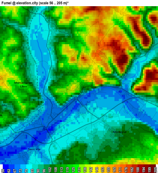
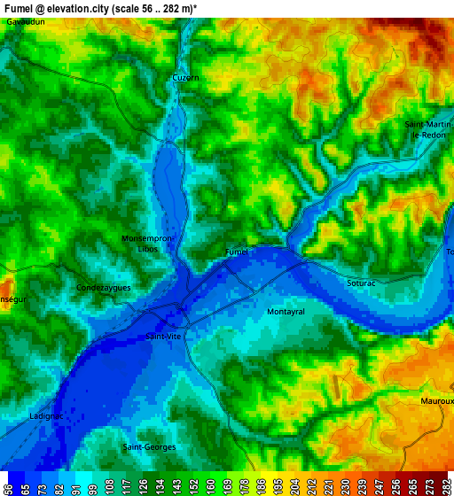
Below is the Elevation map of Fumel, which displays elevation range with different colors. Scale of the first map is from 56 to 205 m (184 to 673 ft) with average elevation of 108.7 meters (=357 ft) [note 1]
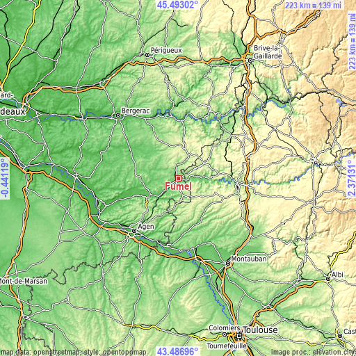
These maps also provides idea of topography and contour of this city, they are displayed at different zoom levels. More info about maps, scale and edge coordinates you can find below images.
| \ | Map #1 | Map #2 | Topo.Map |
| Scale [m] | 56..205 m | 56..282 m | × |
| Scale [ft] | 184..673 ft | 184..925 ft | × |
| Average | 108.7 m = 357 ft | 137.3 m = 450 ft | × |
| Width | 6.97 km = 4.3 mi | 13.94 km = 8.7 mi | 223.1 km = 138.6 mi |
| Height | 6.97 km = 4.3 mi | 13.94 km = 8.7 mi | 223 km = 138.6 mi |
| ↑Max Latitude | 44.529956° | 44.561276° | 45.49302° |
| Latitude at center | 44.49862° | 44.49862° | 44.49862° |
| ↓Min Latitude | 44.467267° | 44.435897° | 43.48696° |
| ← Min Longitude | 0.921115° | 0.877169° | -0.44119° |
| Longitude center | 0.96506° | 0.96506° | 0.96506° |
| →Max Longitude | 1.009005° | 1.052951° | 2.37131° |
Nearby cities:
Cities around Fumel sort by population:
• Villeneuve-sur-Lot elevation 56 m
23 km,  244°
244°
• Pujols 68 m
24.9 km, 242°
• Montayral 105 m
3.2 km,  145°
145°
• Prayssac 110 m
17.7 km,  87°
87°
• Monflanquin 145 m
16 km,  282°
282°
• Monsempron-Libos 97 m
2.1 km, 243°
• Saint-Sylvestre-sur-Lot 65 m
17.1 km,  228°
228°
• Puy-l’Évêque 131 m
13.9 km, 87°
• Montaigu-de-Quercy 169 m
18.1 km,  166°
166°
• Saint-Hilaire 81 m
20.1 km, 281°
• Saint-Vite 79 m
3.7 km,  214°
214°
• Villeréal 103 m
23.3 km,  311°
311°
Multilingual:
 En español:
Fumel elevación 123 m.
 En France:
Fumel élévation 123 m.


Sources and notes:
- [note 1] Map square and city borders are not equal. Map elevation data is calculated only from area inside that square.
- [src 1] Elevation data from geonames database provided with same terms of usage.
- [src 2] The elevation map of Fumel is generated using elevation data from NASA's 3 arcsec (90m) resolution SRTM data.
- [src 3] Base (background) map © OpenStreetMap contributors tiles are generated by Geofabrik and OpenTopoMap.
Copyright & License:
This Fumel Elevation Map is licensed under CC BY-SA. You may reuse any part from this page, if you give a proper credit by linking to this URL:
 More info on terms of use page.