Gambsheim elevation
Gambsheim (Grand Est, Bas-Rhin), France elevation is 126 meters and Gambsheim elevation in feet is 413 ft above sea level [src 1]. Gambsheim is a populated place (feature code) with elevation that is 48 meters (157 ft) smaller than average city elevation in France.
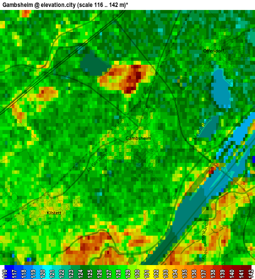
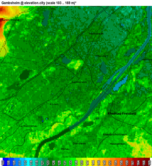
Below is the Elevation map of Gambsheim, which displays elevation range with different colors. Scale of the first map is from 116 to 142 m (381 to 466 ft) with average elevation of 126.7 meters (=416 ft) [note 1]
These maps also provides idea of topography and contour of this city, they are displayed at different zoom levels. More info about maps, scale and edge coordinates you can find below images.
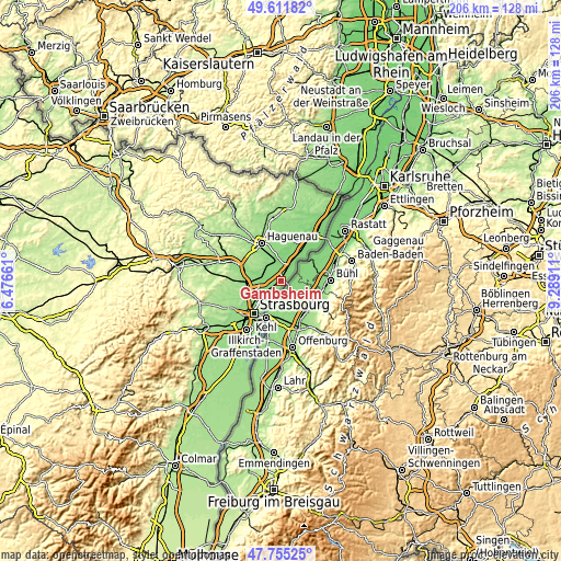
| \ | Map #1 | Map #2 | Topo.Map |
| Scale [m] | 116..142 m | 103..169 m | × |
| Scale [ft] | 381..466 ft | 338..554 ft | × |
| Average | 126.7 m = 416 ft | 128.1 m = 420 ft | × |
| Width | 6.45 km = 4 mi | 12.9 km = 8 mi | 206.4 km = 128.3 mi |
| Height | 6.45 km = 4 mi | 12.9 km = 8 mi | 206.4 km = 128.3 mi |
| ↑Max Latitude | 48.72109° | 48.750074° | 49.61182° |
| Latitude at center | 48.69209° | 48.69209° | 48.69209° |
| ↓Min Latitude | 48.663073° | 48.634039° | 47.75525° |
| ← Min Longitude | 7.838915° | 7.794969° | 6.47661° |
| Longitude center | 7.88286° | 7.88286° | 7.88286° |
| →Max Longitude | 7.926805° | 7.970751° | 9.28911° |
Nearby cities:
Cities around Gambsheim sort by population:
• Bischwiller elevation 130 m
8.7 km,  345°
345°
• La Wantzenau 133 m
5.4 km,  225°
225°
• Reichstett 140 m
10.6 km,  242°
242°
• Drusenheim 123 m
9.3 km,  33°
33°
• Herrlisheim 125 m
4.6 km,  21°
21°
• Hœrdt 138 m
7.4 km,  276°
276°
• Oberhoffen-sur-Moder 137 m
10.3 km, 352°
• Weyersheim 141 m
6.6 km,  294°
294°
• Gries 143 m
8.5 km,  323°
323°
• Weitbruch 163 m
10.3 km,  312°
312°
• Geudertheim 150 m
10.3 km, 290°
• Kilstett 130 m
2.7 km, 229°
Multilingual:
 En español:
Gambsheim elevación 126 m.
 En France:
Gambsheim élévation 126 m.
 Auf Deutsch:
Gambsheim höhe über dem Meeresspiegel ist 126 m.

Sources and notes:
- [note 1] Map square and city borders are not equal. Map elevation data is calculated only from area inside that square.
- [src 1] Elevation data from geonames database provided with same terms of usage.
- [src 2] The elevation map of Gambsheim is generated using elevation data from NASA's 3 arcsec (90m) resolution SRTM data.
- [src 3] Base (background) map © OpenStreetMap contributors tiles are generated by Geofabrik and OpenTopoMap.
Copyright & License:
This Gambsheim Elevation Map is licensed under CC BY-SA. You may reuse any part from this page, if you give a proper credit by linking to this URL:
 More info on terms of use page.