Givet elevation
Givet (Grand Est, Ardennes), France elevation is 104 meters and Givet elevation in feet is 341 ft above sea level [src 1]. Givet is a populated place (feature code) with elevation that is 70 meters (230 ft) smaller than average city elevation in France.
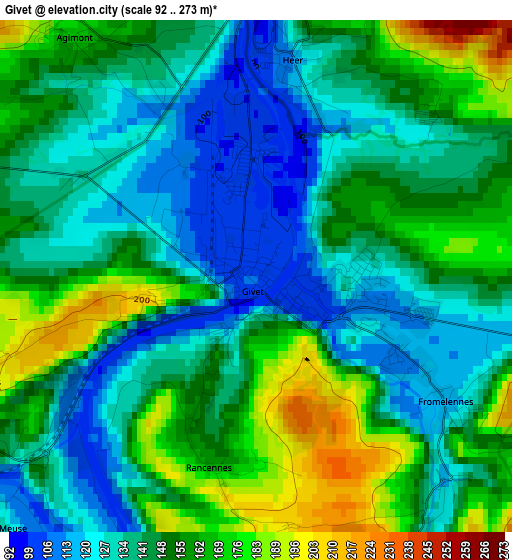
Below is the Elevation map of Givet, which displays elevation range with different colors. Scale of the first map is from 92 to 273 m (302 to 896 ft) with average elevation of 146.2 meters (=480 ft) [note 1]
These maps also provides idea of topography and contour of this city, they are displayed at different zoom levels. More info about maps, scale and edge coordinates you can find below images.
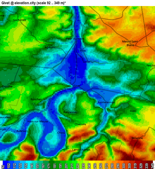
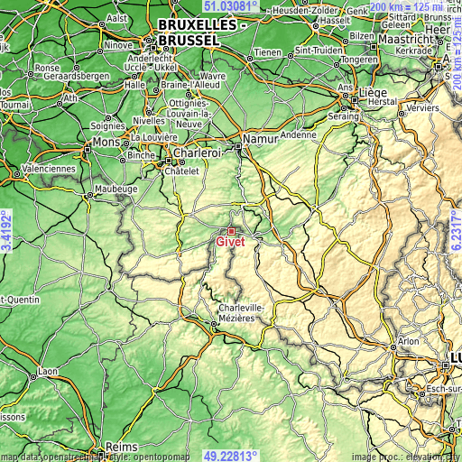
| \ | Map #1 | Map #2 | Topo.Map |
| Scale [m] | 92..273 m | 92..349 m | × |
| Scale [ft] | 302..896 ft | 302..1145 ft | × |
| Average | 146.2 m = 480 ft | 194.3 m = 637 ft | × |
| Width | 6.26 km = 3.9 mi | 12.53 km = 7.8 mi | 200.4 km = 124.5 mi |
| Height | 6.26 km = 3.9 mi | 12.53 km = 7.8 mi | 200.4 km = 124.5 mi |
| ↑Max Latitude | 50.166118° | 50.19426° | 51.03081° |
| Latitude at center | 50.13796° | 50.13796° | 50.13796° |
| ↓Min Latitude | 50.109785° | 50.081594° | 49.22813° |
| ← Min Longitude | 4.781505° | 4.737559° | 3.4192° |
| Longitude center | 4.82545° | 4.82545° | 4.82545° |
| →Max Longitude | 4.869395° | 4.913341° | 6.2317° |
Nearby cities:
Cities around Givet sort by population:
• Revin elevation 146 m
25.8 km,  211°
211°
• Fumay 145 m
18.3 km, 207°
• Monthermé 141 m
29 km,  193°
193°
• Rocroi 384 m
32 km,  222°
222°
• Haybes 165 m
17.1 km, 210°
• Vireux-Wallerand 130 m
9.2 km,  227°
227°
• Les Hautes-Rivières 161 m
28 km,  177°
177°
• Vireux-Molhain 111 m
9.8 km, 227°
• Deville 147 m
30 km,  196°
196°
• Fromelennes 117 m
2.9 km,  123°
123°
• Gespunsart 202 m
35.2 km, 179°
• Thilay 151 m
29.4 km, 182°
Multilingual:
 En español:
Givet elevación 104 m.
 En France:
Givet élévation 104 m.


Sources and notes:
- [note 1] Map square and city borders are not equal. Map elevation data is calculated only from area inside that square.
- [src 1] Elevation data from geonames database provided with same terms of usage.
- [src 2] The elevation map of Givet is generated using elevation data from NASA's 3 arcsec (90m) resolution SRTM data.
- [src 3] Base (background) map © OpenStreetMap contributors tiles are generated by Geofabrik and OpenTopoMap.
Copyright & License:
This Givet Elevation Map is licensed under CC BY-SA. You may reuse any part from this page, if you give a proper credit by linking to this URL:
 More info on terms of use page.