Gourin elevation
Gourin (Brittany, Morbihan), France elevation is 155 meters and Gourin elevation in feet is 509 ft above sea level [src 1]. Gourin is a populated place (feature code) with elevation that is 19 meters (62 ft) smaller than average city elevation in France.
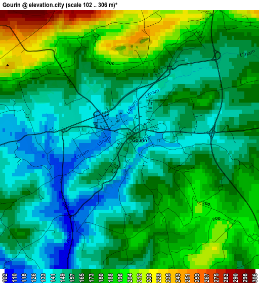
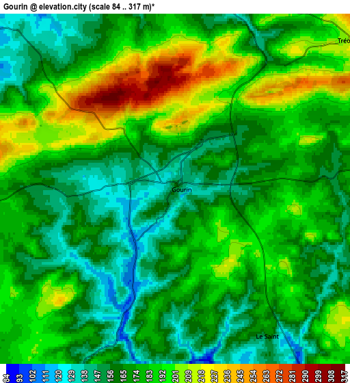
Below is the Elevation map of Gourin, which displays elevation range with different colors. Scale of the first map is from 102 to 306 m (335 to 1004 ft) with average elevation of 167.2 meters (=549 ft) [note 1]
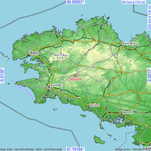
These maps also provides idea of topography and contour of this city, they are displayed at different zoom levels. More info about maps, scale and edge coordinates you can find below images.
| \ | Map #1 | Map #2 | Topo.Map |
| Scale [m] | 102..306 m | 84..317 m | × |
| Scale [ft] | 335..1004 ft | 276..1040 ft | × |
| Average | 167.2 m = 549 ft | 176 m = 577 ft | × |
| Width | 6.52 km = 4.1 mi | 13.04 km = 8.1 mi | 208.7 km = 129.7 mi |
| Height | 6.52 km = 4.1 mi | 13.04 km = 8.1 mi | 208.7 km = 129.7 mi |
| ↑Max Latitude | 48.167978° | 48.197279° | 49.06853° |
| Latitude at center | 48.13866° | 48.13866° | 48.13866° |
| ↓Min Latitude | 48.109326° | 48.079974° | 47.19164° |
| ← Min Longitude | -3.651495° | -3.695441° | -5.0138° |
| Longitude center | -3.60755° | -3.60755° | -3.60755° |
| →Max Longitude | -3.563605° | -3.519659° | -2.2013° |
Nearby cities:
Cities around Gourin sort by population:
• Carhaix-Plouguer elevation 145 m
15.5 km,  9°
9°
• Scaër 157 m
13.6 km,  210°
210°
• Châteauneuf-du-Faou 120 m
16.5 km,  289°
289°
• Le Faouët 147 m
14.6 km,  143°
143°
• Guiscriff 192 m
10.3 km,  195°
195°
• Langonnet 189 m
9.2 km,  113°
113°
• Spézet 89 m
10.6 km,  310°
310°
• Priziac 161 m
16.3 km,  119°
119°
• Lanvénégen 114 m
16.4 km,  162°
162°
• Cléden-Poher 152 m
11.8 km,  337°
337°
• Plouray 194 m
16.4 km,  87°
87°
• Landeleau 107 m
13.3 km,  317°
317°
Multilingual:
 En español:
Gourin elevación 155 m.
 En France:
Gourin élévation 155 m.


Sources and notes:
- [note 1] Map square and city borders are not equal. Map elevation data is calculated only from area inside that square.
- [src 1] Elevation data from geonames database provided with same terms of usage.
- [src 2] The elevation map of Gourin is generated using elevation data from NASA's 3 arcsec (90m) resolution SRTM data.
- [src 3] Base (background) map © OpenStreetMap contributors tiles are generated by Geofabrik and OpenTopoMap.
Copyright & License:
This Gourin Elevation Map is licensed under CC BY-SA. You may reuse any part from this page, if you give a proper credit by linking to this URL:
 More info on terms of use page.