Grasse elevation
Grasse (Provence-Alpes-Côte d'Azur, Alpes-Maritimes), France elevation is 194 meters and Grasse elevation in feet is 636 ft above sea level [src 1]. Grasse is a seat of a third-order administrative division (feature code) with elevation that is 20 meters (66 ft) bigger than average city elevation in France.
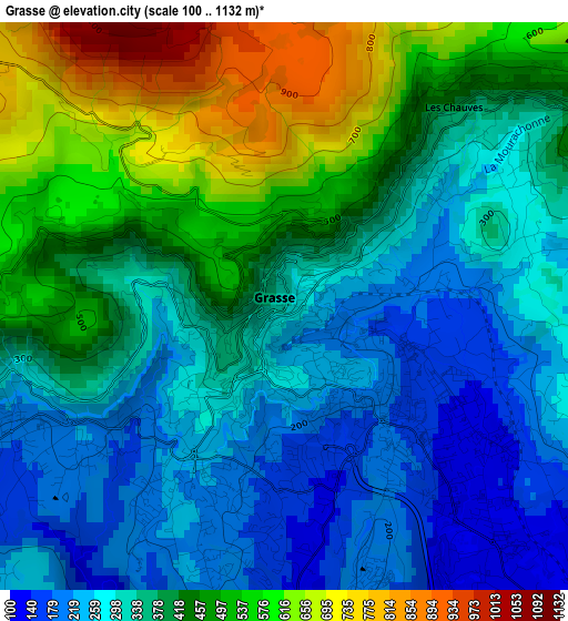
Below is the Elevation map of Grasse, which displays elevation range with different colors. Scale of the first map is from 100 to 1132 m (328 to 3714 ft) with average elevation of 383.9 meters (=1260 ft) [note 1]
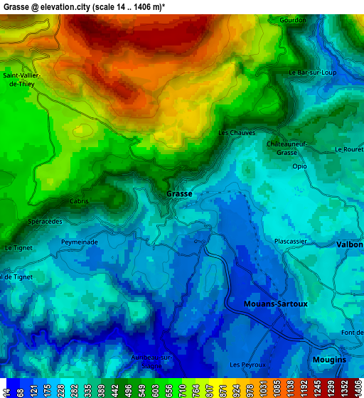
These maps also provides idea of topography and contour of this city, they are displayed at different zoom levels. More info about maps, scale and edge coordinates you can find below images.
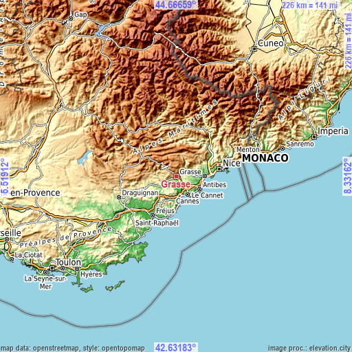
| \ | Map #1 | Map #2 | Topo.Map |
| Scale [m] | 100..1132 m | 14..1406 m | × |
| Scale [ft] | 328..3714 ft | 46..4613 ft | × |
| Average | 383.9 m = 1260 ft | 442.3 m = 1451 ft | × |
| Width | 7.07 km = 4.4 mi | 14.14 km = 8.8 mi | 226.2 km = 140.6 mi |
| Height | 7.07 km = 4.4 mi | 14.14 km = 8.8 mi | 226.2 km = 140.6 mi |
| ↑Max Latitude | 43.689615° | 43.721383° | 44.66659° |
| Latitude at center | 43.65783° | 43.65783° | 43.65783° |
| ↓Min Latitude | 43.626028° | 43.59421° | 42.63183° |
| ← Min Longitude | 6.881425° | 6.837479° | 5.51912° |
| Longitude center | 6.92537° | 6.92537° | 6.92537° |
| →Max Longitude | 6.969315° | 7.013261° | 8.33162° |
Nearby cities:
Cities around Grasse sort by population:
• Valbonne elevation 232 m
6.5 km,  115°
115°
• Mouans-Sartoux 150 m
5.5 km,  137°
137°
• Peymeinade 213 m
4.3 km,  246°
246°
• Pégomas 43 m
6.8 km,  175°
175°
• La Roquette-sur-Siagne 155 m
7 km,  159°
159°
• Châteauneuf-Grasse 258 m
4.8 km,  78°
78°
• Le Tignet 257 m
6.7 km, 252°
• Le Bar-sur-Loup 385 m
6.6 km,  44°
44°
• Auribeau-sur-Siagne 57 m
6.5 km,  191°
191°
• Opio 294 m
4.7 km, 75°
• Cabris 410 m
4.2 km,  267°
267°
• Spéracèdes 240 m
5.4 km,  259°
259°
Multilingual:
 En español:
Grasse elevación 194 m.
 En France:
Grasse élévation 194 m.


Sources and notes:
- [note 1] Map square and city borders are not equal. Map elevation data is calculated only from area inside that square.
- [src 1] Elevation data from geonames database provided with same terms of usage.
- [src 2] The elevation map of Grasse is generated using elevation data from NASA's 3 arcsec (90m) resolution SRTM data.
- [src 3] Base (background) map © OpenStreetMap contributors tiles are generated by Geofabrik and OpenTopoMap.
Copyright & License:
This Grasse Elevation Map is licensed under CC BY-SA. You may reuse any part from this page, if you give a proper credit by linking to this URL:
 More info on terms of use page.