Grigny elevation
Grigny (Île-de-France, Département de l'Essonne), France elevation is 85 meters and Grigny elevation in feet is 279 ft above sea level [src 1]. Grigny is a populated place (feature code) with elevation that is 89 meters (292 ft) smaller than average city elevation in France.
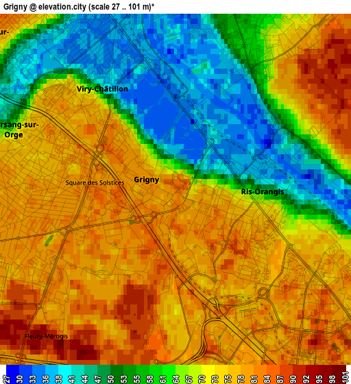
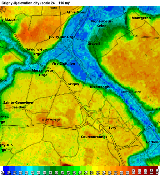
Below is the Elevation map of Grigny, which displays elevation range with different colors. Scale of the first map is from 27 to 101 m (89 to 331 ft) with average elevation of 68.2 meters (=224 ft) [note 1]
These maps also provides idea of topography and contour of this city, they are displayed at different zoom levels. More info about maps, scale and edge coordinates you can find below images.
| \ | Map #1 | Map #2 | Topo.Map |
| Scale [m] | 27..101 m | 24..116 m | × |
| Scale [ft] | 89..331 ft | 79..381 ft | × |
| Average | 68.2 m = 224 ft | 70.6 m = 232 ft | × |
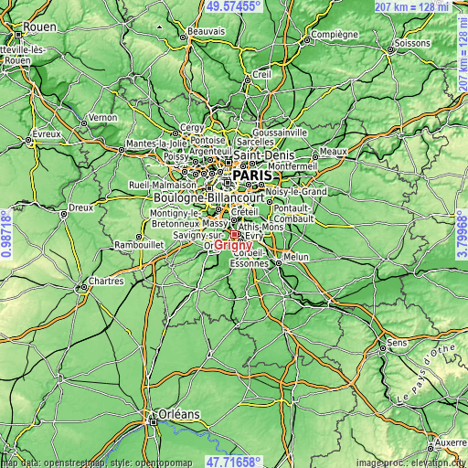
| Width | 6.46 km = 4 mi | 12.91 km = 8 mi | 206.6 km = 128.4 mi |
| Height | 6.46 km = 4 mi | 12.91 km = 8 mi | 206.6 km = 128.4 mi |
| ↑Max Latitude | 48.683142° | 48.712147° | 49.57455° |
| Latitude at center | 48.65412° | 48.65412° | 48.65412° |
| ↓Min Latitude | 48.625081° | 48.596026° | 47.71658° |
| ← Min Longitude | 2.349485° | 2.305539° | 0.98718° |
| Longitude center | 2.39343° | 2.39343° | 2.39343° |
| →Max Longitude | 2.437375° | 2.481321° | 3.79968° |
Nearby cities:
Cities around Grigny sort by population:
• Évry elevation 77 m
4.2 km,  124°
124°
• Savigny-sur-Orge 71 m
4.2 km,  307°
307°
• Viry-Châtillon 38 m
2 km,  359°
359°
• Draveil 56 m
3.7 km,  24°
24°
• Ris-Orangis 73 m
1.6 km,  102°
102°
• Morsang-sur-Orge 76 m
3.1 km,  286°
286°
• Courcouronnes 80 m
4.5 km,  166°
166°
• Juvisy-sur-Orge 38 m
3.3 km,  347°
347°
• Bondoufle 80 m
4.7 km,  194°
194°
• Fleury-Mérogis 80 m
2.9 km,  229°
229°
• Soisy-sur-Seine 59 m
4.4 km, 97°
• Villemoisson-sur-Orge 42 m
4.4 km, 287°
Multilingual:
 En español:
Grigny elevación 85 m.
 En France:
Grigny élévation 85 m.


Sources and notes:
- [note 1] Map square and city borders are not equal. Map elevation data is calculated only from area inside that square.
- [src 1] Elevation data from geonames database provided with same terms of usage.
- [src 2] The elevation map of Grigny is generated using elevation data from NASA's 3 arcsec (90m) resolution SRTM data.
- [src 3] Base (background) map © OpenStreetMap contributors tiles are generated by Geofabrik and OpenTopoMap.
Copyright & License:
This Grigny Elevation Map is licensed under CC BY-SA. You may reuse any part from this page, if you give a proper credit by linking to this URL:
 More info on terms of use page.