Groslay elevation
Groslay (Île-de-France, Département du Val-d’Oise), France elevation is 69 meters and Groslay elevation in feet is 226 ft above sea level [src 1]. Groslay is a populated place (feature code) with elevation that is 105 meters (344 ft) smaller than average city elevation in France.
Below is the Elevation map of Groslay, which displays elevation range with different colors. Scale of the first map is from 31 to 181 m (102 to 594 ft) with average elevation of 76.9 meters (=252 ft) [note 1]
These maps also provides idea of topography and contour of this city, they are displayed at different zoom levels. More info about maps, scale and edge coordinates you can find below images.
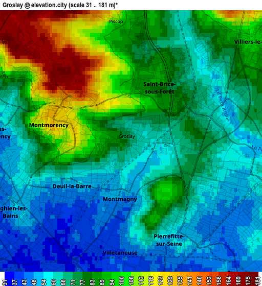
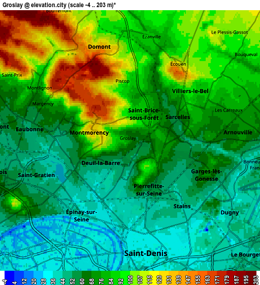
| \ | Map #1 | Map #2 | Topo.Map |
| Scale [m] | 31..181 m | -4..203 m | × |
| Scale [ft] | 102..594 ft | -13..666 ft | × |
| Average | 76.9 m = 252 ft | 74 m = 243 ft | × |
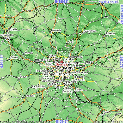
| Width | 6.41 km = 4 mi | 12.83 km = 8 mi | 205.2 km = 127.5 mi |
| Height | 6.41 km = 4 mi | 12.83 km = 8 mi | 205.2 km = 127.5 mi |
| ↑Max Latitude | 49.014441° | 49.043255° | 49.89993° |
| Latitude at center | 48.98561° | 48.98561° | 48.98561° |
| ↓Min Latitude | 48.956763° | 48.927899° | 48.0542° |
| ← Min Longitude | 2.303415° | 2.259469° | 0.94111° |
| Longitude center | 2.34736° | 2.34736° | 2.34736° |
| →Max Longitude | 2.391305° | 2.435251° | 3.75361° |
Nearby cities:
Cities around Groslay sort by population:
• Sarcelles elevation 75 m
2.6 km,  59°
59°
• Garges-lès-Gonesse 64 m
4.2 km,  118°
118°
• Pierrefitte-sur-Seine 60 m
2.3 km,  154°
154°
• Deuil-la-Barre 54 m
1.8 km,  236°
236°
• Montmorency 68 m
0.4 km,  315°
315°
• Soisy-sous-Montmorency 49 m
3.4 km,  274°
274°
• Montmagny 50 m
1.4 km,  181°
181°
• Saint-Brice-sous-Forêt 84 m
1.8 km,  14°
14°
• Villetaneuse 40 m
3.1 km,  187°
187°
• Enghien-les-Bains 43 m
3.1 km,  226°
226°
• Margency 70 m
3.8 km,  294°
294°
• Andilly 170 m
4.2 km,  308°
308°
Multilingual:
 En español:
Groslay elevación 69 m.
 En France:
Groslay élévation 69 m.


Sources and notes:
- [note 1] Map square and city borders are not equal. Map elevation data is calculated only from area inside that square.
- [src 1] Elevation data from geonames database provided with same terms of usage.
- [src 2] The elevation map of Groslay is generated using elevation data from NASA's 3 arcsec (90m) resolution SRTM data.
- [src 3] Base (background) map © OpenStreetMap contributors tiles are generated by Geofabrik and OpenTopoMap.
Copyright & License:
This Groslay Elevation Map is licensed under CC BY-SA. You may reuse any part from this page, if you give a proper credit by linking to this URL:
 More info on terms of use page.